Result: Summited Matterhorn Peak
Class: 2
Rating: 2/5
Horse Creek Trail from Upper Twin Lake
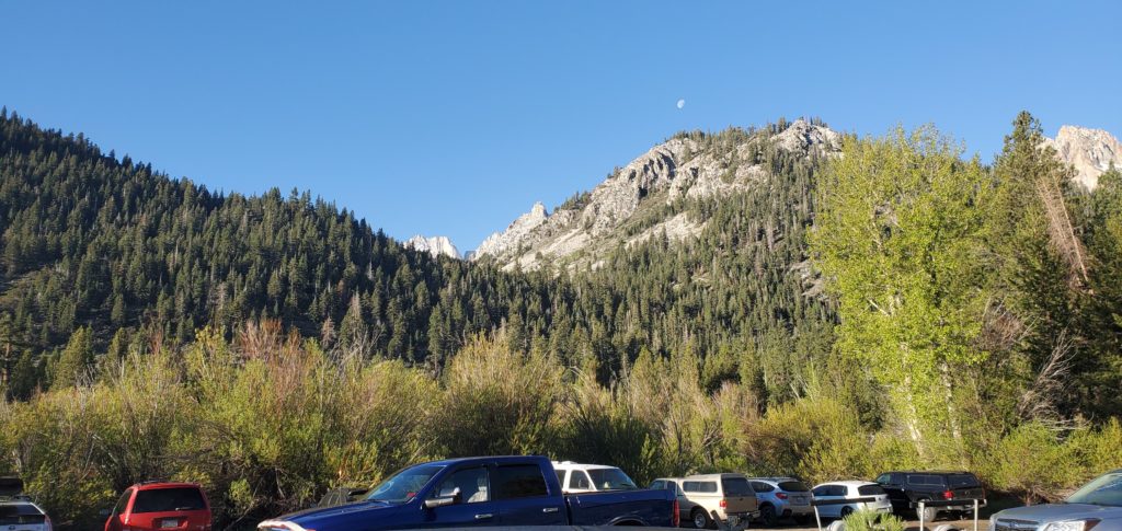
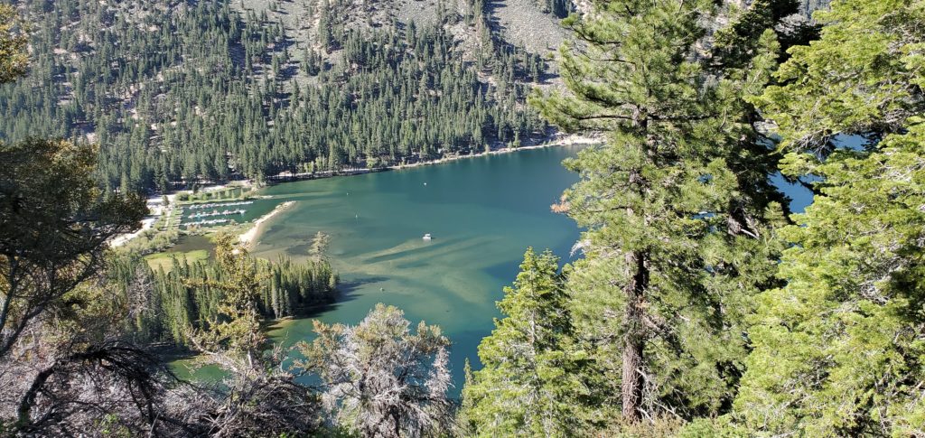
I got to Annett’s Mono Village around 6:20a, hopeful to conquer my first Emblem Peak and tired from a terrible night of sleep at a motel in Walker and still sore from my first foray into the Sierra since September 2019 (a thunderstorm had dashed that previous day’s hopes of summiting Highland Peak in the Carson-Iceberg Wilderness area).
There are a couple parking lots available at the resort, with the hiker’s lot the furthest along the main road, keeping straight past the marina and ignoring the camping turn to the right. Some confusion about parking permits: Their booth says every car needs a permit, but they don’t open until 8a and have no self-service. I didn’t get a permit or, thankfully, a ticket.
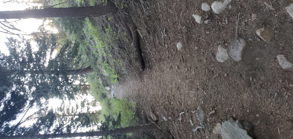
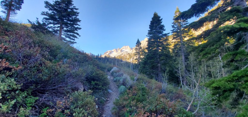
A little after 6:45a I hit the trail. This too is a bit confusing at first as there are multiple paths through the marshy area where Horse Creek Trail meets Upper Twin Lake. I initially took the wrong path, which petered out into brambles. The correct trail, I believe, is the first right from the path that leads through the RV lot – it’s a bigger path than the others. While the AllTrails app doesn’t show it connecting to the Horse Creek Trail, it does so via a bridge that spans the creek.
From there route finding is straightforward until you get to the first headhall.
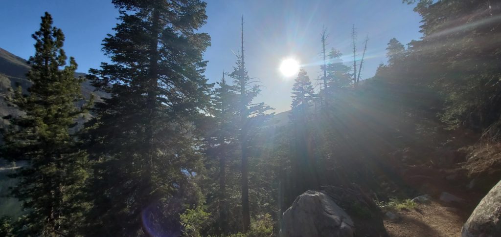
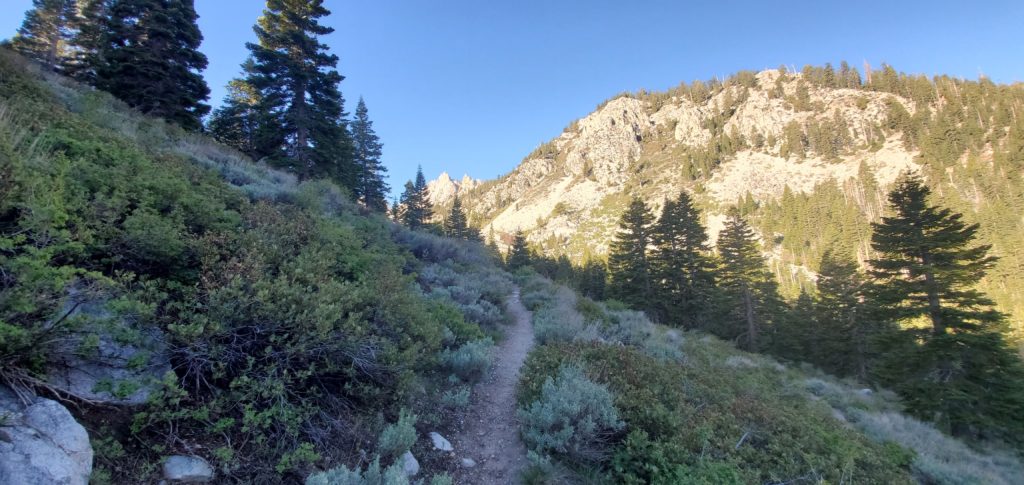
The switchbacks on the lower part of the trail, like all switchbacks, are agonizing. They gain very little elevation in too many miles. Long, swooping, needless. It’s easy and, in the early morning, alternated between cool shade and the warming sun poking through tree cover. Bob Burd (and others) have taken shortcuts by sticking next to Horse Creek. I’ll probably do that when I return to summit Whorl.
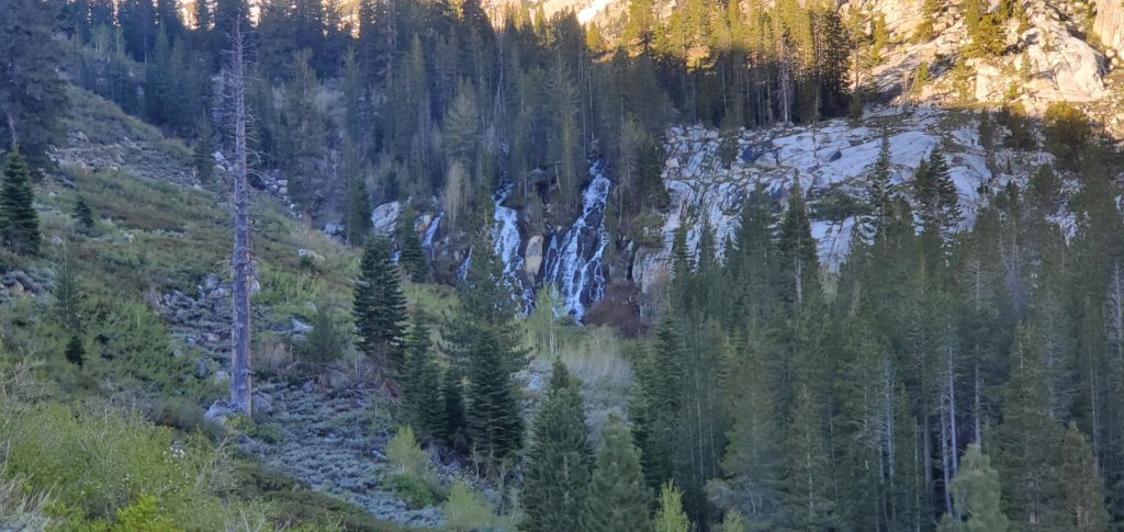
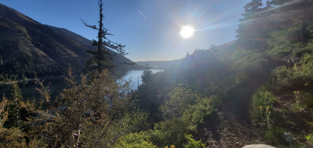
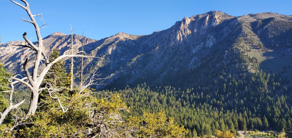
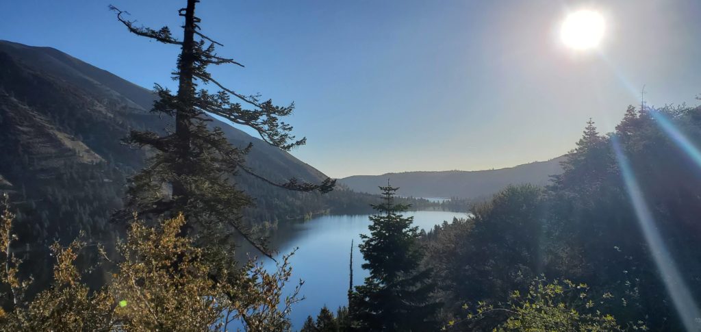
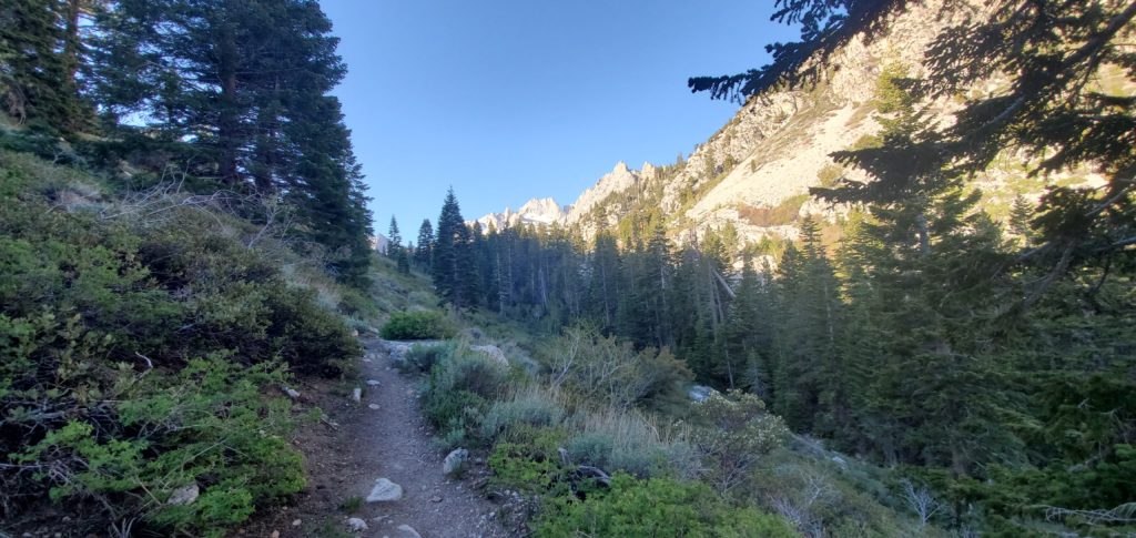
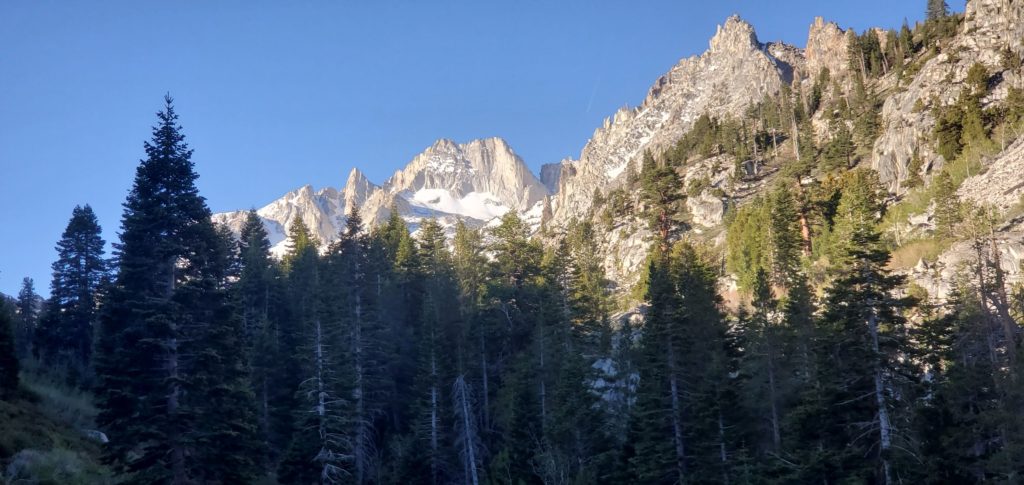
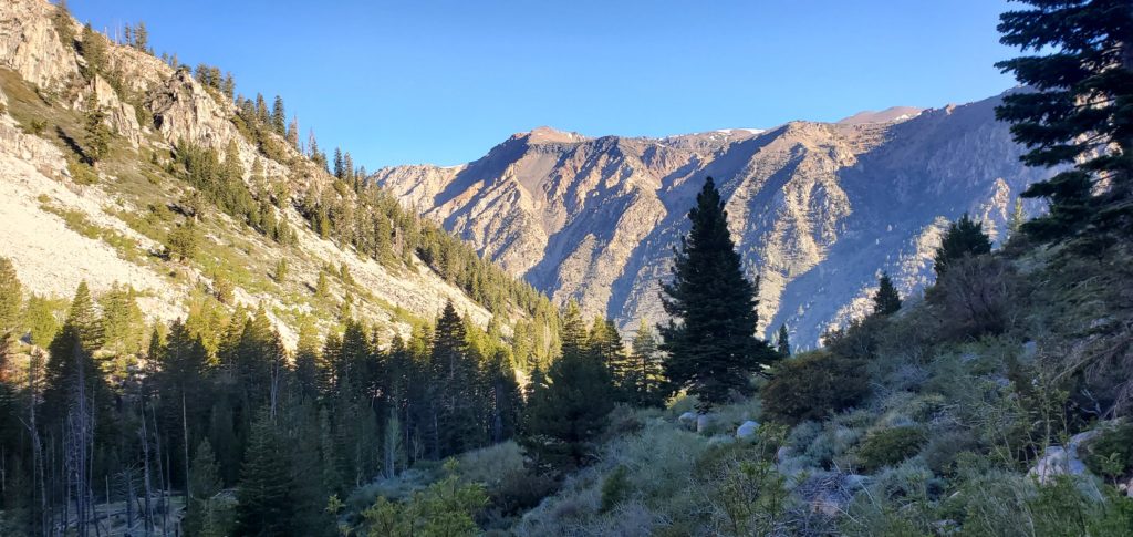
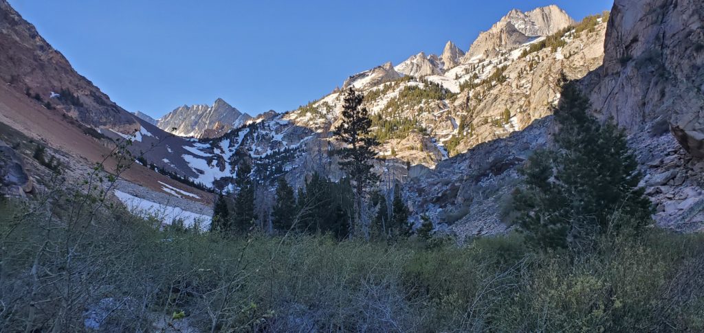
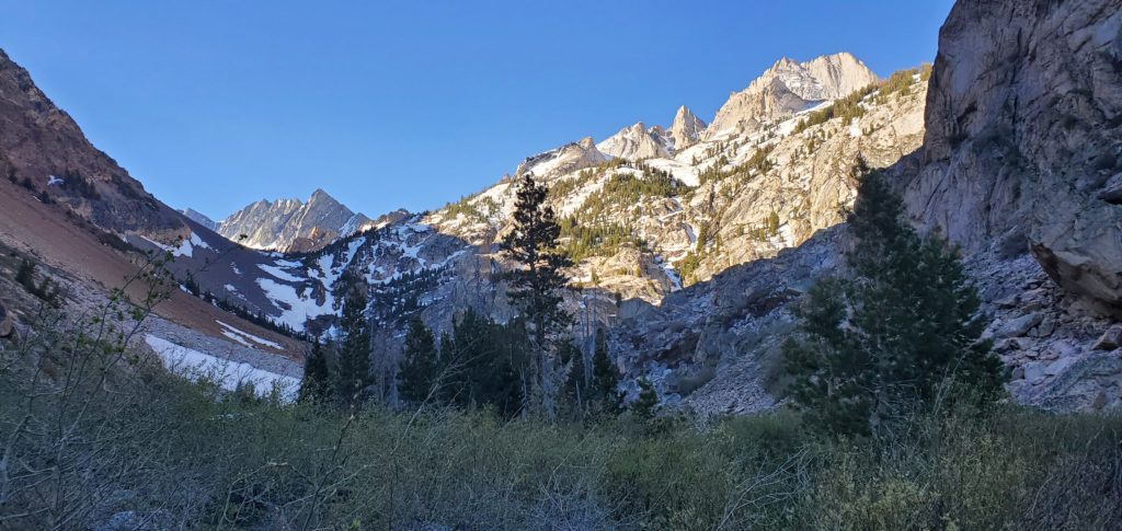
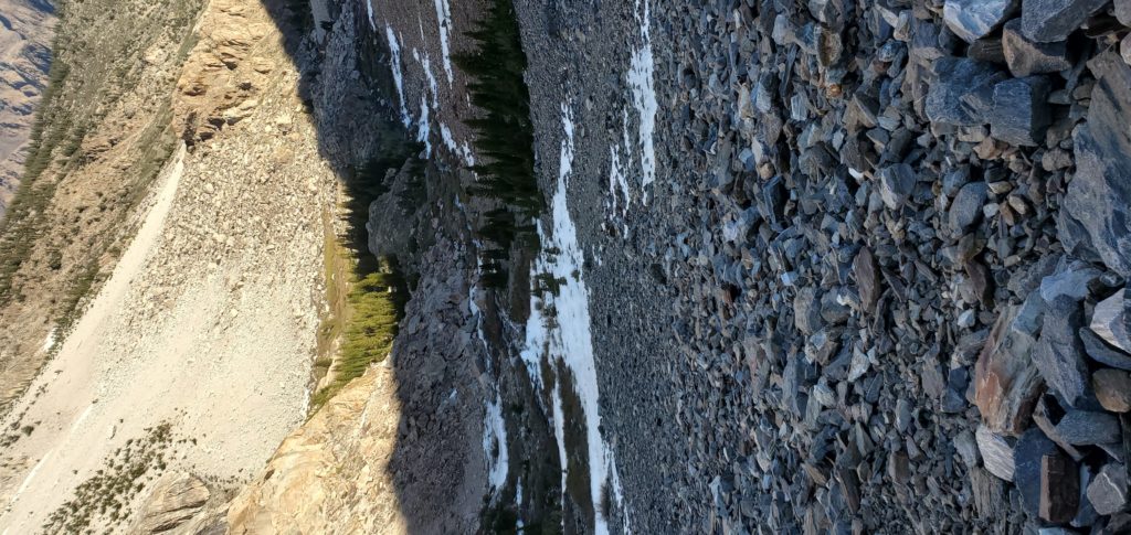
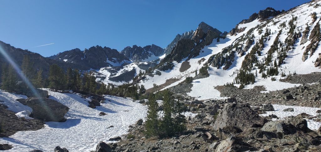
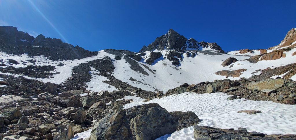
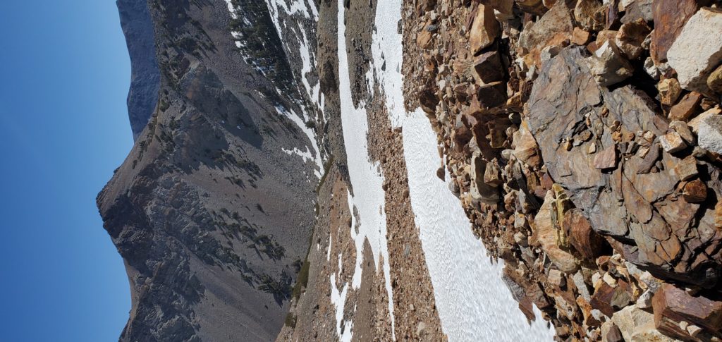
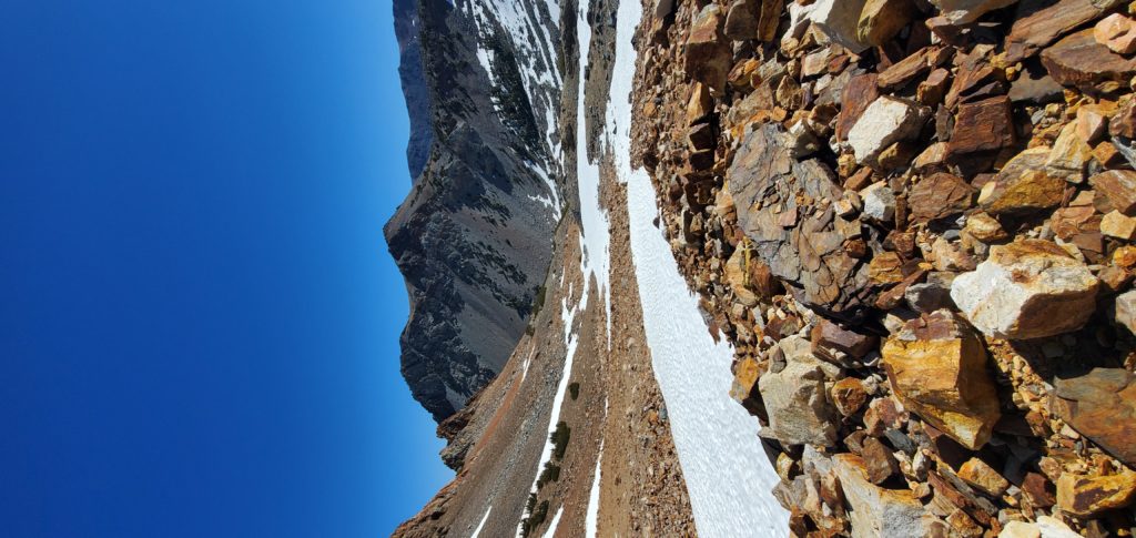
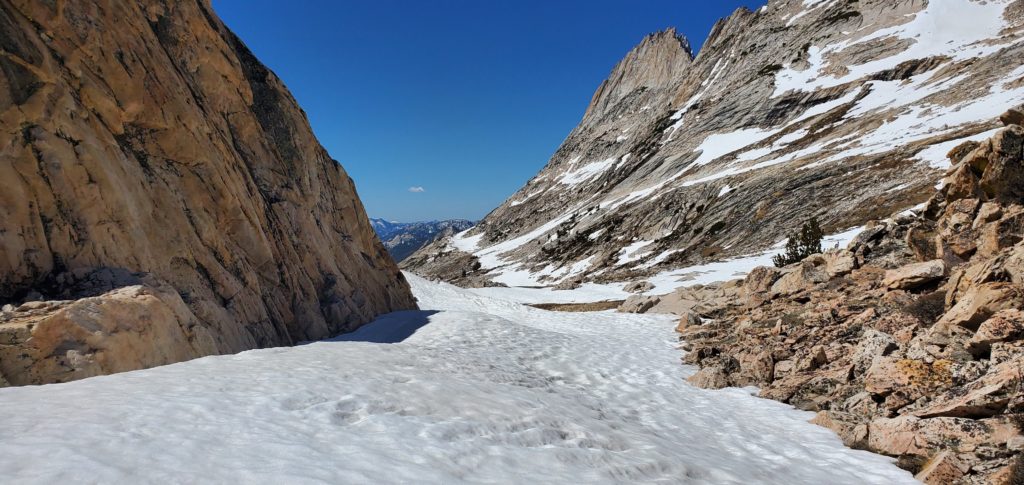
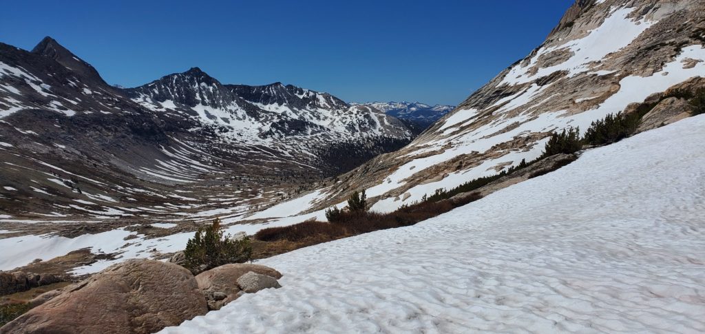
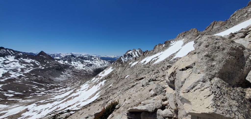
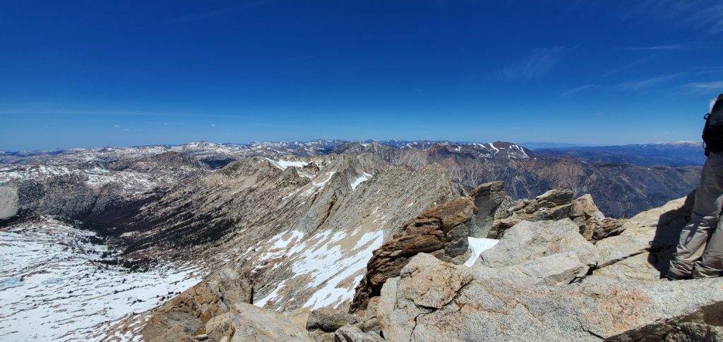
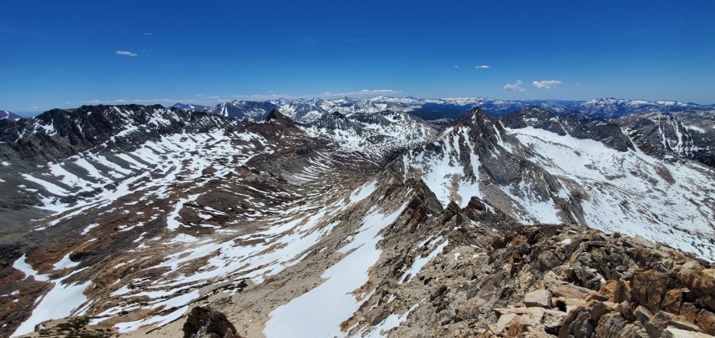
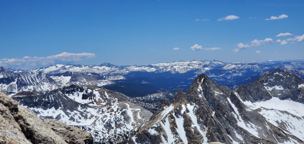
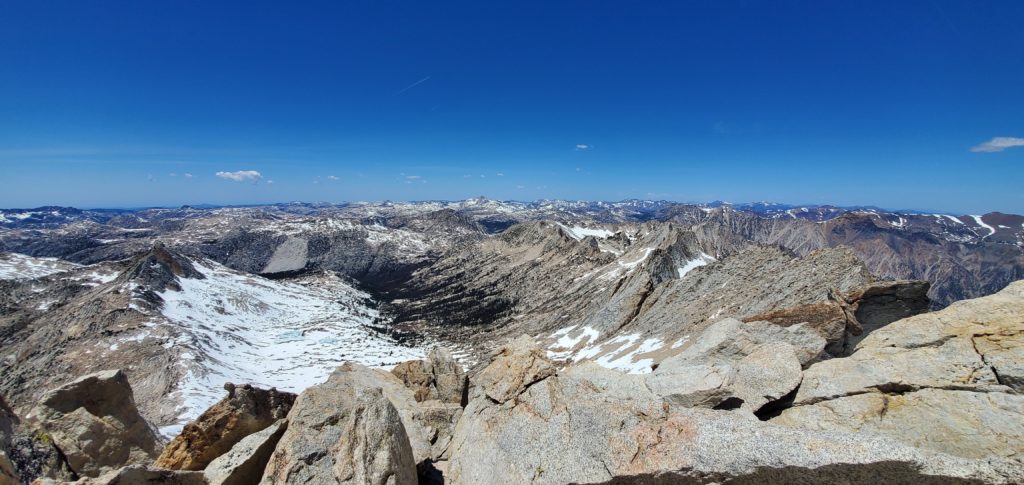
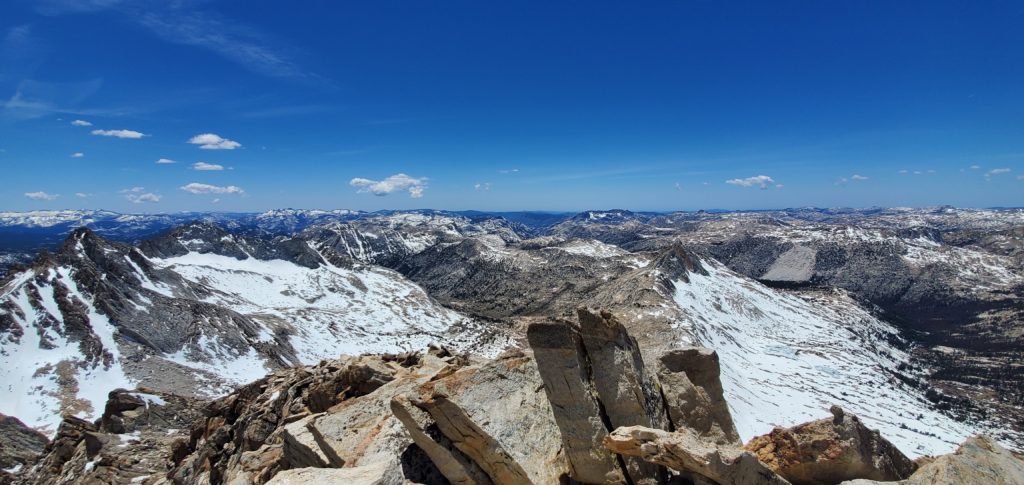
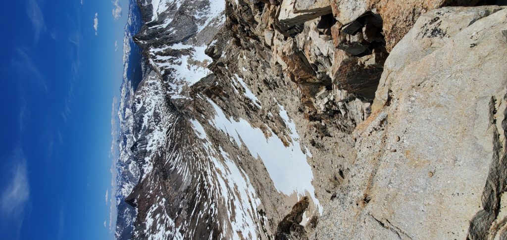
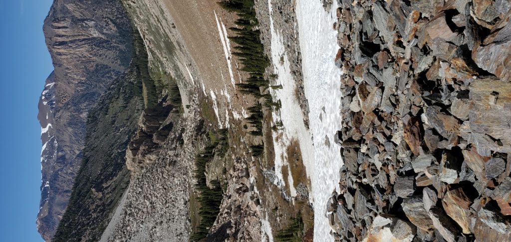
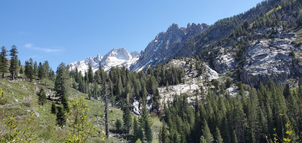
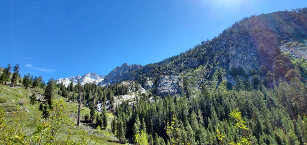
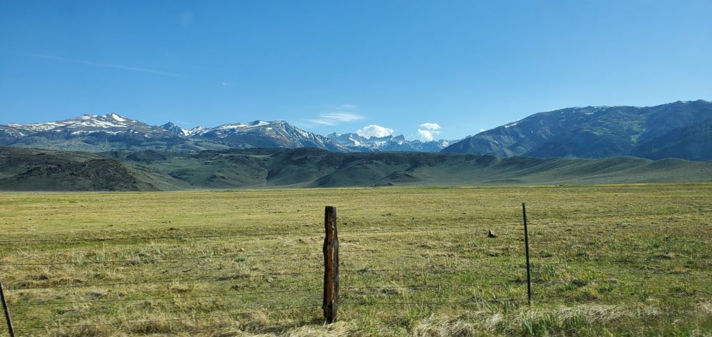
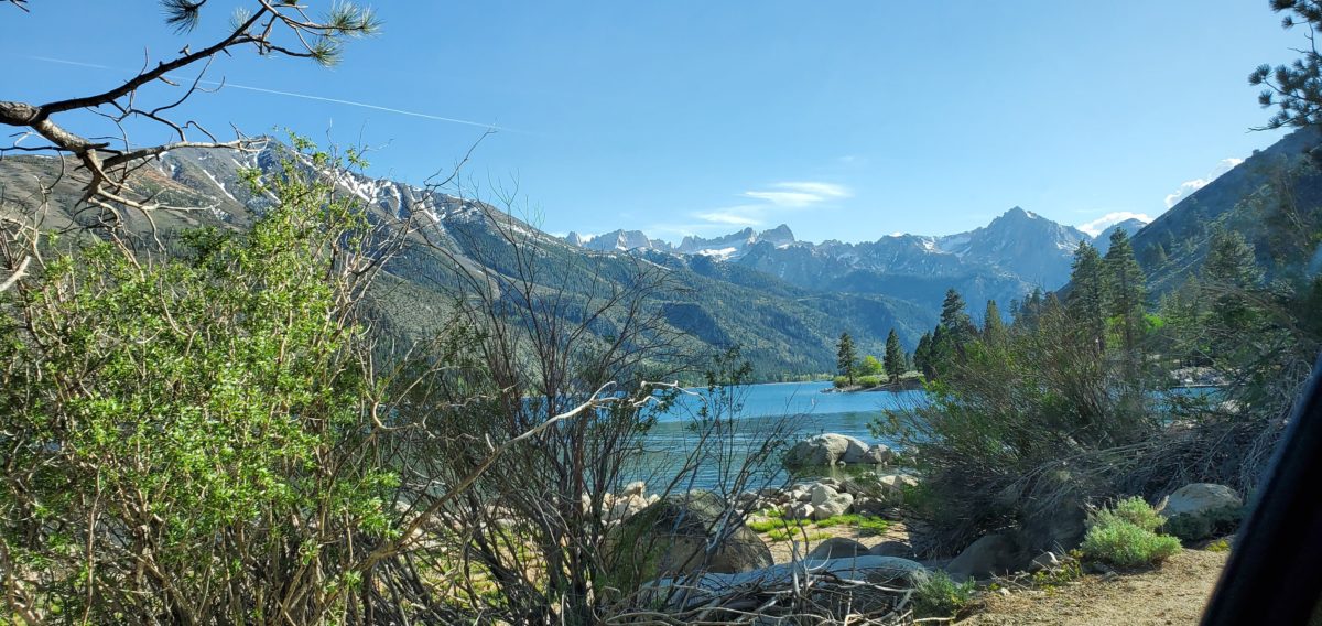
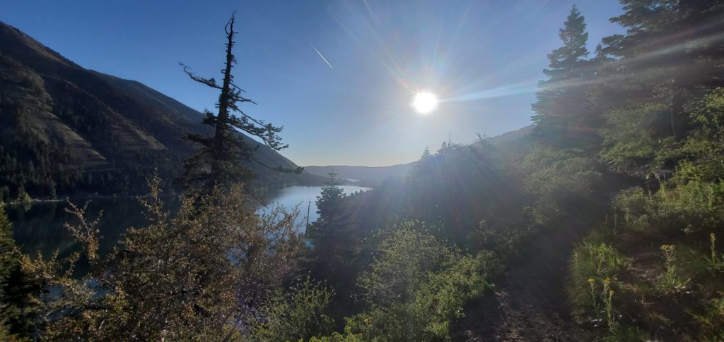
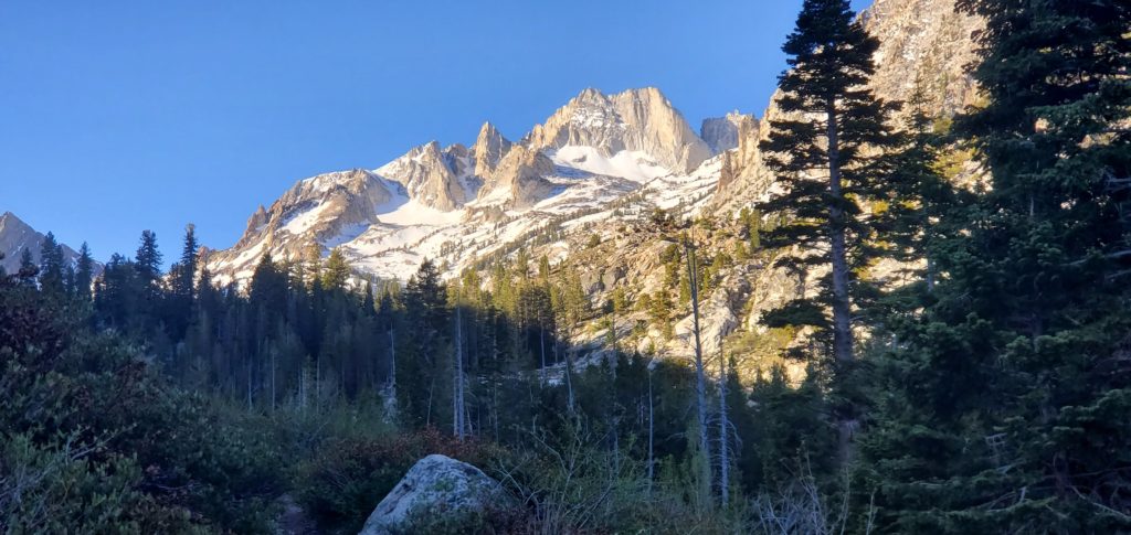
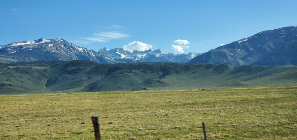
Horse Creek brings a nice melody to the trail until you pass the falls. Then the stream quiets and still settles on the valley with the sun blocked by the left ridge. It’s all quick: I knocked out the first four or so miles in less than 80 minutes. The Sawtooth Range looms high ahead, a reminder of the climbing to come.
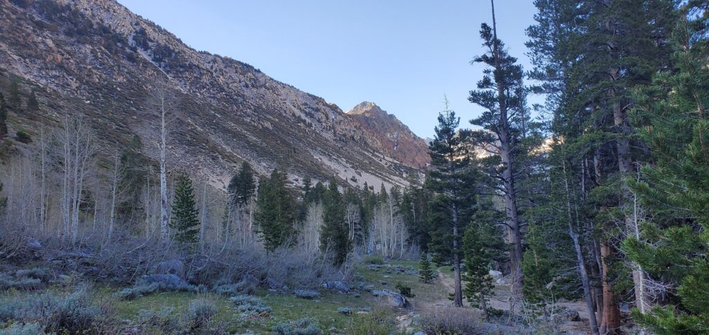
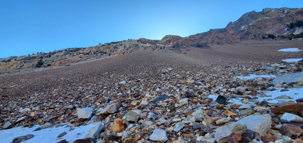
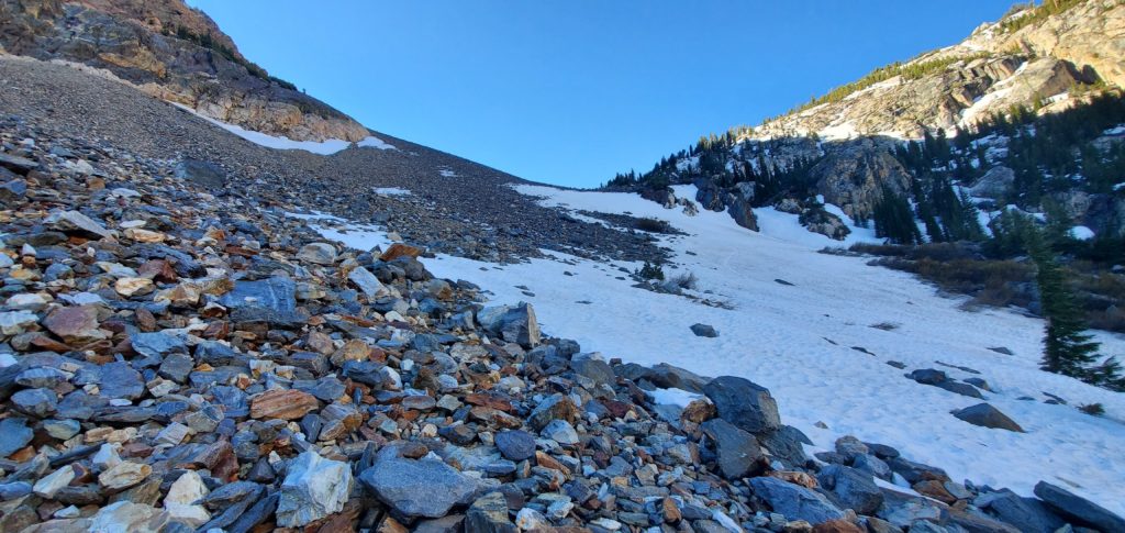
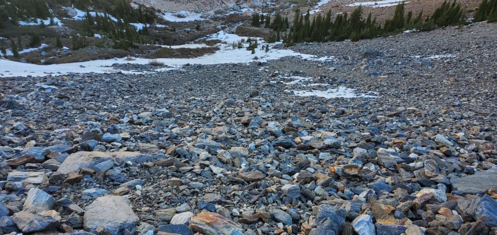
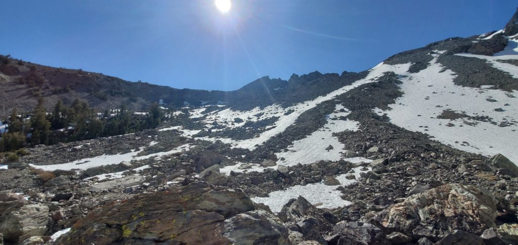
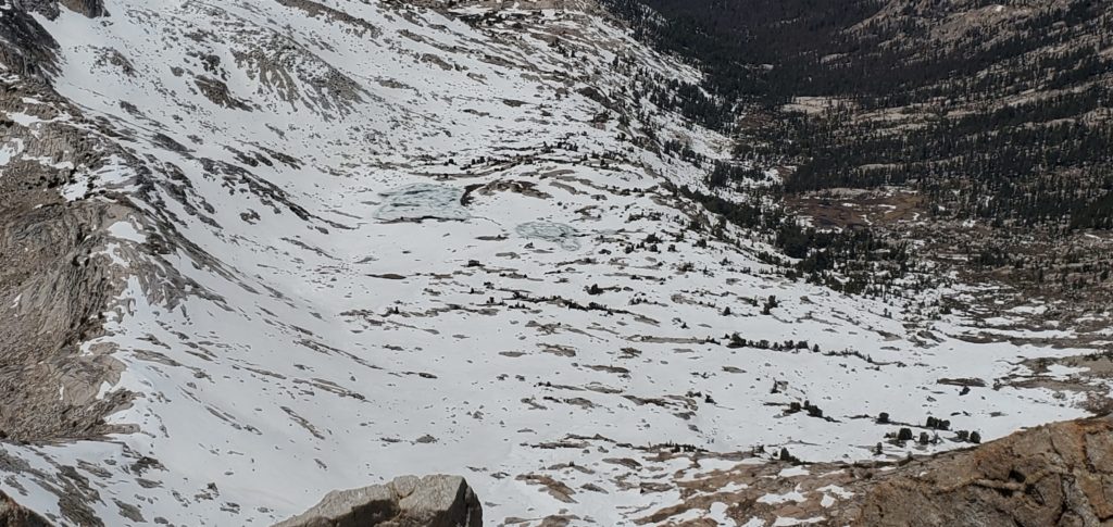
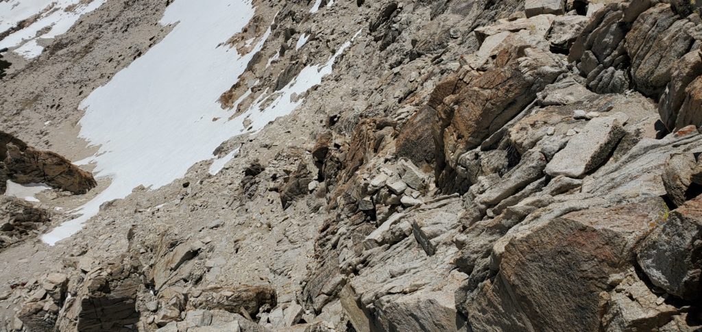
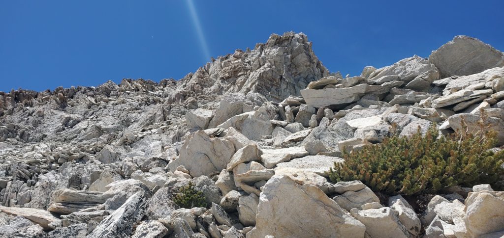
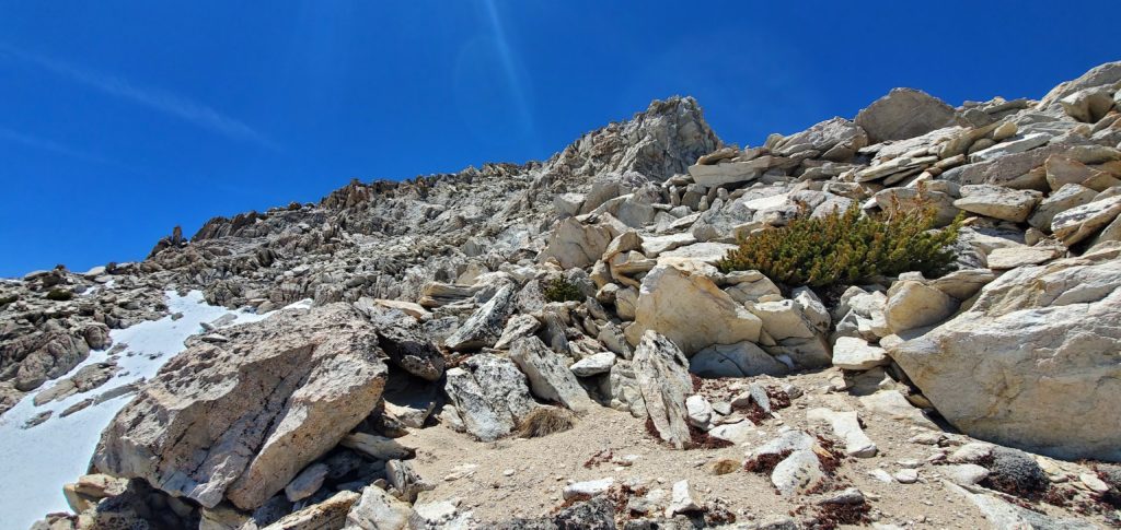
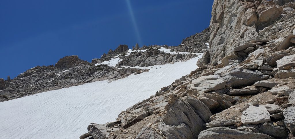
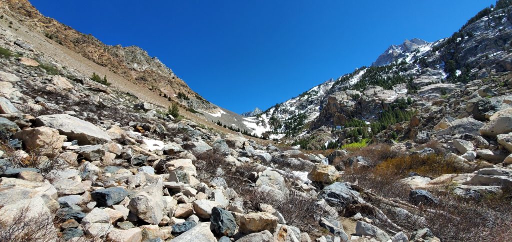
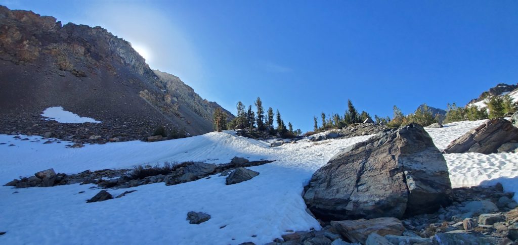
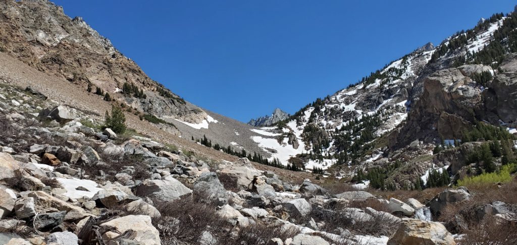
The trail gets a little more interesting as the trees break some and you go through rocks and some brush. But the real slog begins around 9600 feet.
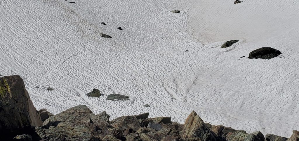
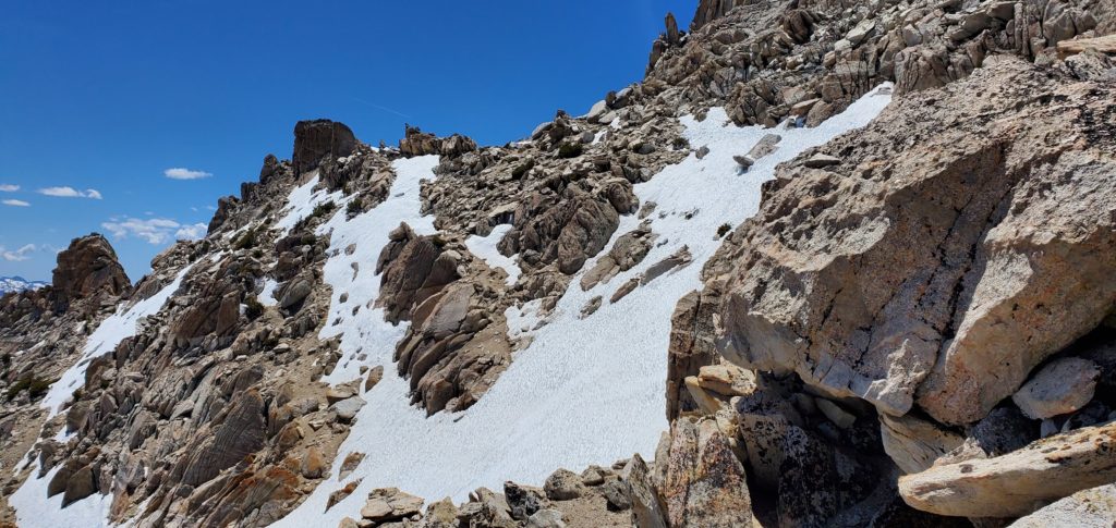
Here, in early season even in a low snow year, large patches of it cover parts of the trail, making adherence difficult especially as there are a number of use paths that wind over the rocks.
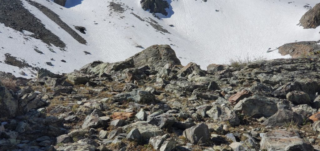
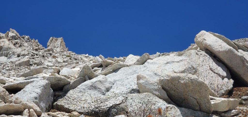
This is where I made my first route finding decision that slowed me down. Rather than go straight up the fairly firm snow patches – low enough angle and probably soft enough for kick-stepping; crampons, which I had, would’ve made those patches a breeze – I opted to route through the boulders on the left of the snow banks.

These rocks, glacial deposits mixed with fall from the sharp canyon sides, are every bit as annoying as you can imagine. Uneven hopping on unstable boulders that simply takes time and needlessly works legs. Given comfort and equipment, I’d take the snow.
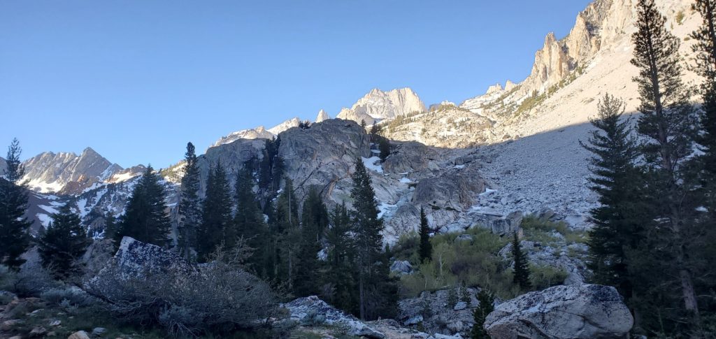
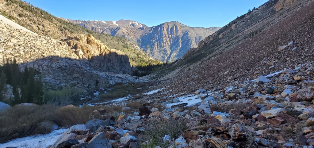
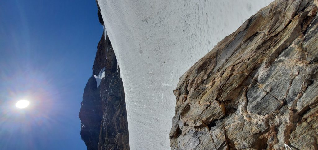
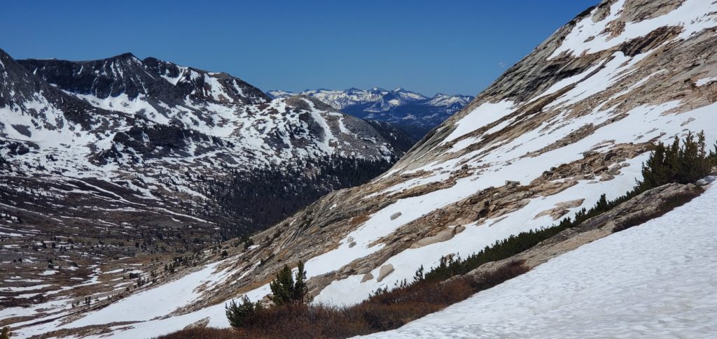
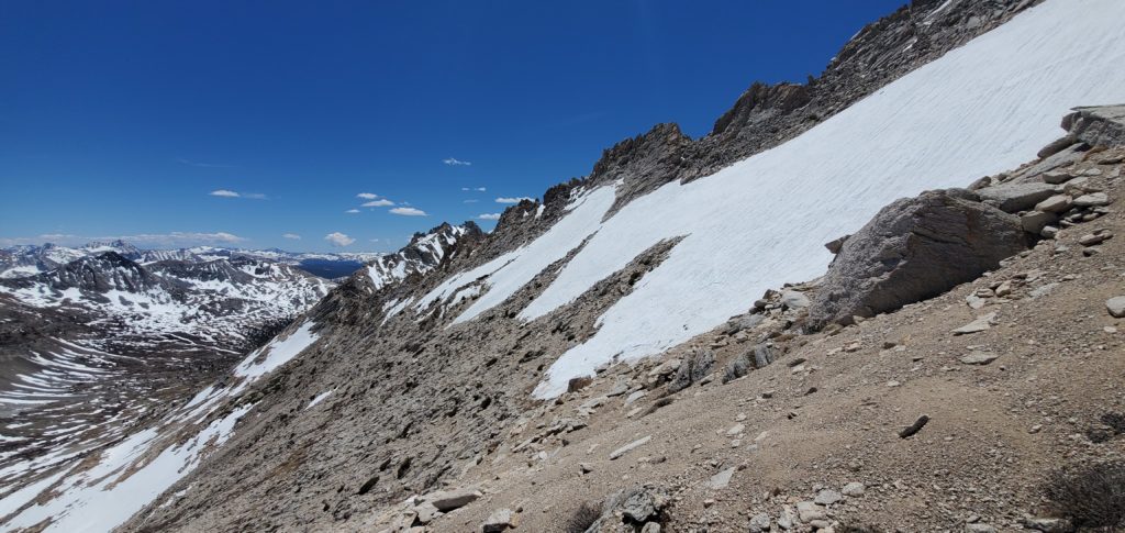
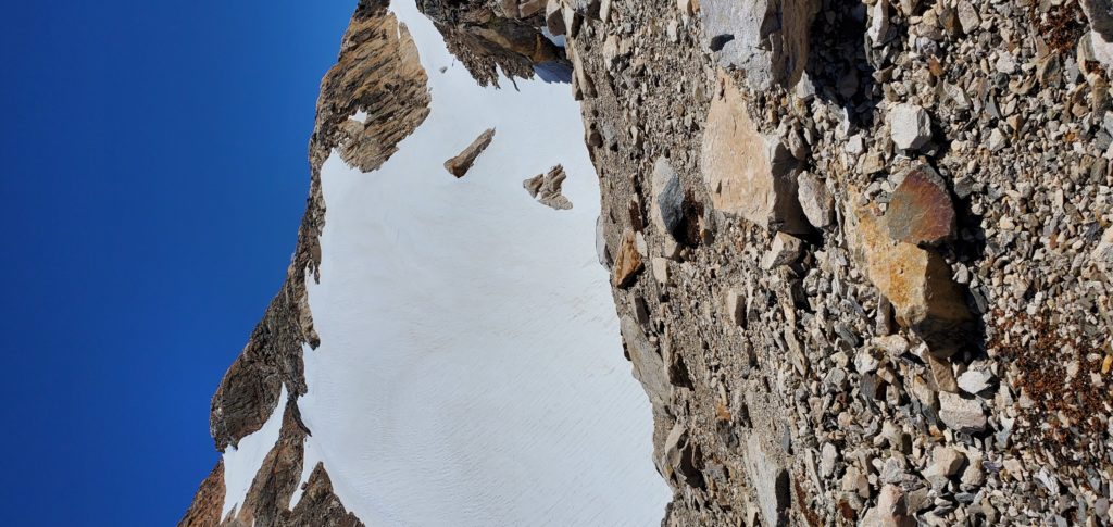
After the first sharp elevation increase, there’s a brief plateau and still hundreds of feet above you, Horse Creek Pass. There’s lots of running water for refills and, on May 30, safe snow pack to cross the stream any time you want.
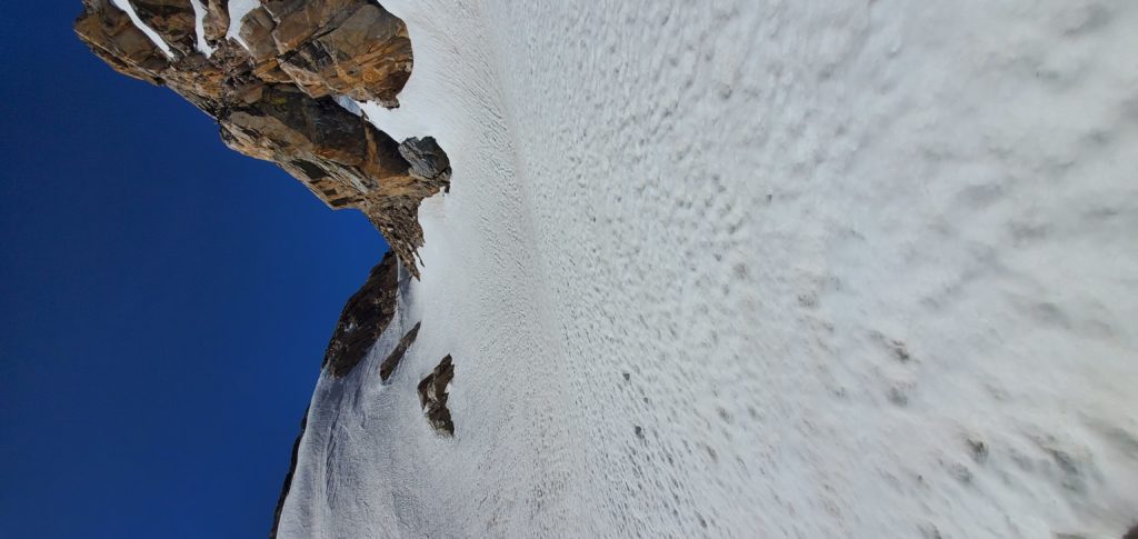
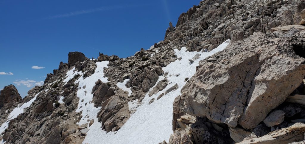
As the rise began again, I alternated between boulders and traverses on the snow, though generally using boulders for elevation gain. This section is steep and windy and none too pleasant, though a walk in the park compared to the SE slope.
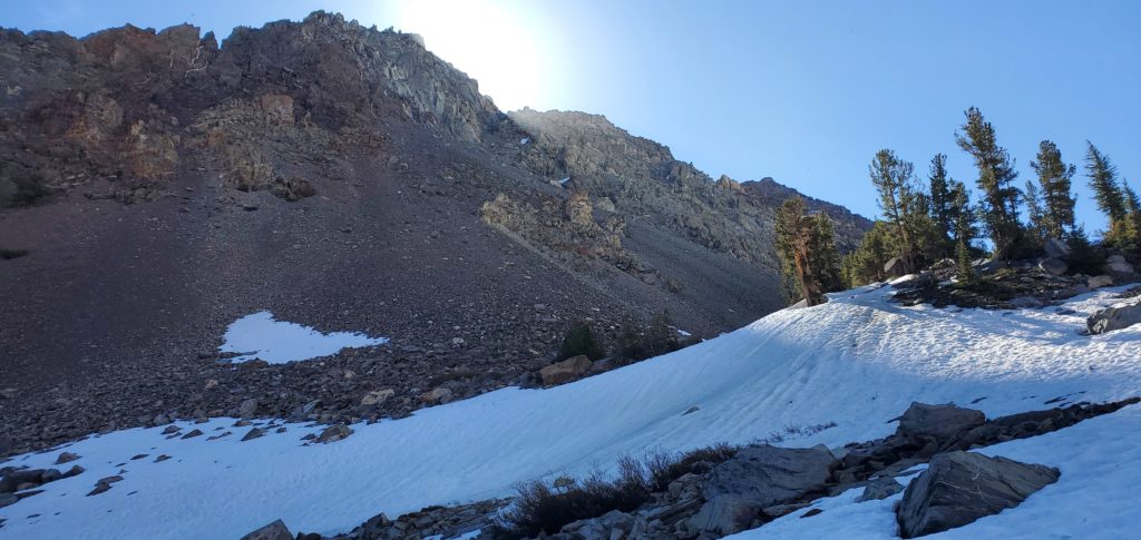
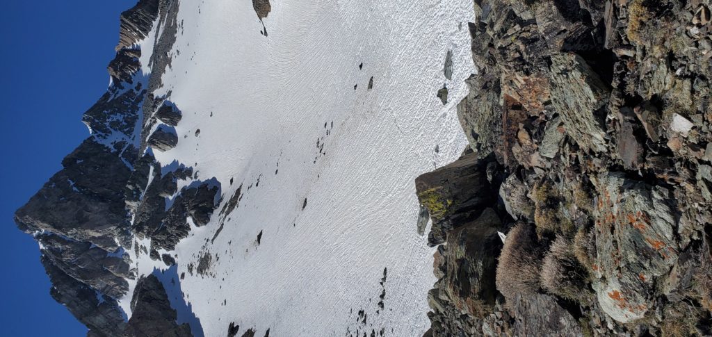
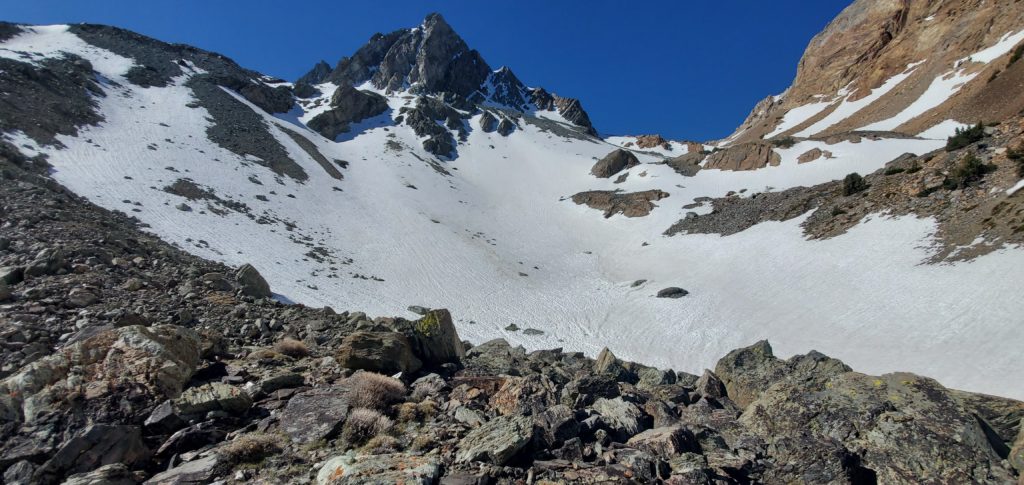
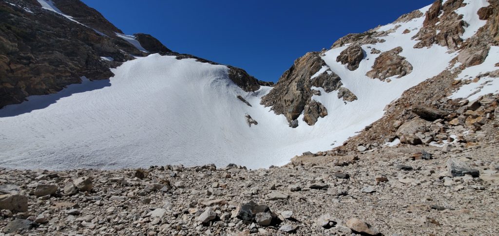
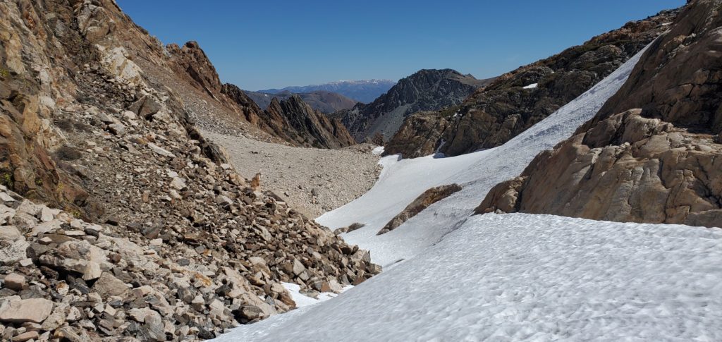
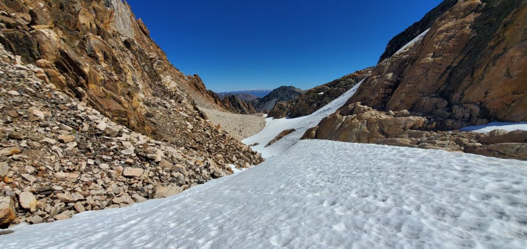
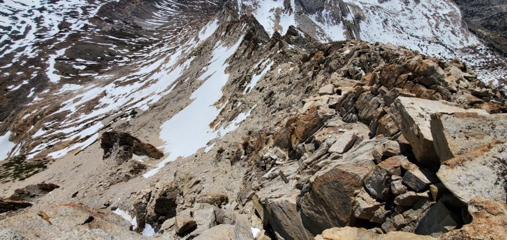
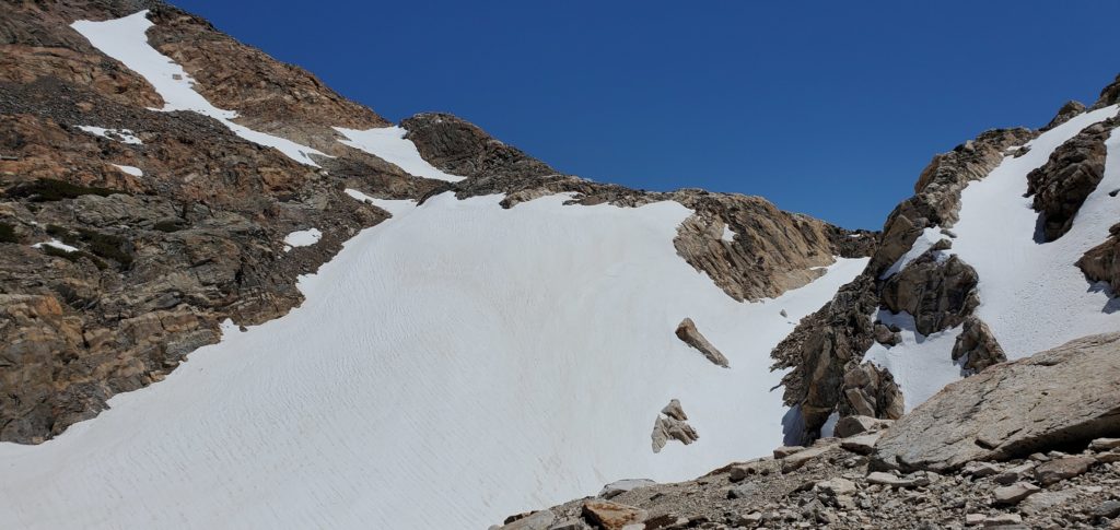
On final approach to Horse Creek Pass, AllTrails recommends taking a route high to the right of the pass. This bypasses the largest and probably steepest snow bank that goes straight over the pass and continues on Horse Creek Trail, a path you’d follow to get, eg, to Whorl Mountain. Following the AllTrails route immediately leaves you on the talus and scree SE slope of the Matterhorn.
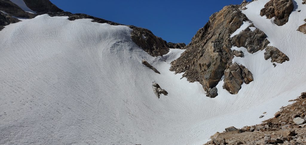
I was having problems with my AllTrails app and ended up going straight over the pass, donning my crampons – unnecessarily, the slope wasn’t as steep as it looked, the snow was in fine condition for kick-stepping, and the runout was great if I did slip – for the last snow field. From there, I continued a bit over the pass before seeing a group of three hikers up on the scree to my right. Oops. I needed to backtrack and find a route to that slope.
This little detour, plus the earlier imperfections, added maybe 500 feet of climbing to the hike (5,700 feet of elevation gain, per Strava, versus the 5,280 usually associated with the effort). It also delayed me by 30-45 minutes. Not a big deal; I had plenty of time ahead of me.

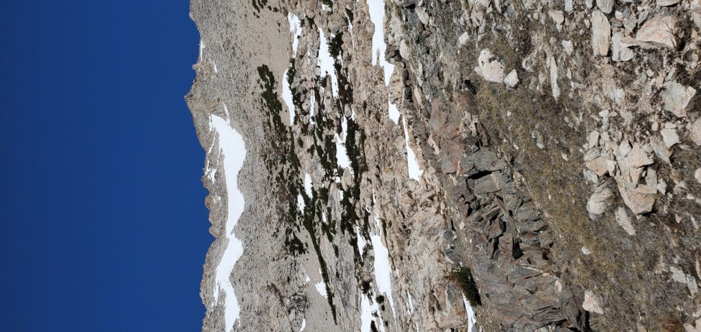
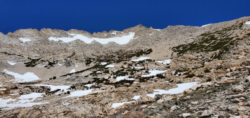
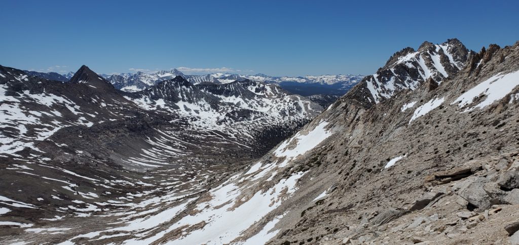
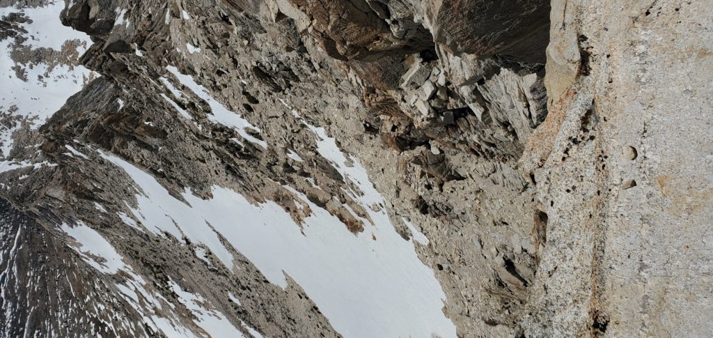
Here the hike devolves into tedium. There’s roughly 1,400 feet of elevation gained in less than a mile on a scree slope. The views are pleasant but the terrain so annoying that it makes the hike rather miserable. It didn’t help that I had back-to-back nights of 4 hours of sleep, had only gotten to 9,400 feet the day before, and had best trained in the Flat Nothing Land of Chicago by running up and down high school bleachers with an N95!
As the slog continued, I definitely felt the affects of altitude. I had to stop every handful of steps, the scree slippage draining my sore legs and my breath needing to catch. Though I didn’t get a headache, my mind felt a bit fuzzy from want of sleep, altitude, and being annoyed.

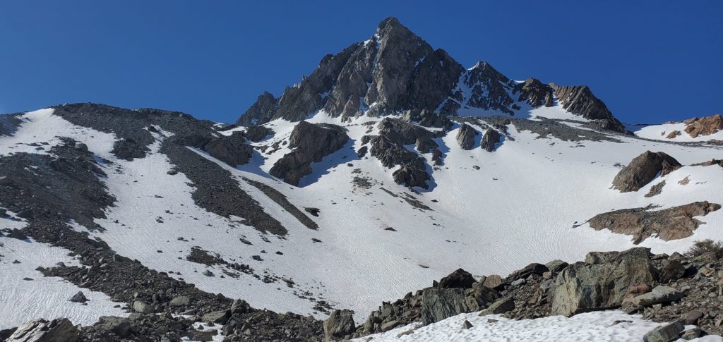
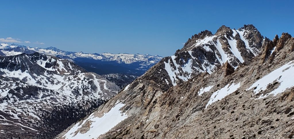
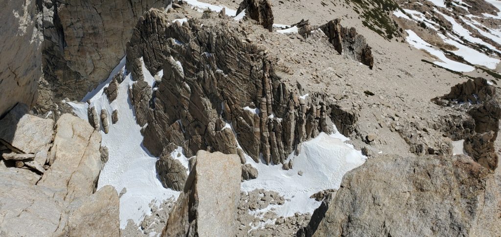
This continues for a while. Matterhorn Peak finally emerges to the left as the scree firms a little. There was one almost sketchy snow field that had a horrendous runout and steep slope. However, there were many boot prints to follow, a number of them having postholed 6+ inches, so the risk was very low. I put my crampons on just in case, though I definitely did not need them (and did not wear them on descent).
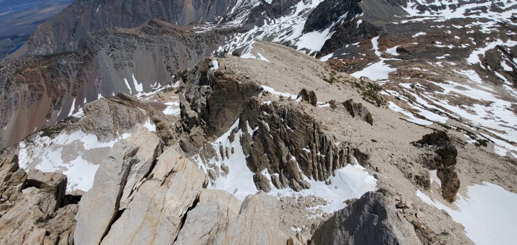
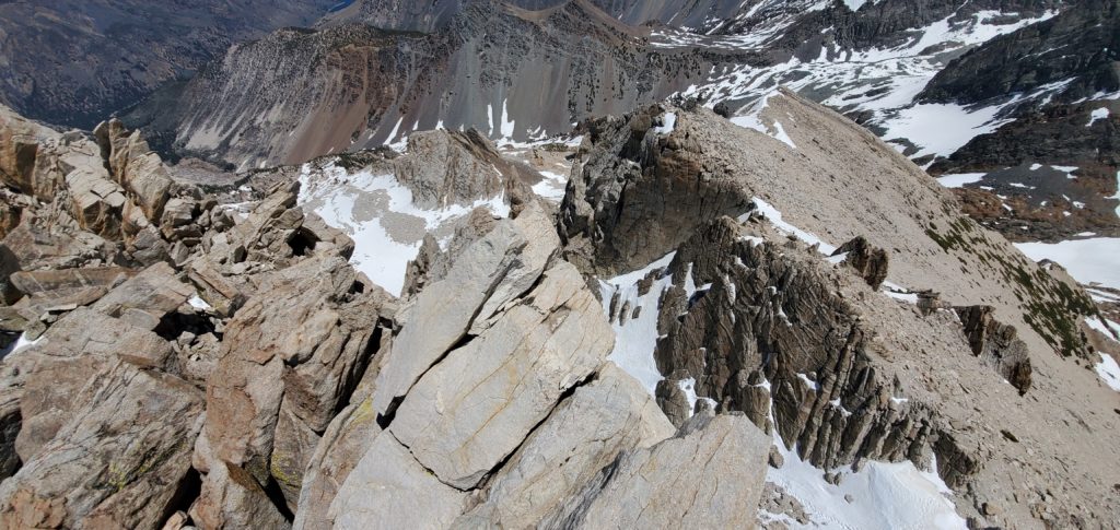
At this point, the route is supposed to assume some fun Class 3 scrambling. I’d hardly call it Class 3. There are no needed technical moves and most of the exposure is only 20-30 feet. Nothing feels sketchy; it’s straightforward scrambling on solid rock. Even coming down it’s easy. Honestly, I had hoped for more fun, something to make my hands sweat.
At 12:10 I reached the summit.
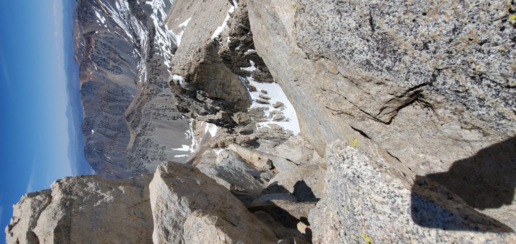
The summit block actually has exposure – you can look down a hundred feet in three directions. But there’s nothing technical in getting to or walking around the summit. The register is box is older and hard to get the lid on or off.
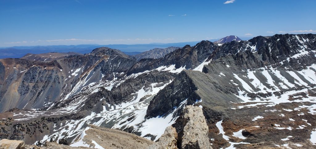
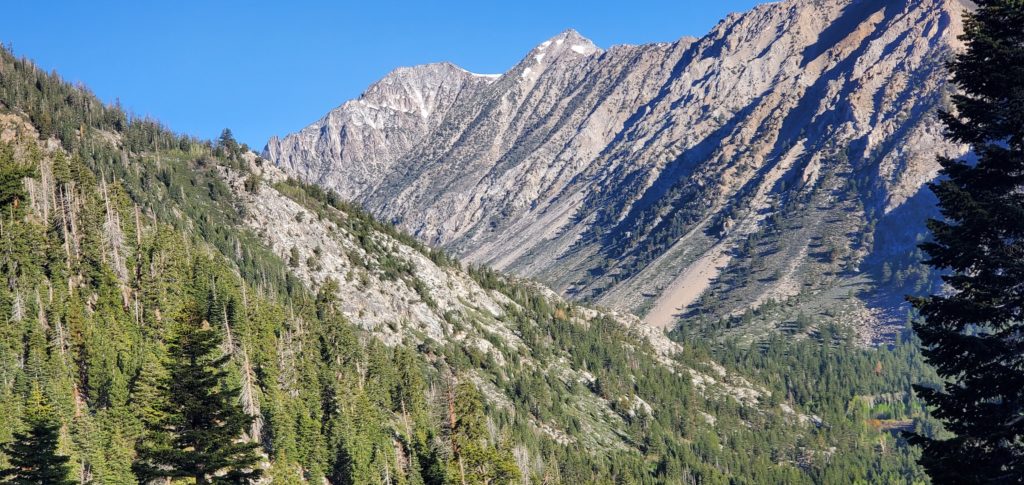
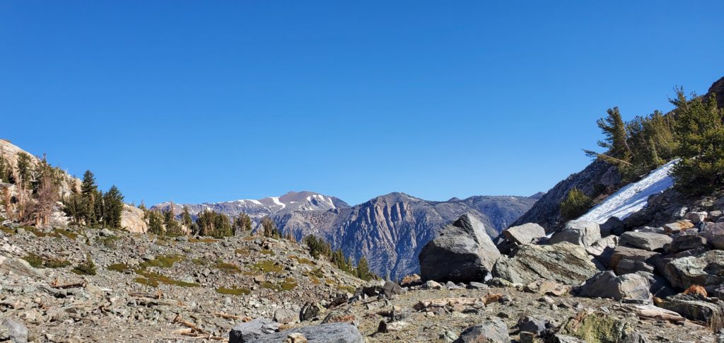
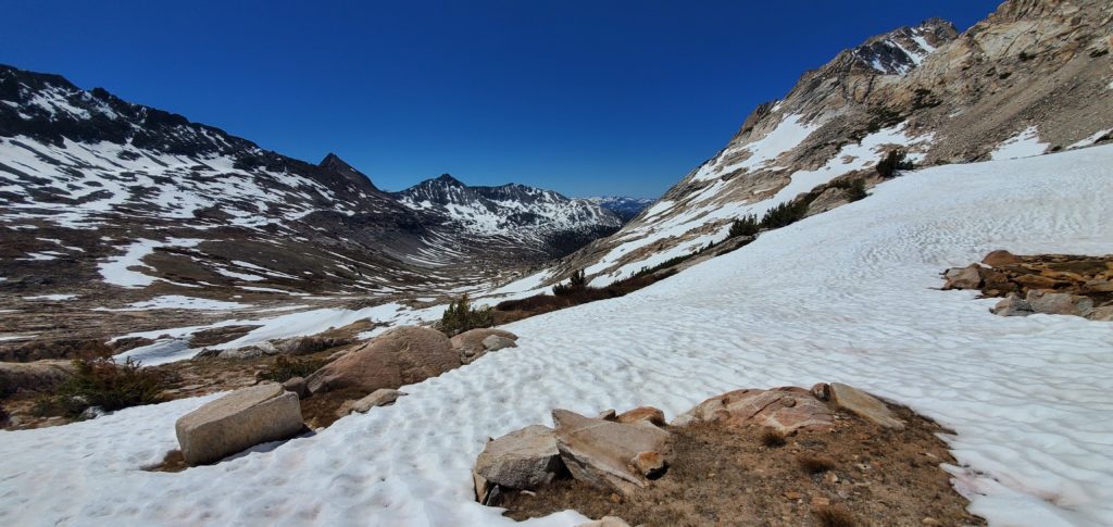
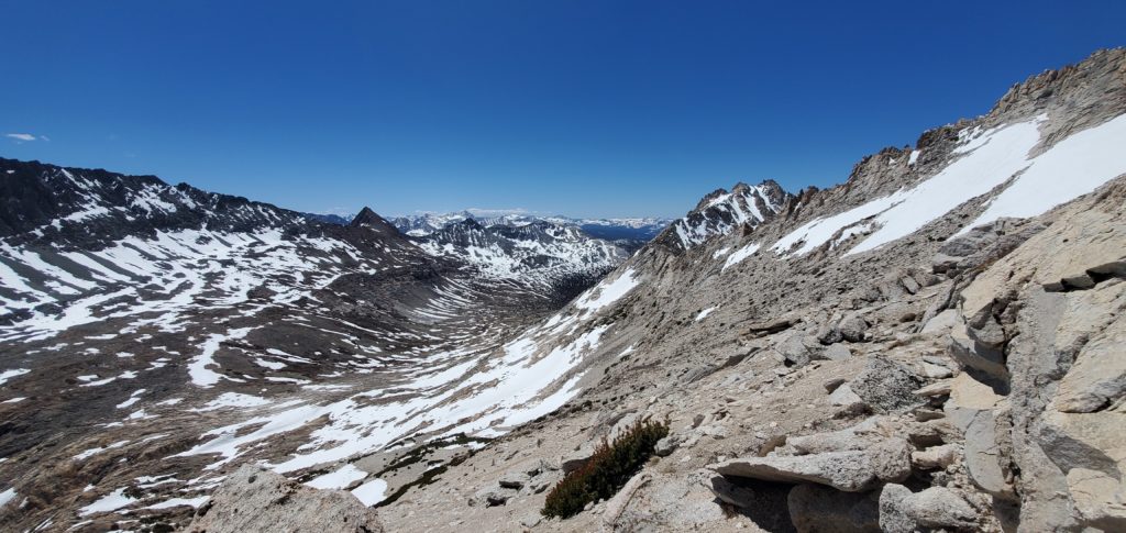
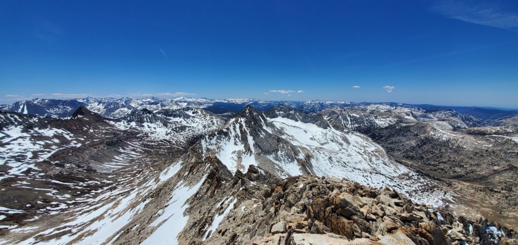
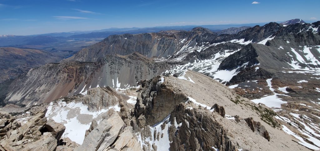
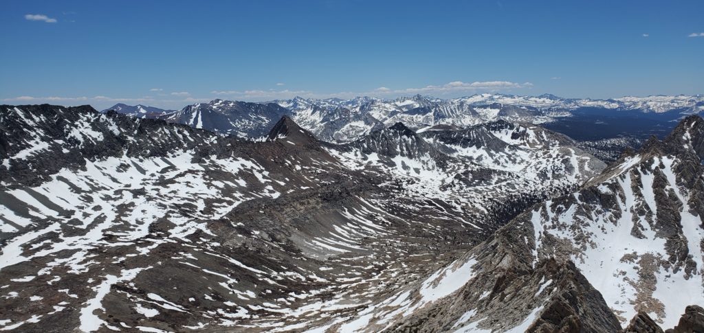
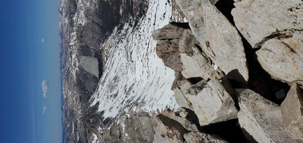
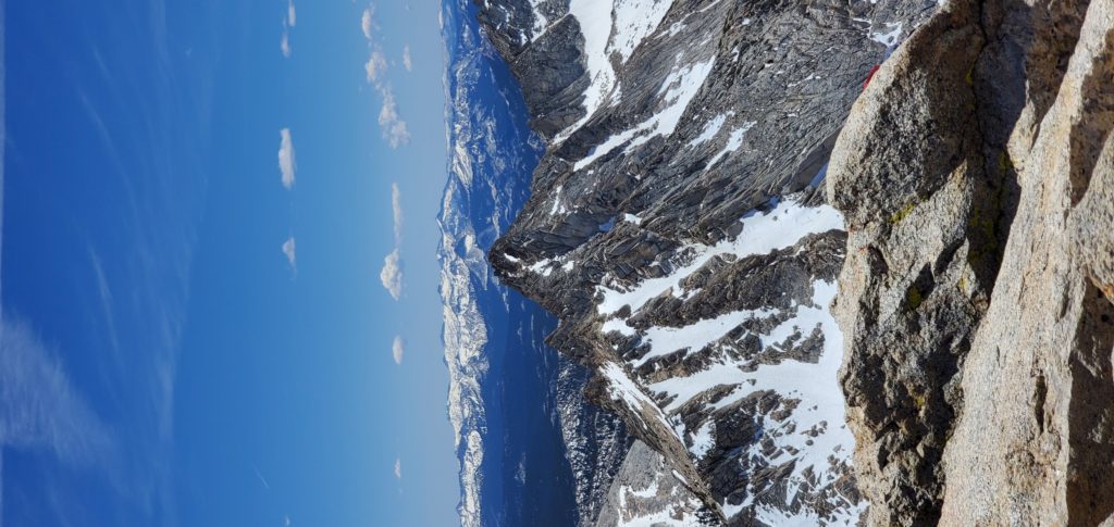
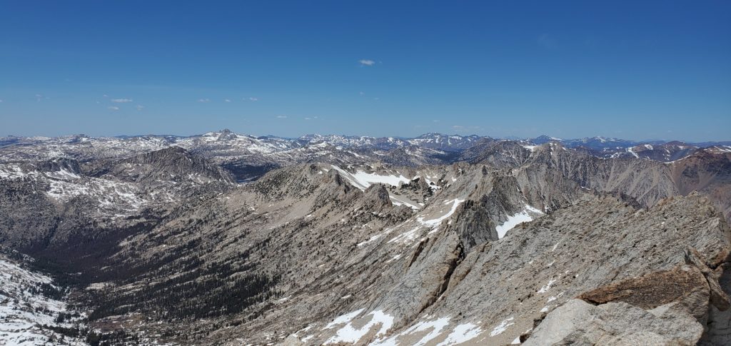
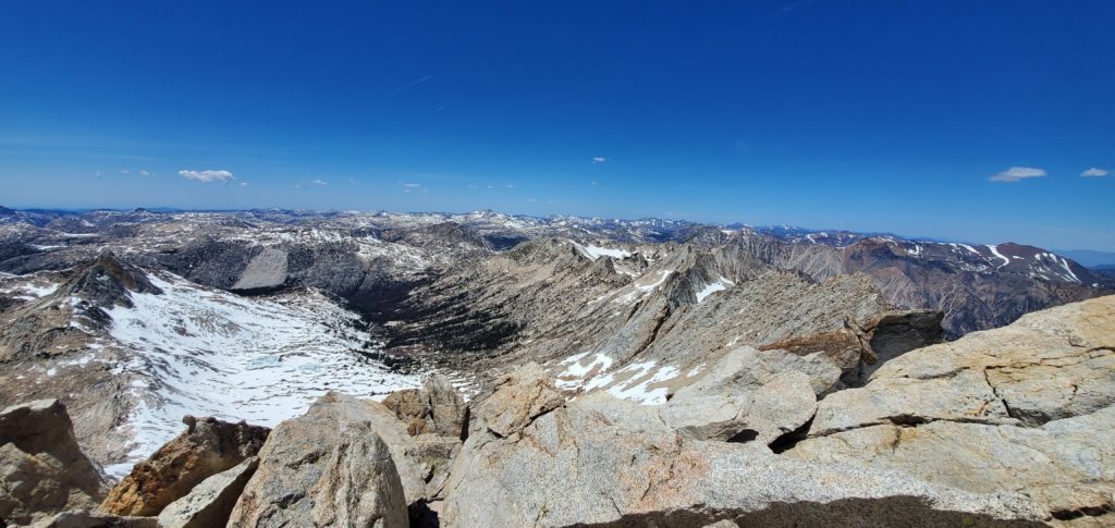
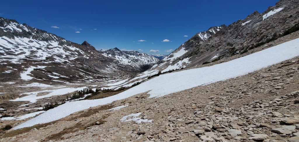
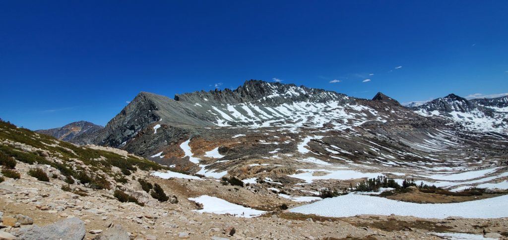
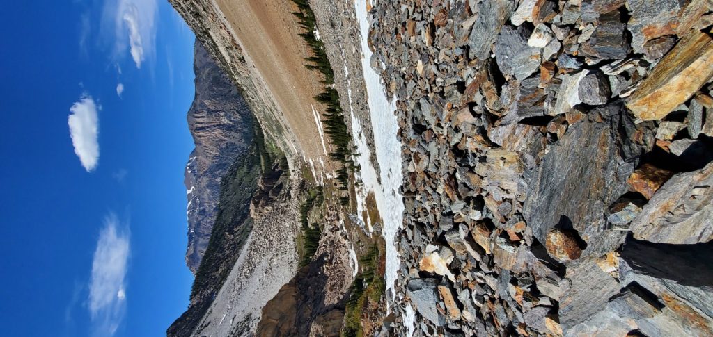
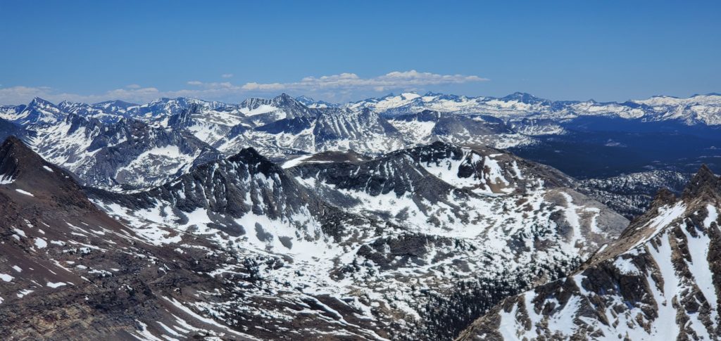
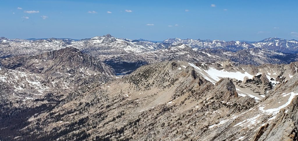
Views are magnificent, especially on a clear day. You can see to the Coast Range’s highest peaks in the west, Lyell and McClure to the south in Yosemite, Ritter and Banner, the Mammoth Crest, and so on. I’m less familiar with the subranges to the north, but the views there are spectacular, too. The glacially carved canyons below are stunning, as is the rest of the Sawtooth Range with Whorl looking tantalizingly close.
I stayed on the summit for about an hour, chatting with some folks who started at 4:30a and then a couple who started at the same time I did. All great people enjoying a beautiful day.
After nearly an hour, I left the summit and began the return trip.
Downclimbing the Class 3 section is straightforward. Good grips, nothing technical, little fear of falling into the exposure. I’m still not used to how my pack changes my center of gravity. That was the hardest part of heading down.
I scree-skied the slopes down, kicking lots of debris and losing elevation many times faster than I gained it, the one benefit of those slopes, and took the correct, high path through Horse Creek Trail. Here, again, it’s largely staying above the central path through the pass. The trail alternated between rock and snow, more rock up high and snow as the descent continued.

From here, route finding did become difficult as I wanted to stay true to the trail, seeing if it was easier than coming up off it. This isn’t strictly necessary: Point-and-shooting downhill will get you to the same place in probably the same time. I was just curious and exhausted. Having the trail think for me would be a nice mental break.
Of course, with the snow covering most of it, I had to keep checking AllTrails for my adherence, which got fairly annoying to keep looking at the device every couple dozen steps. Oh well. Following the trail did make things pretty easy. I got to glissade down a couple snowbanks in wonderful condition for arrests. Definitely the highlight on the way down. Sticking to the trail also kept me off most of the annoying rock and made the descent so much more pleasant than the steep boulder hopping on the way up.
Once on flatter terrain the trail still loses itself in rocks and brambles but always emerges after twenty feet or so. Following Horse Creek will always keep you on the right path.
By now I was dead exhausted and just wanted to sit down in the car. But the switchbacks kept coming and coming and coming, highlighting their inefficiency and teasing nature. They would be easy to run down, though.
At about 4:50p I returned to the resort. Overall it took just shy of 10 hours with 5.5 for the ascent and 3.5 for the descent (1 on the summit). Better route finding, slightly better strength, and better acclimation probably could have shaved an hour off the ascent time.

In the end, this was a pretty tedious hike not worth repeating. I imagine the East Couloir presents a more enjoyable ascent and better challenge. Even the stunning views could fully offset the slog it took to get there.
Still: First Emblem Peak accomplished!
Equipment
Time Splits
6:45a: Started hiking
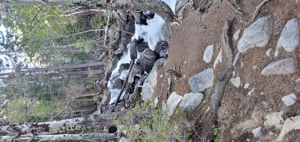
7:15a: Horse Creek Falls
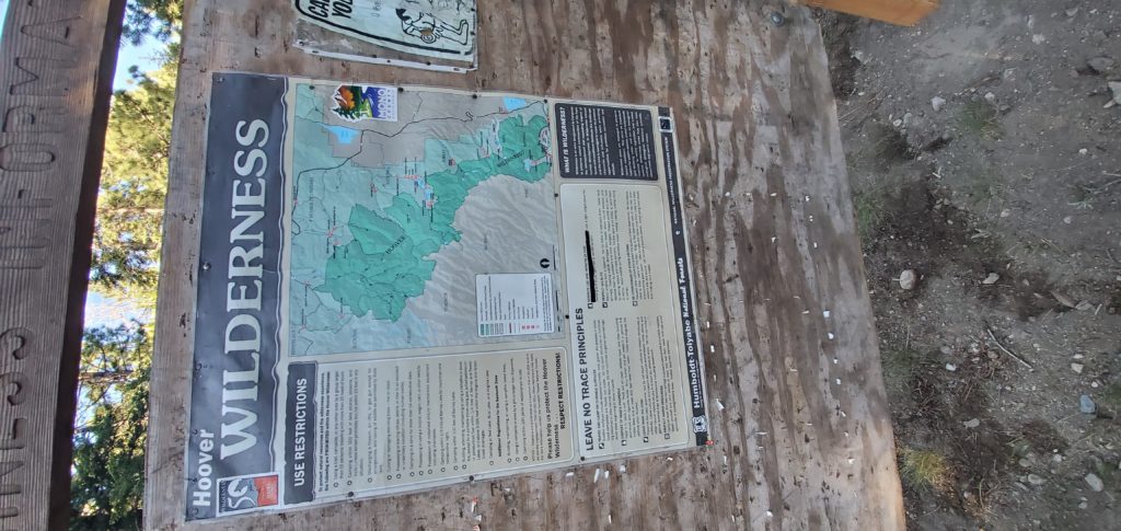
7:30a: Hoover Wilderness sign
8:00a: First ascent
8:45a: Ascent plateau (stopped for water and food)
10:00a: Snowbank immediately below Horse Creek Pass
10:45a: Horse Creek Pass (long break before that final short climb)
12:10p: Summit
1:10p: Left summit
1:45p: Horse Creek Pass
3:30p: Below the headwalls
4:50p: Back at parking lot