Result: Summited Dick’s Peak and Jack’s Peak
Class: 2
The Plan
On Tuesday, I hoped to climb Dick’s Peak and Jack’s Peak. If all went well, I planned on climbing down Jack’s Peak to Desolation Valley and venturing to Jabu Lake, too. More on this later, but any such plan should reverse the order: Jabu to Desolation Valley then up to Jack’s Peak and across to Dick’s Peak.
These peaks would bring me closer to climbing the 7 tallest Crystal Range and Desolation Wilderness peaks over the course of 2 long day-hikes and 1 afternoon jaunt to Mt. Tallac. High hopes for my week vacation at Fallen Leaf Lake.
I would fall two peaks short – I cut Pyramid Peak and Mt. Ralston from my plans – but hit 5 of the tallest 7 (besides these two, Mt. Tallac, Mt. Price, and Mt. Agassiz) and 3 subsidiary peaks (Echo Peak, Angora Peak, and Indian Rock) as well. (Okay, technically 2 minor peaks and 1 subordinate peak of Angora.)
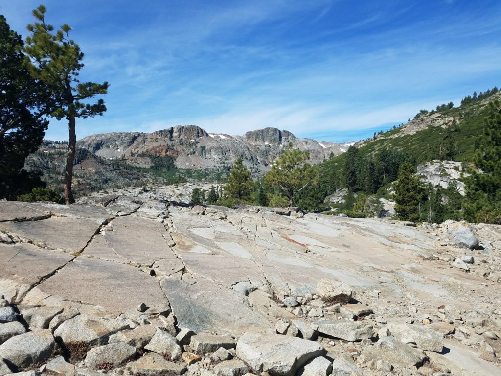
Glen Alpine Trail
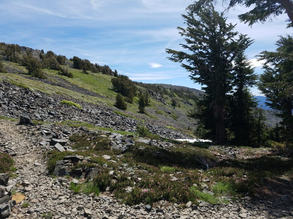
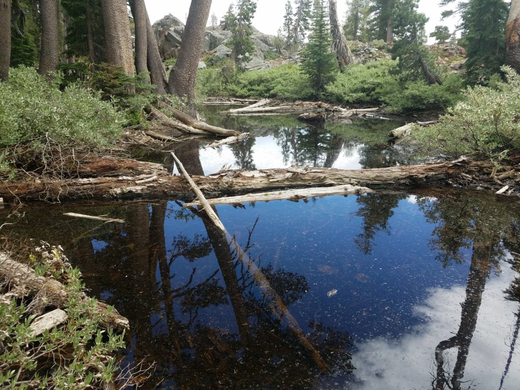
It’s very easy to reach Dick’s Pass. Starting between 8:45 and 9, I took the Glen Alpine Trailhead at Lily Lake (walking there from Fallen Leaf). As I’ve written elsewhere, Glen Alpine is an incredibly easy trail that meanders along the Glen Alpine creek, which feeds Fallen Leaf Lake from the backcountry snow melt, and slowly gains elevation.
I’ve been there too many times to find it scenic, and thus always rush along the trail. After a few miles, the trail splits to Gilmore Lake on the right, and to the PCT and Dick’s Pass on the left. It takes 3-4 miles to reach this point with only 2,000 feet of elevation gain. I got here in a little more than an hour.
Junction with the PCT
Naturally enough, take the PCT to Dick’s Pass. Reluctantly, I declined to take the brief detour to Gilmore Lake. Gilmore is one of the most beautiful lakes in Desolation Wilderness, in my opinion bested only by Lake of the Woods.
I paused just after the junction to eat a snack. A few minutes before I had passed two folks backpacking from the Echo Lakes to Truckee. Their packs looked heavy and they accordingly moved slowly, but were enjoying each others’ companies. I’ve always wondered whether I would have enough conversation to sustain multiple days of hiking with someone.
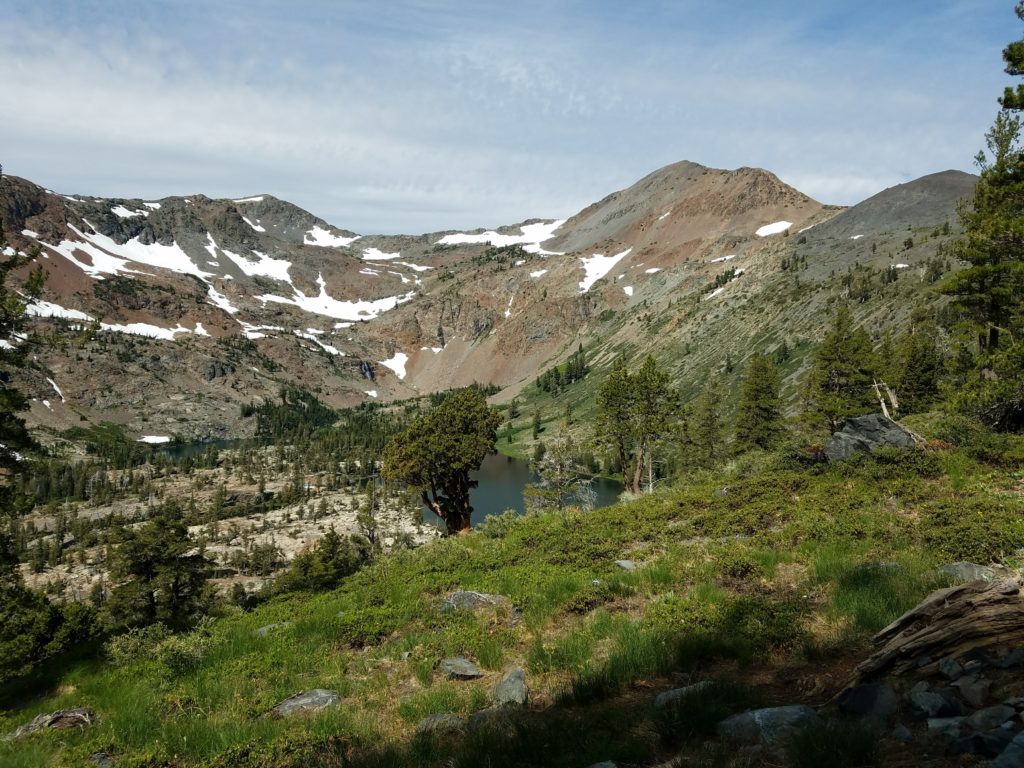
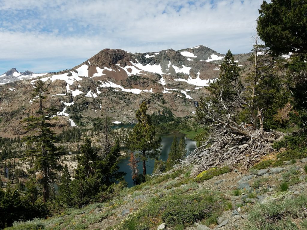
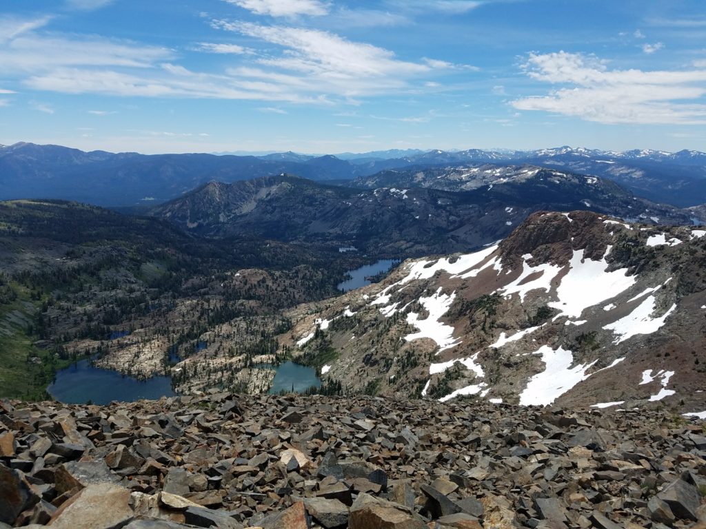
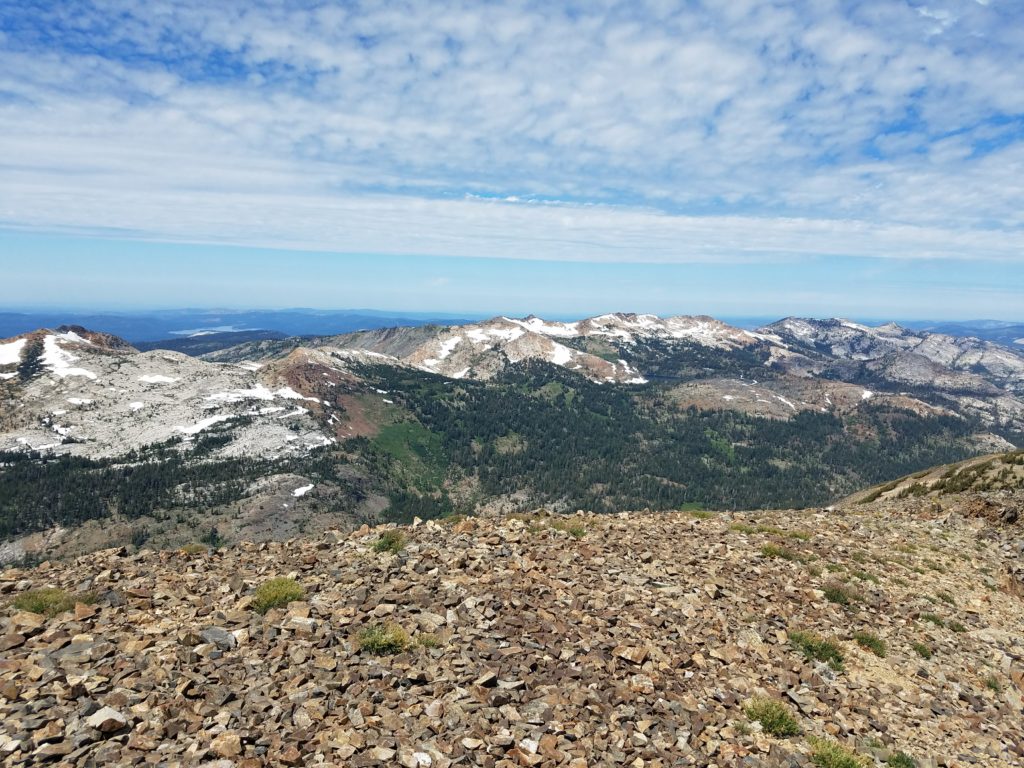
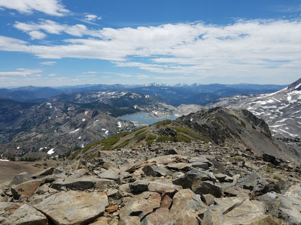
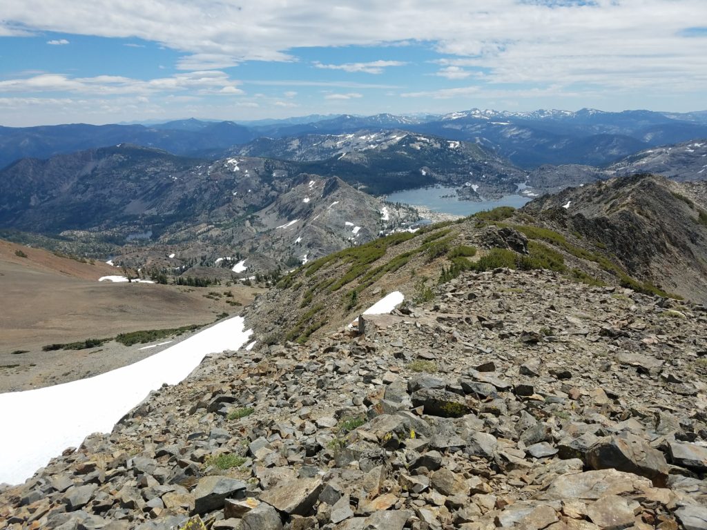
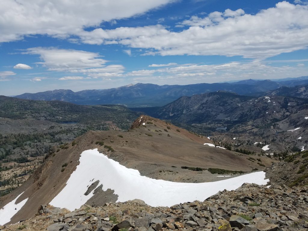
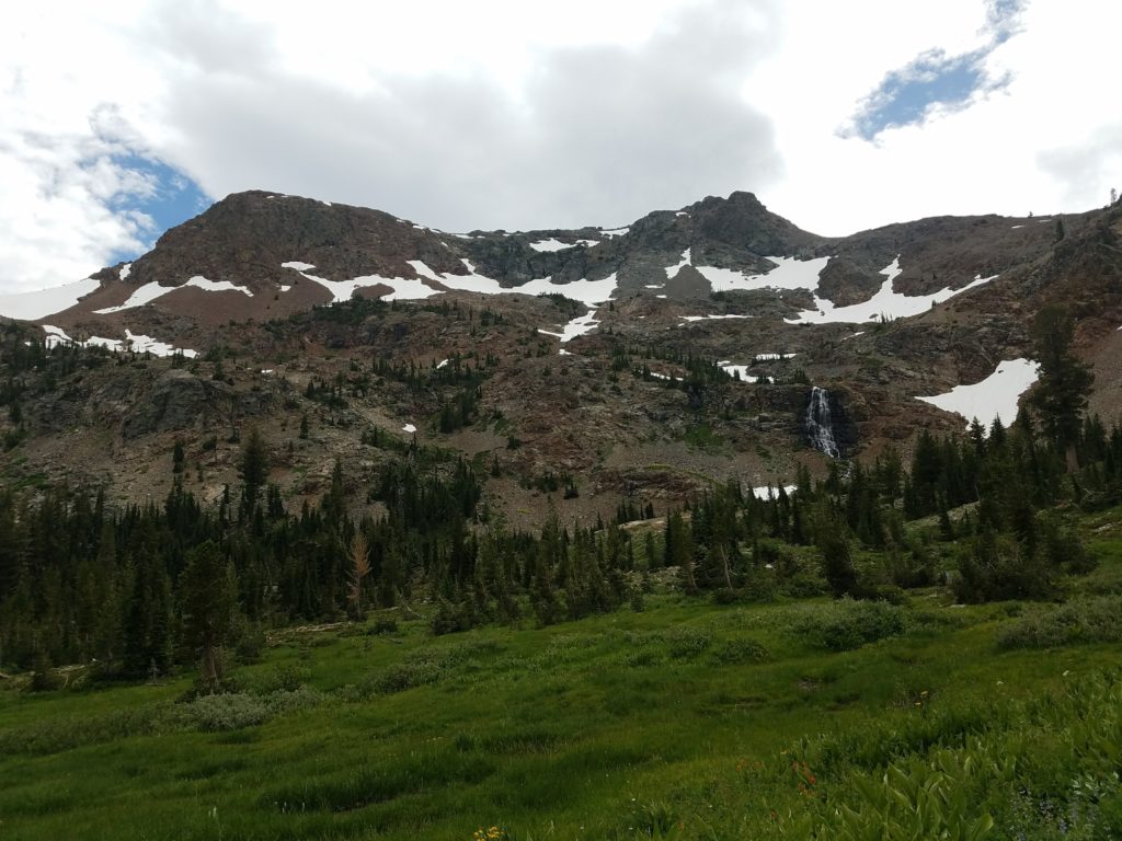
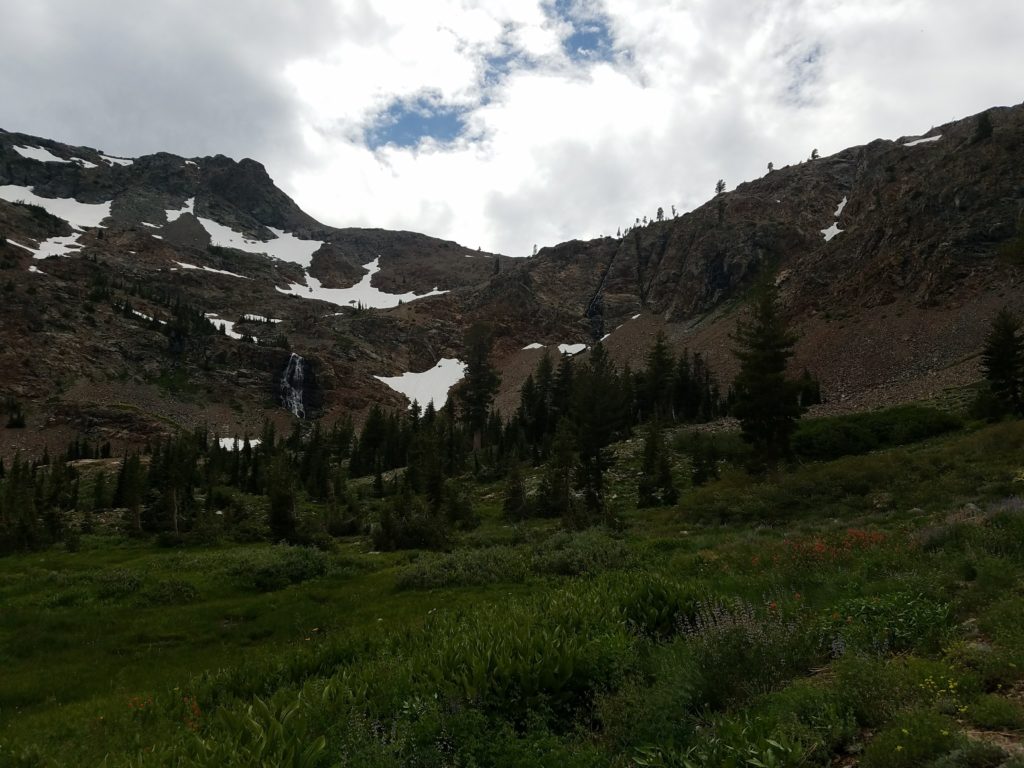
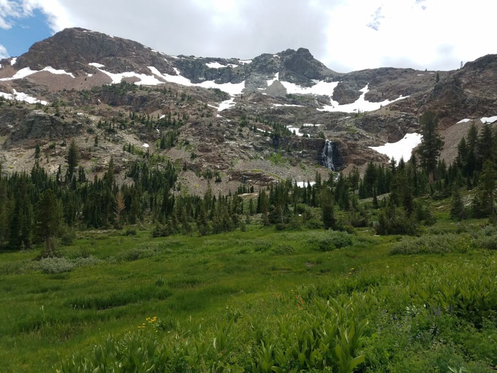
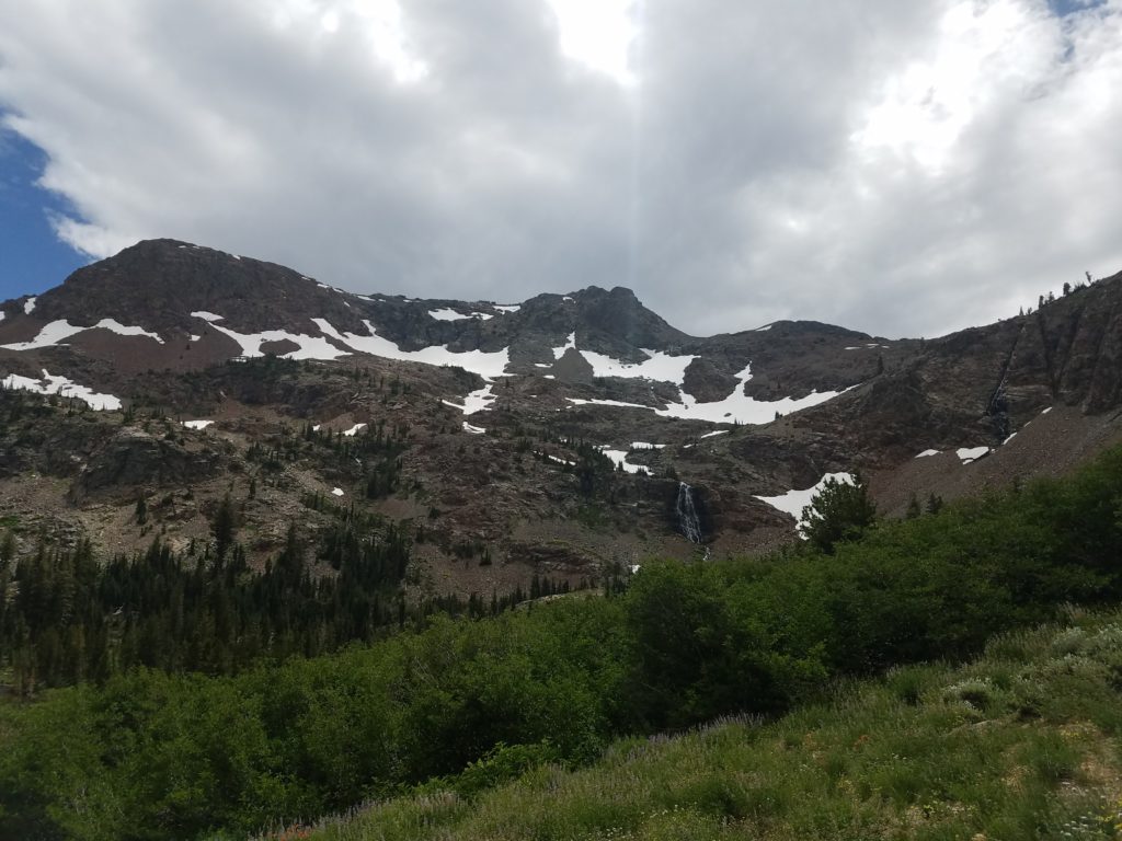
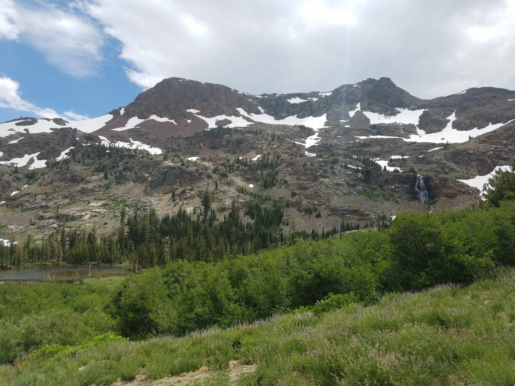
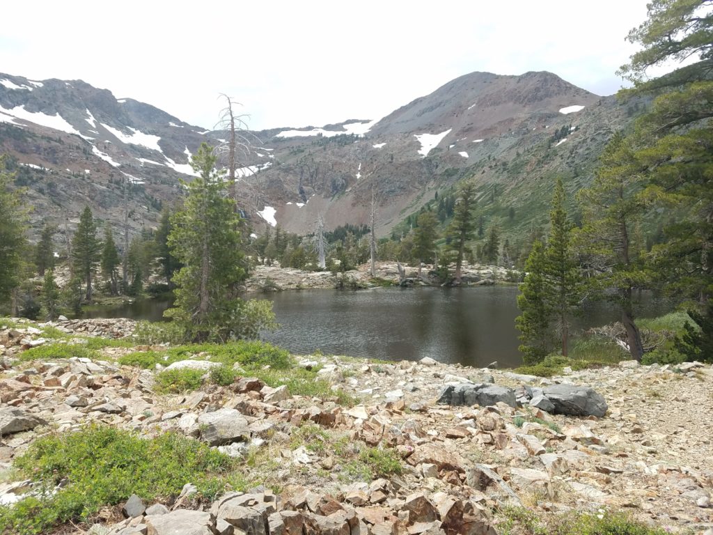
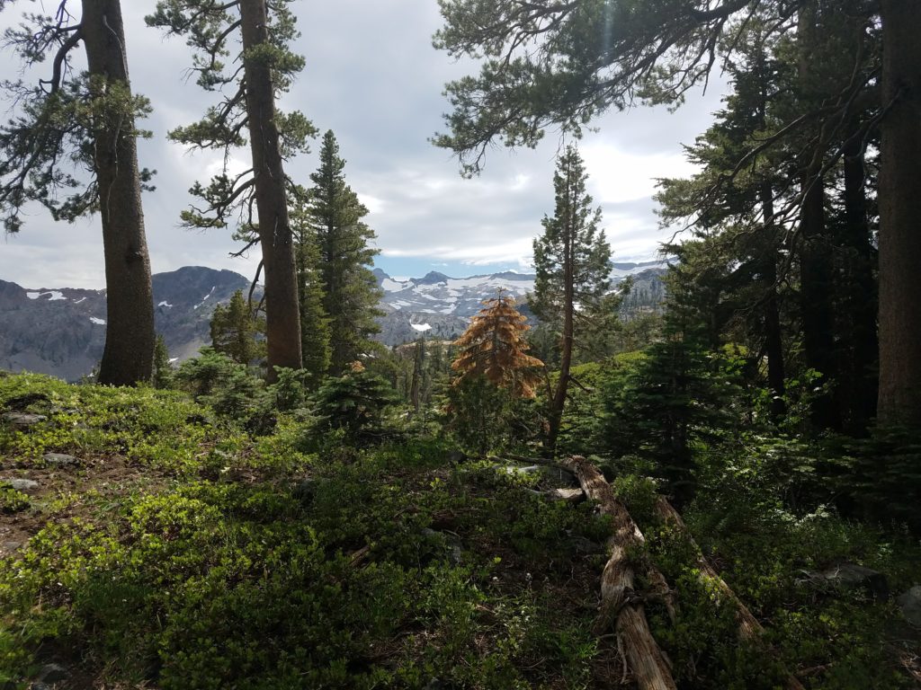
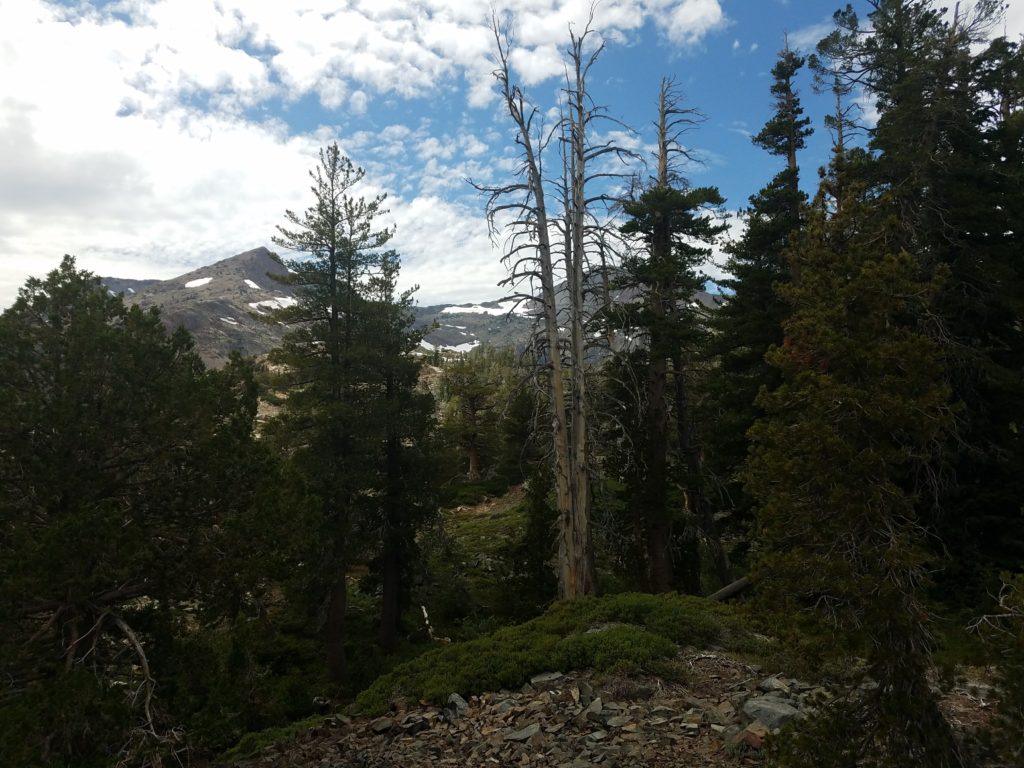
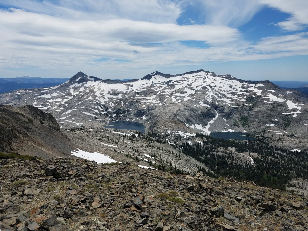
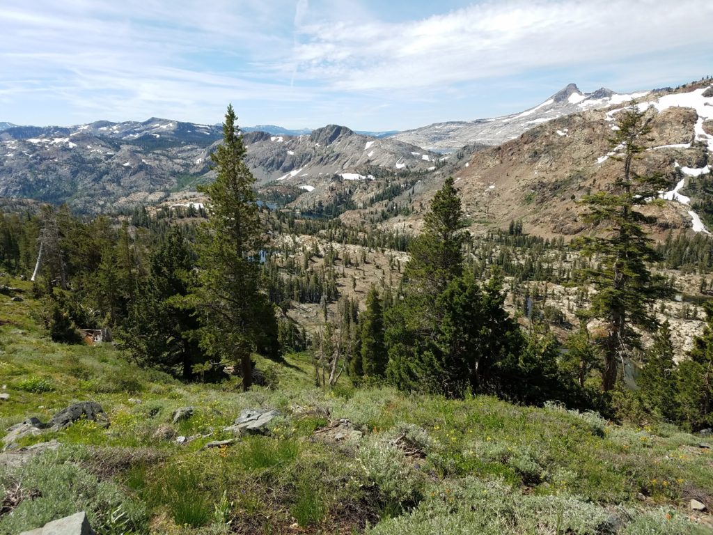
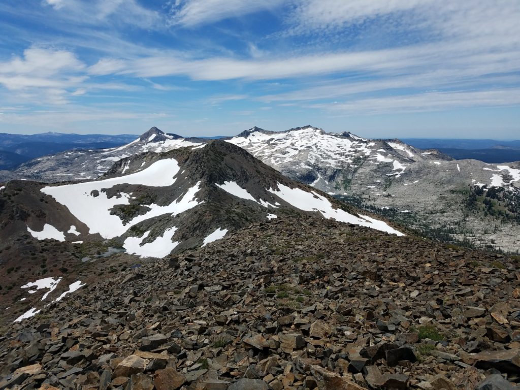
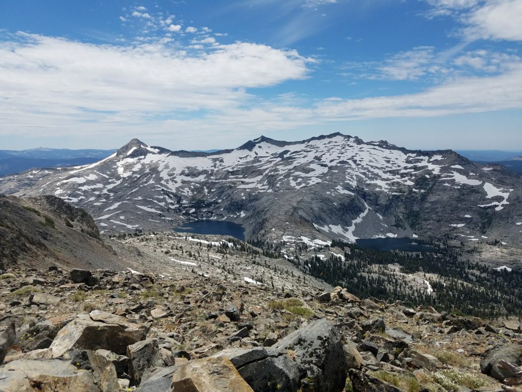
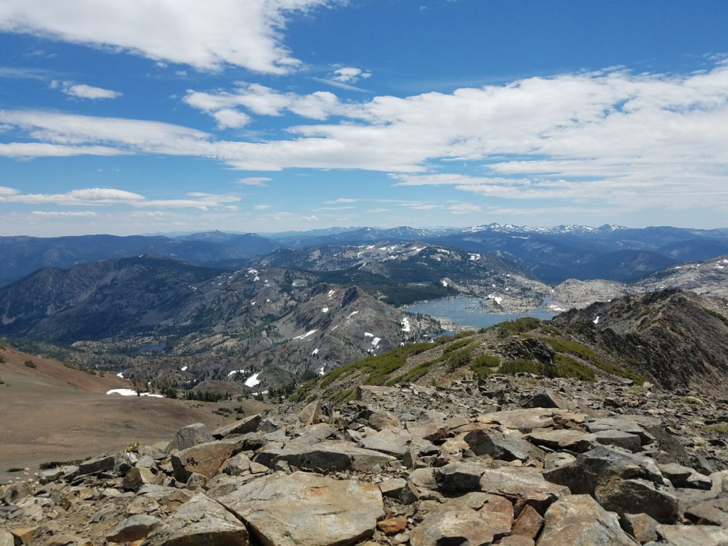
They passed me and I soon resumed and passed them again after a few minutes. Soon the trail gets prettier. As it climbs – again, slowly – the Crystal Range merges in the distance and Half Moon Lake’s basin begins to unfold below, bounded by Dick’s Peak and Jack’s Peak , both looking far and imposing.
Here I met someone sitting off the trail’s side. After casual greetings, he remarked “this trail is pretty hard!” I instantly felt bad for him. We hadn’t reached – or had just reached – 9,000 feet and nothing about this trail had particular difficulty.
And then I reprimanded myself for having any sort of judgment. Hike your own hike. He’s out enjoying nature and the low Sierra beauty. Ability be damned – be nice, have fun, and Leave No Trace.
Maybe a dozen minutes later I passed a group a little older than myself, all heading for Dick’s Pass and unknown destinations thereafter. I passed them, but quickly noticed they made very good time on the trail.
On long hikes, to save other thoughts for monotonous and wearying times, I enjoy having someone ahead or behind to catch or keep from catching. (On Mt. Shasta on the ascent to the Red Banks I kept track of how many people I passed – both for motivation and to have a mental record of just how many people climbed the mountain that day.)
I kept ahead of them though I felt my pace slowing a bit. On one section roughly 3/4 of the way to Dick’s Pass, the trail briefly splits with one steep and short section laughing at a needlessly long section that climbs to the same spot. I made the mistake of taking the longer, just in case the faint shortcut went no where. Where they rejoined, one member of the group of five or six had just started the shortcut. Uh oh. I figured I had maybe a 10 second advantage over him.
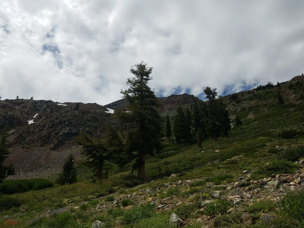
That gave me a kick in the butt. I upped my pace, ceased the occasional few second pauses, and raced over the next part of the trail. A few small snowfields remained, as they did in 2017 when I first climbed Dick’s Peak (and coupled it with an ascent of Mt. Tallac), but nothing difficult.
A few minutes later I chanced a look behind me and didn’t see the fellow hiker. Nor could I see him through the last trees before hitting the timberline around 9,200 feet. Phew. Still, his looming threat pushed me forward.
Dick’s Pass
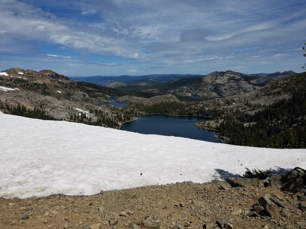
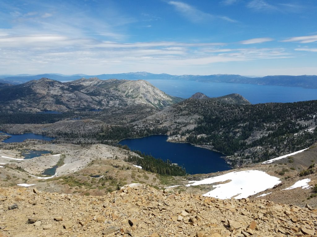
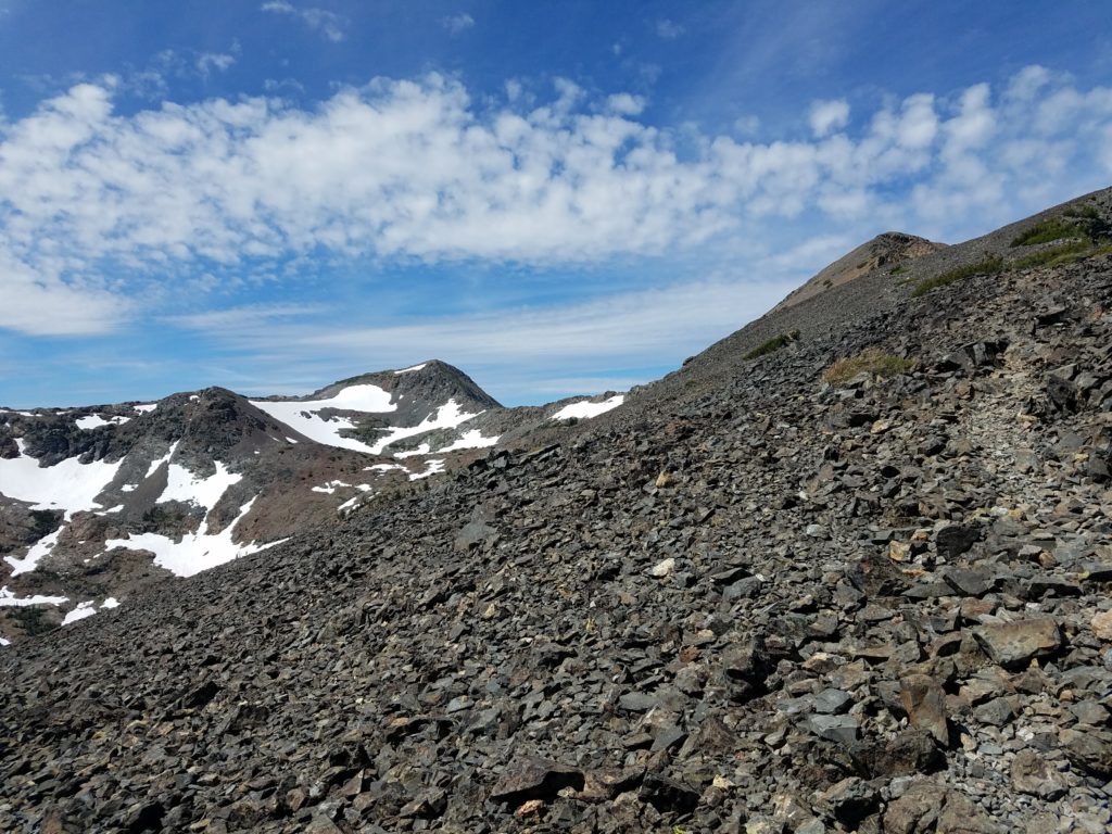
Not long thereafter I reached Dick’s Pass. At this point, the trail winds over and down to Fontanillis Lake. A use trail leads to the talus slopes of Dick’s Peak.
I took a break under the last visible tree, enjoying this bit of shade as I munched on a bagel. Typically in summer I hike in a grey (cotton) tanktop – weather dependent, of course – but in Yosemite I started wearing a cotton t-shirt at my girlfriend’s urging given fairly bad shoulder sunburn from hiking to Shastarama Point.
The t-shirt definitely made my shoulders feel better as my backpack’s straps cut less into them. However, my designated hiking t-shirt is a solid navy blue and a heavy cotton. Great for higher altitude hikes (eg, Mt. Dana) where the weather didn’t require long sleeves; not so great for sun-exposed hikes in Desolation’s typical August heat.
As a result, I had sweat through the back of my shirt, dehydrating me. Foolishly, I was slow to replenish lost liquids, a problem I also faced when hiking Mt. Price (but which I avoided when climbing Half Dome, El Capitan and Eagle Peak, Mt. Dana, and Mt. Shasta).
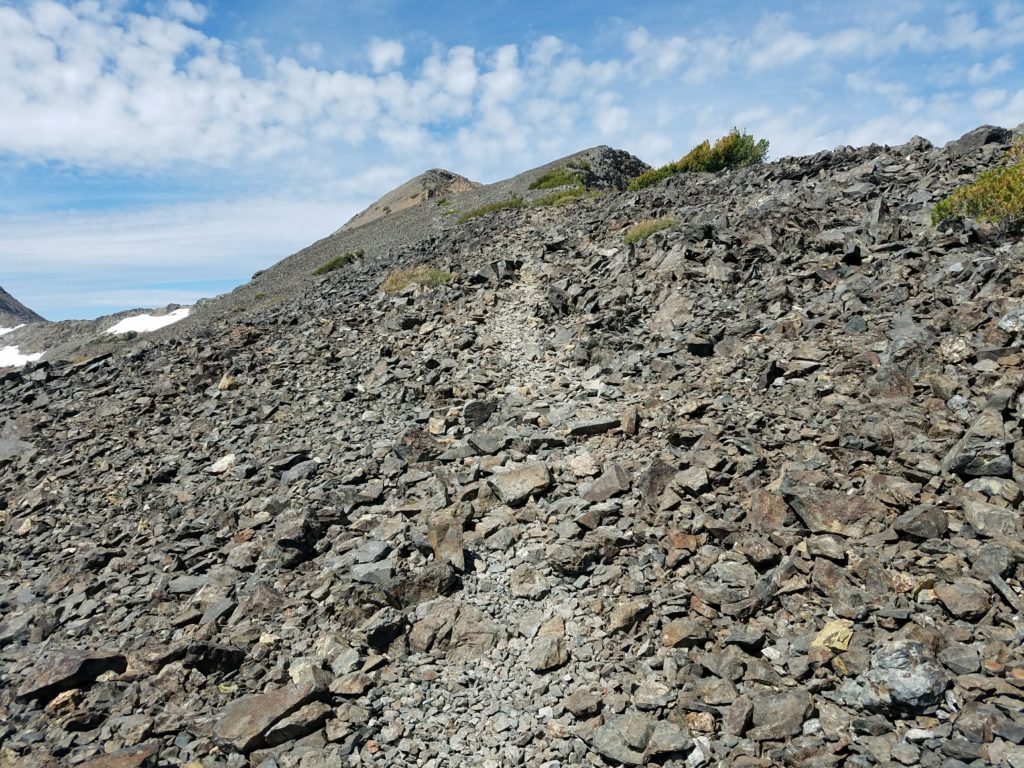
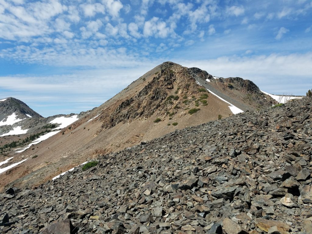
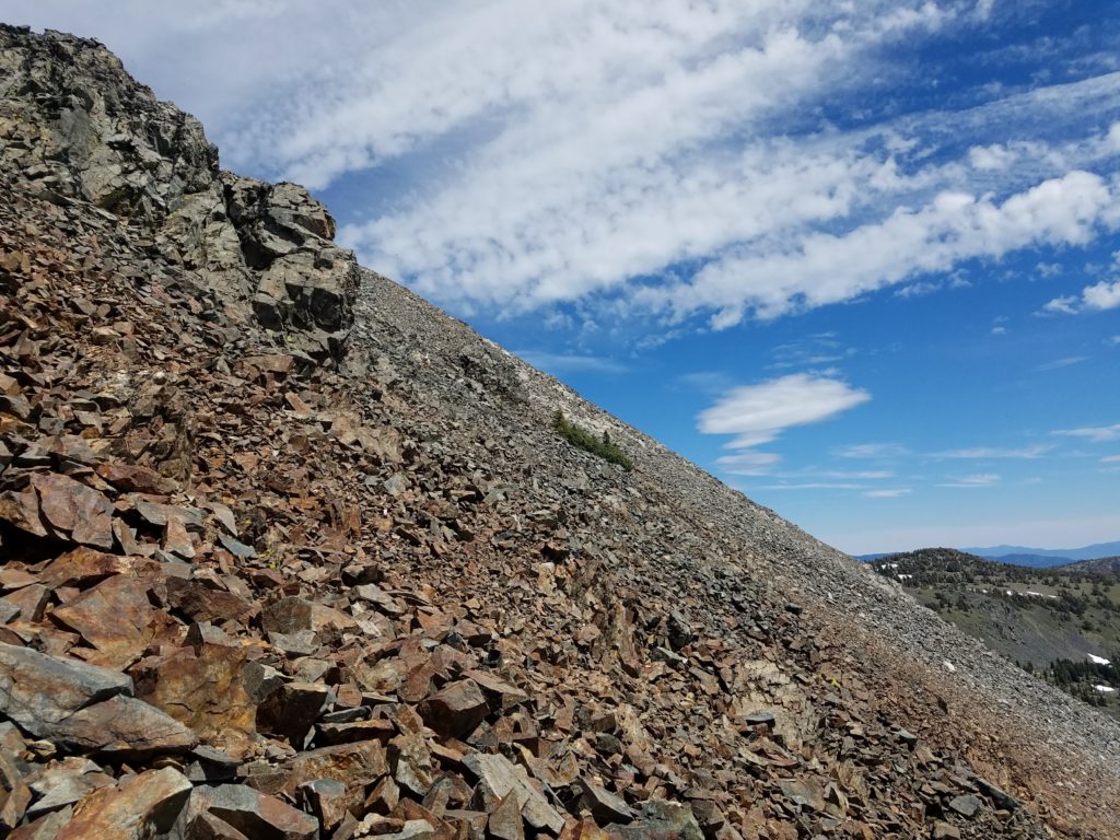
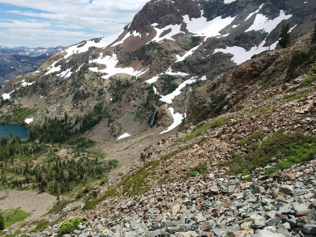
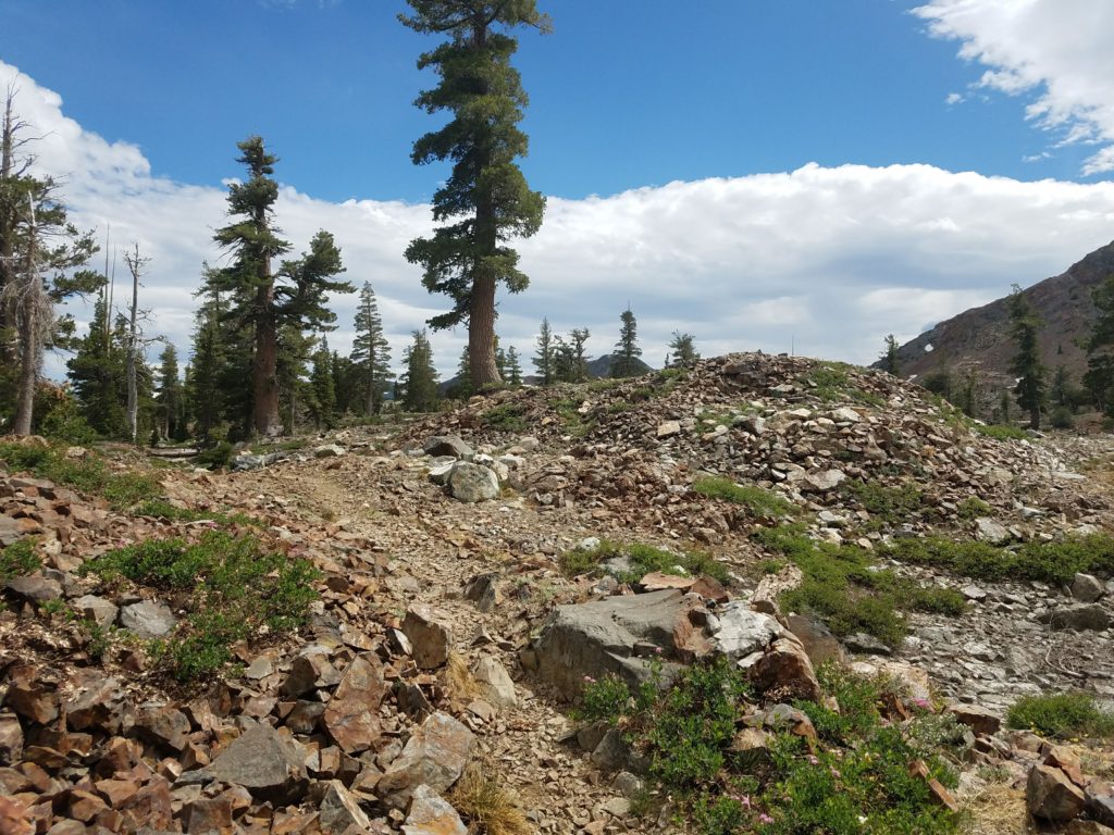
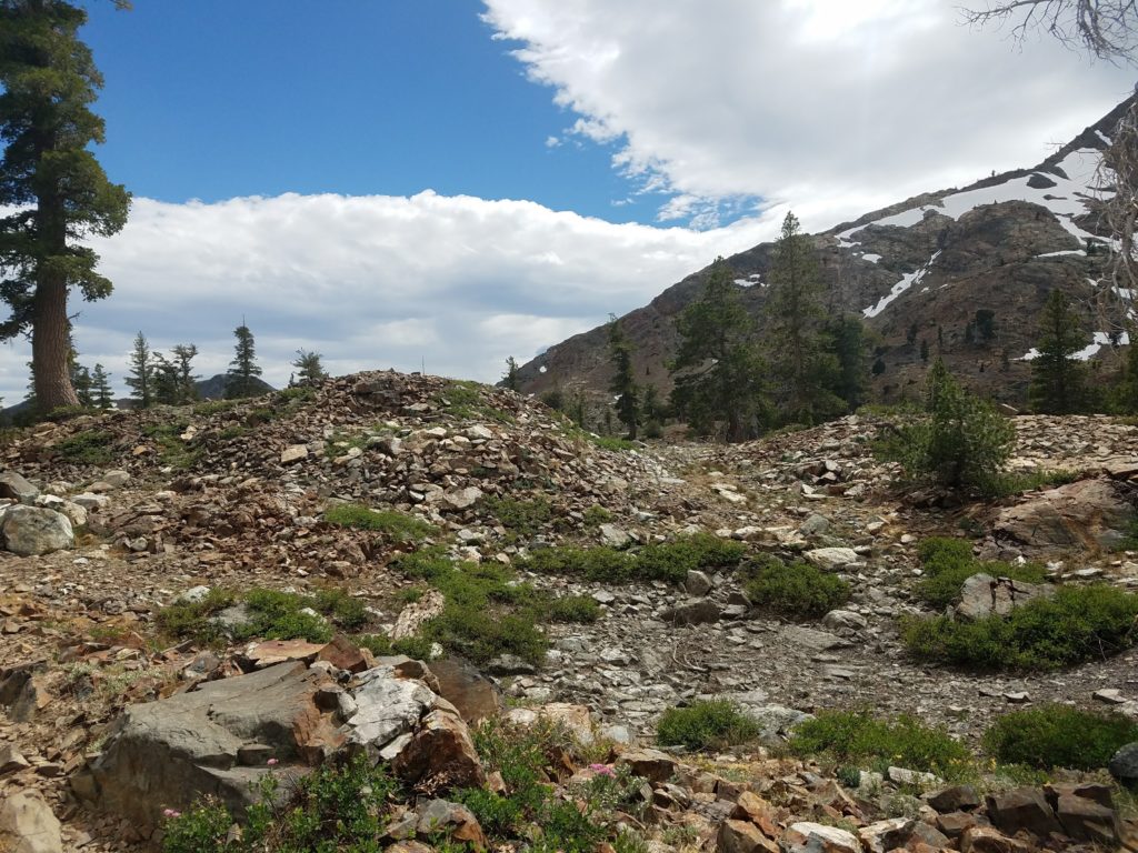
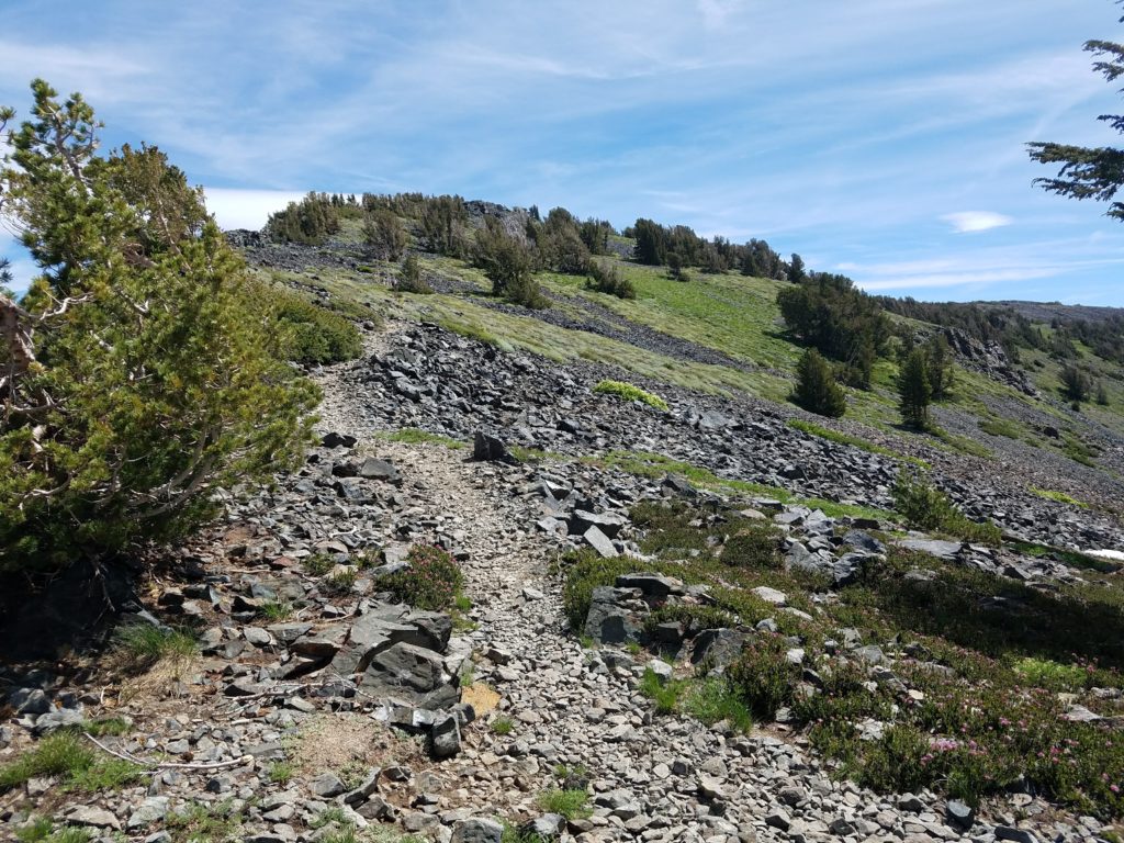
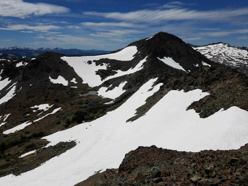
After the snack break (and, despite resting for a handful of minutes, not seeing the hiker once so close to me), I continued the climb to Dick’s Peak. Cairns and a faint use trail lead through an oddly dark rock field and onto the final ridge.
To Dick’s Peak
The last ridge climb to Dick’s Peak involves Class 2 maneuvers around ledges and over boulders. At worst, there are maybe a couple low Class 3 moves – and only because of some exposure. Some cairns guide through a path of least resistance, but overall you don’t really need them. Just climb.
This bit of difficulty ends with a false summit. From there, the last bit of climbing to Dick’s Peak takes only a few minutes and drops in difficulty.
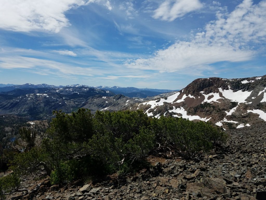
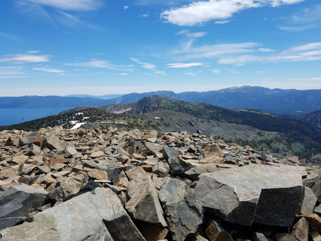
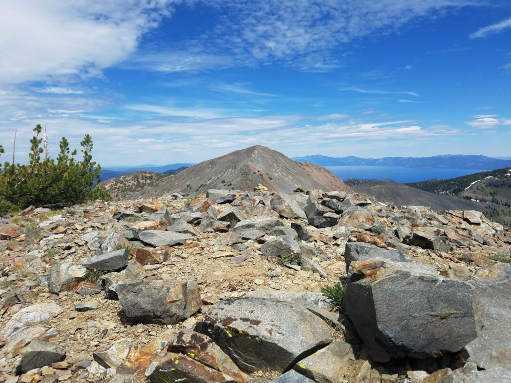
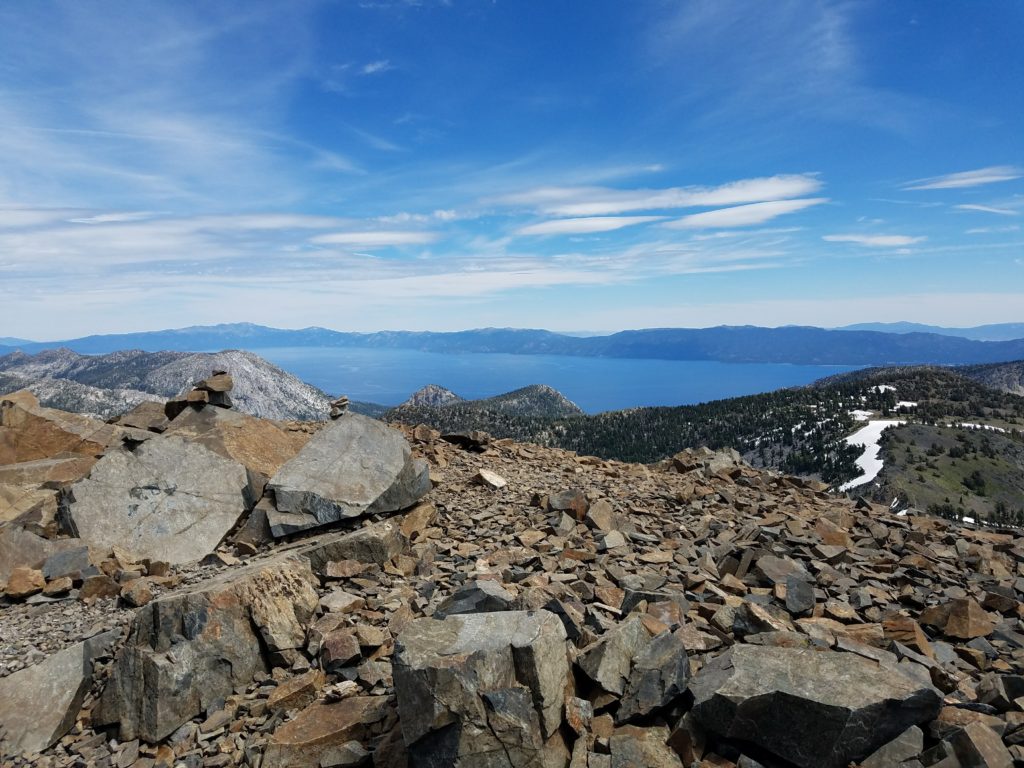
The summit, the third highest in Desolation Wilderness (one foot shorter than Mt. Price), is a broad and flat plateau with a depression to avoid the wind.
Dick’s Peak
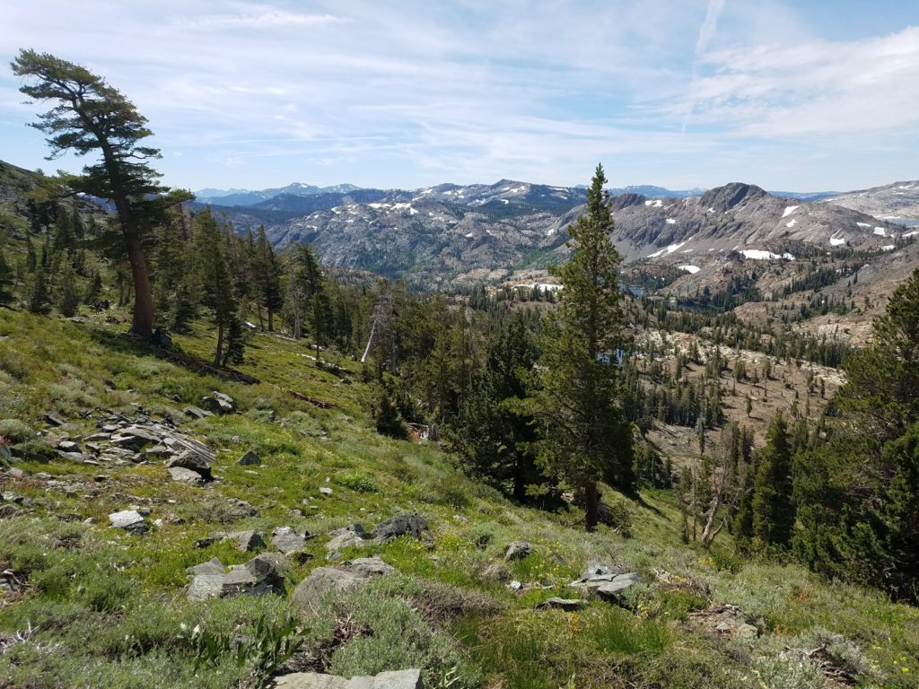
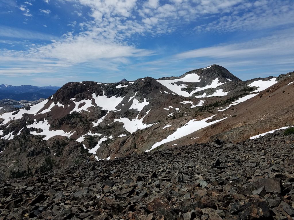
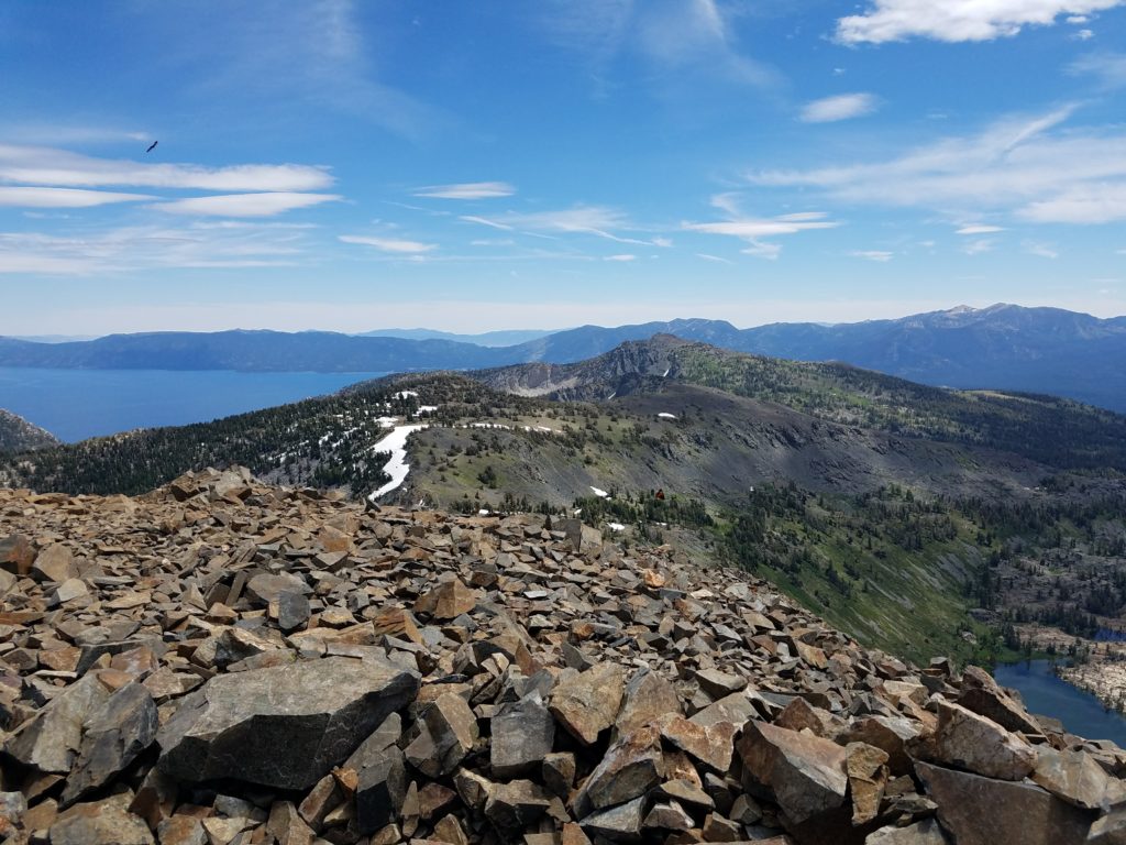
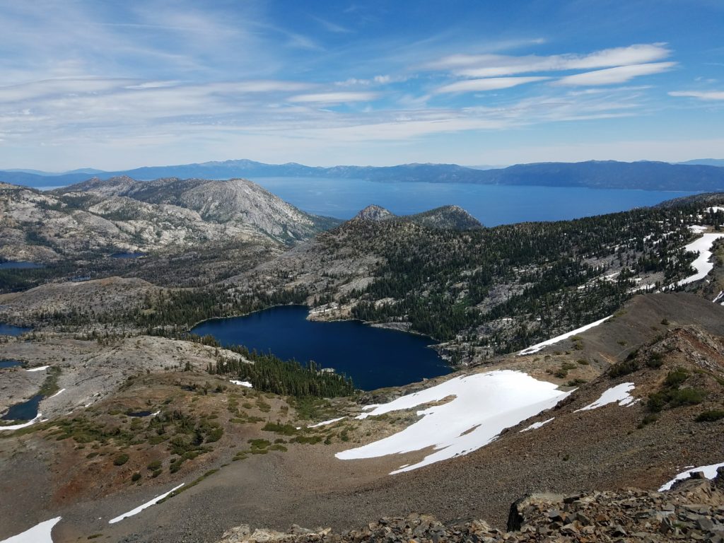
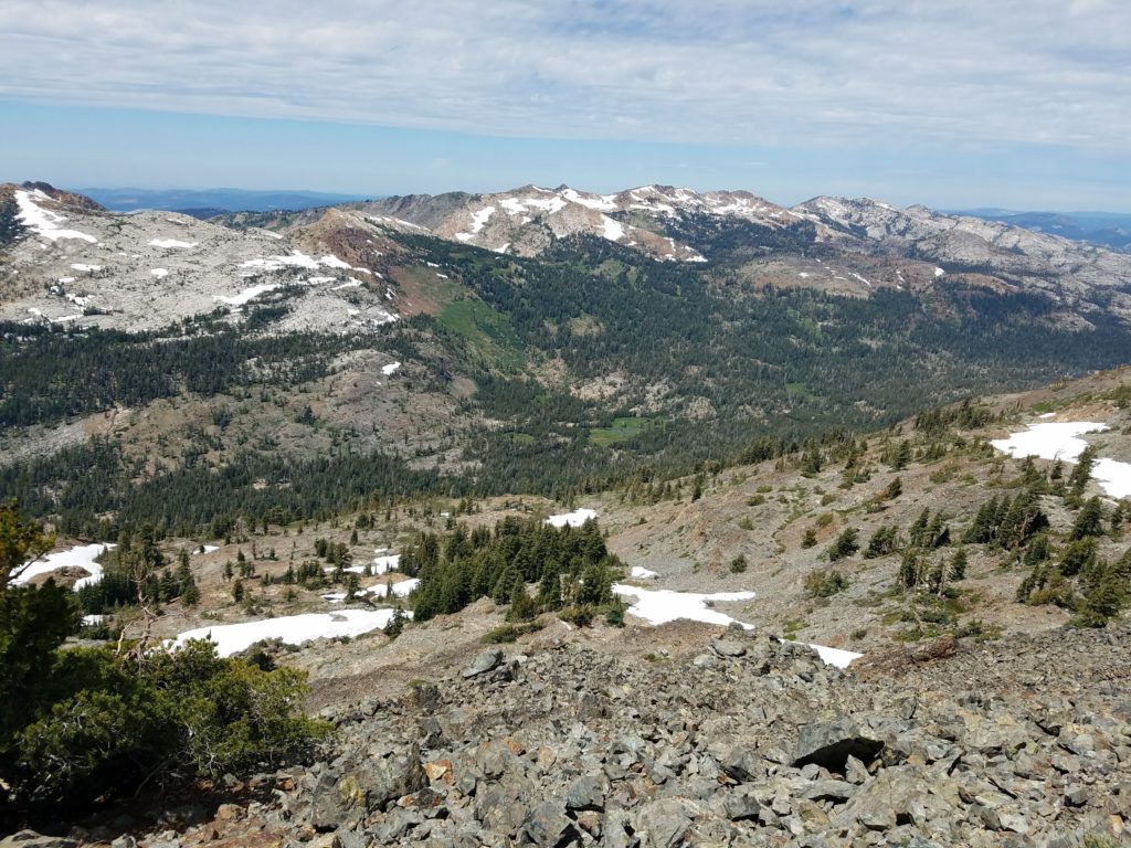
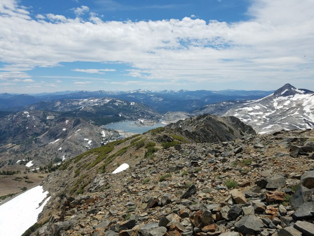
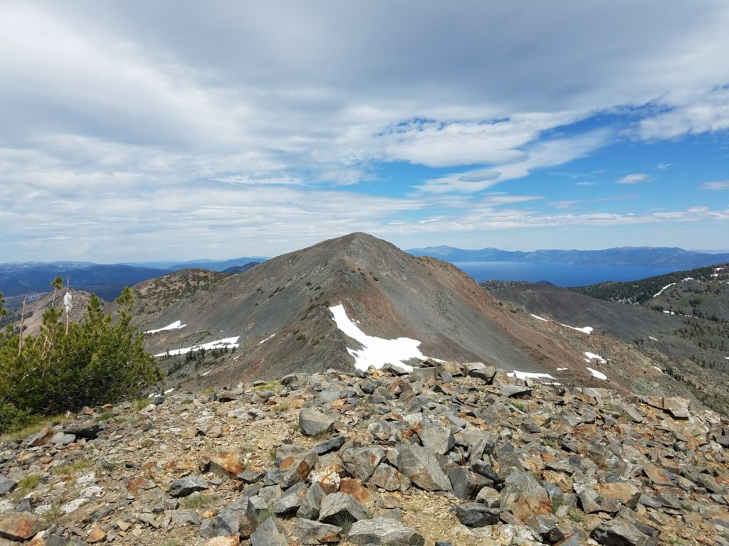
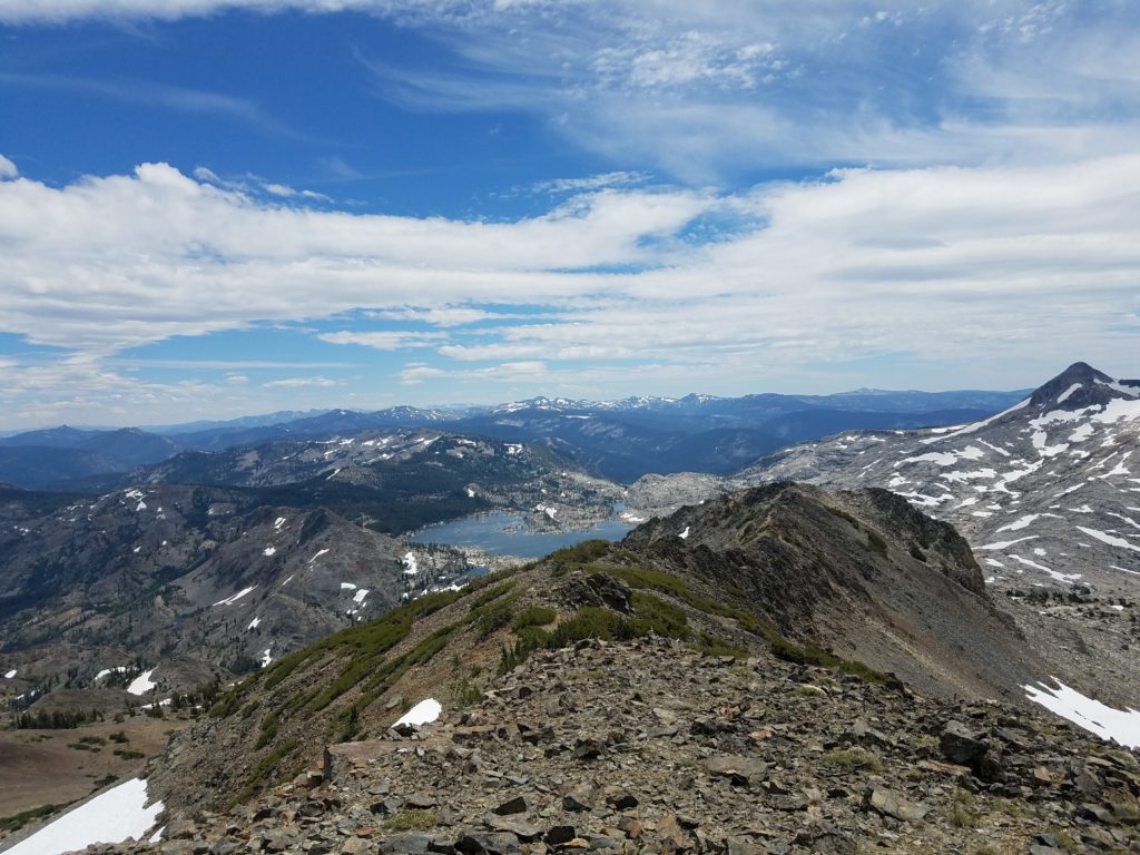
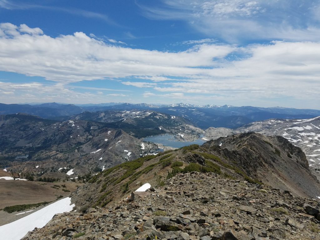
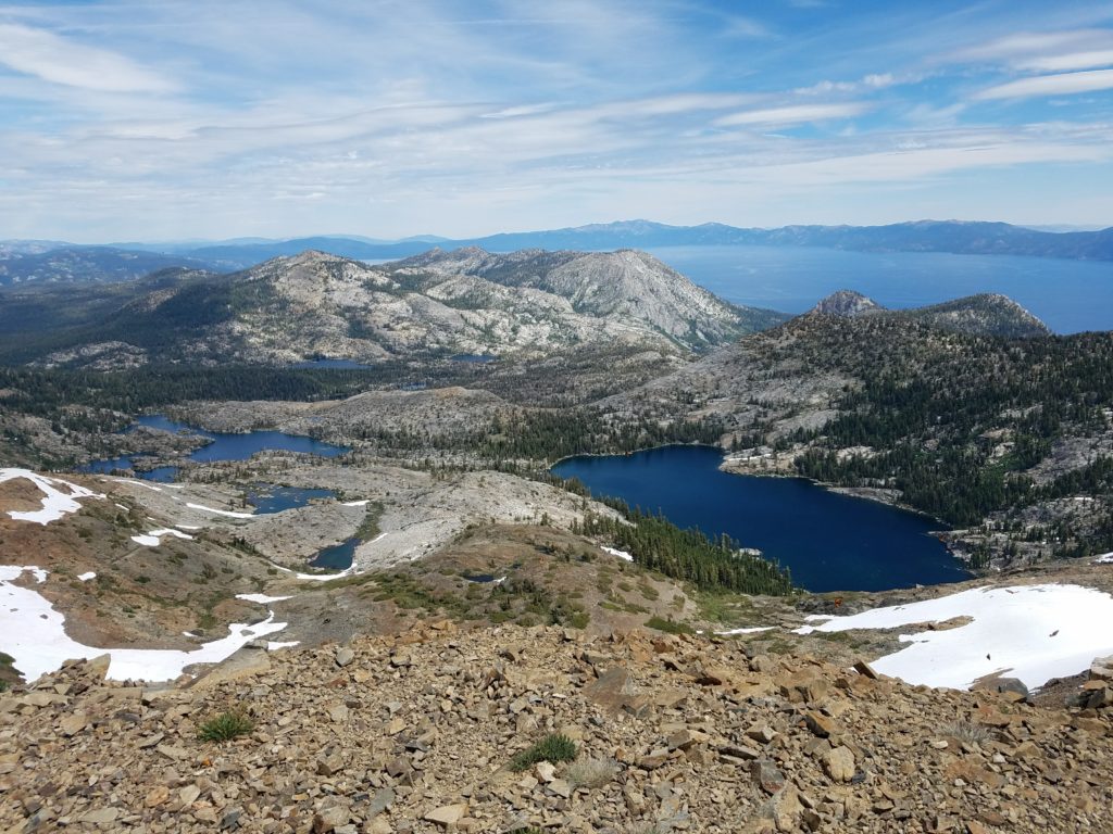
It offers stunning views around Desolation Wilderness, from Dick’s Lake and Fontanillis Lake in the north to Lake Tahoe and Mt. Tallac in the east, Half Moon Lake and the Cracked Crag and distant Sierra slopes to the south, and Rockbound valley to the west. I keep forgetting to research which crests and peaks look so high and seducing south of I-50.
On clear days, hikers can even enjoy such distant beauties such as the Trinity Alps, Mt. Lassen, and the Mt. Shasta area. This clarity typically happens after storms roll through, so not too typical in summer.
I enjoyed a sandwich and the views for 15 or 20 minutes. It was 11:30 or so when I arrived and I figured I had plenty of time to reach Jack’s Peak and climb from it down to Lake Aloha.
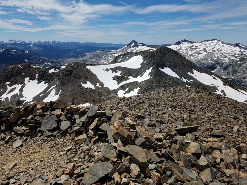
After some final obligatory summit selfies, I retreated off the east side of the summit. I didn’t know the best way of reaching the ridge that separated Jack’s Peak and Dick’s Peak. Going up and over Dick’s Peak didn’t seem great – it looked very steep and with unstable shale on which I wouldn’t want to trust my weight.
To Jack’s Peak
Instead, returning to the east ridge, I downclimbed a bit and then turned towards Jack’s Peak, opting to traverse laterally over shale and scree to the ridge. This wasn’t pleasant. On each step my foot slipped and the layers of talus risked falling further with any weight placed. As I continued I wondered if going up and over Dick’s Peak would have been easier.
I worked to avoid a couple snowbanks, traversing above them at times on narrow ground. Overall, though, nothing proved technically challenging. Just annoying.
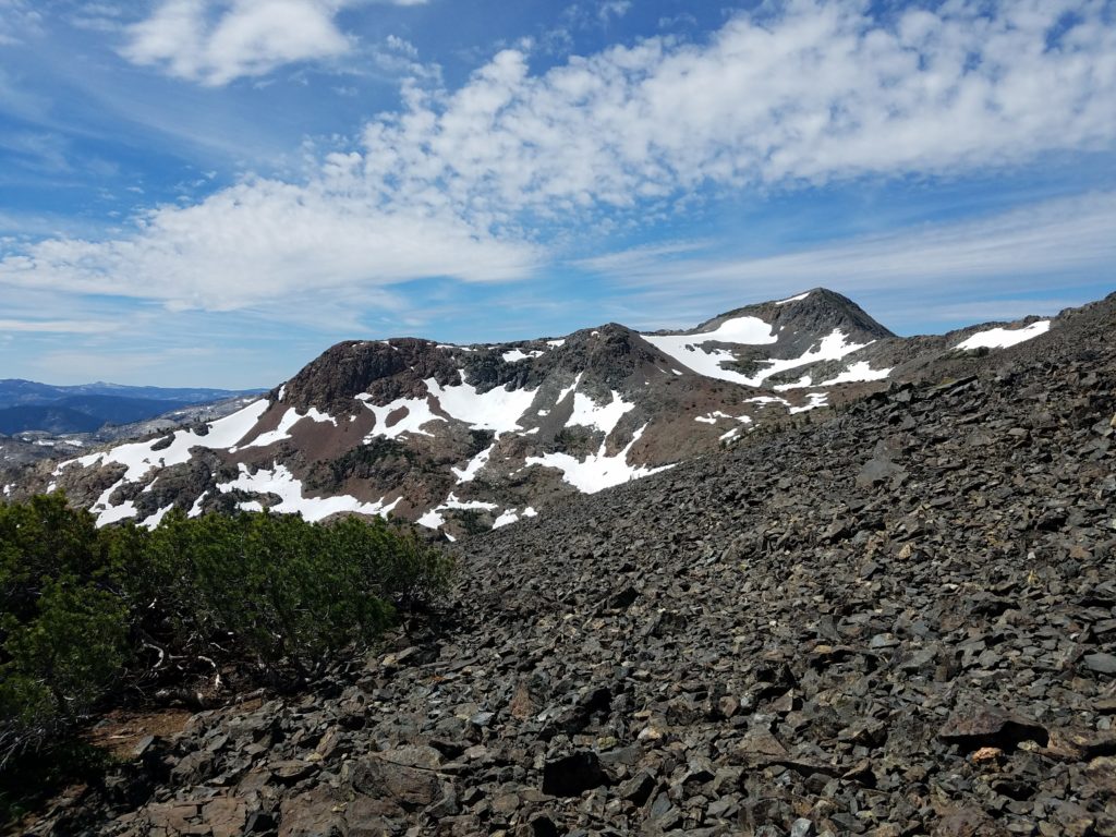
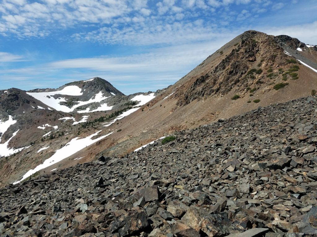
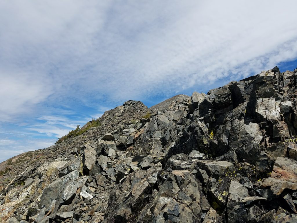
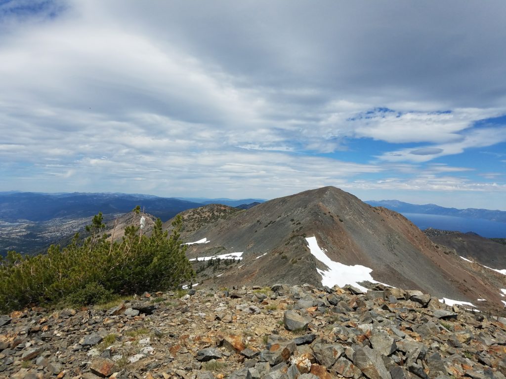
Jack’s Peak loomed ahead on reaching the ridge, a few hundred feet below Dick’s Peak. Here the rock hardened and the ridge itself didn’t require more than Class 2 scrambling. The only difficulty stood at the saddle below the climb up to Jack’s Peak.
A brief Class 3 move separates Jack’s Peak from the ridge. It looks daunting from afar, and the entire time on the ridge I wondered how I would climb it, but once there obvious hand and footholds appear with only limited exposure. Maybe 10 feet.
Jack’s Peak
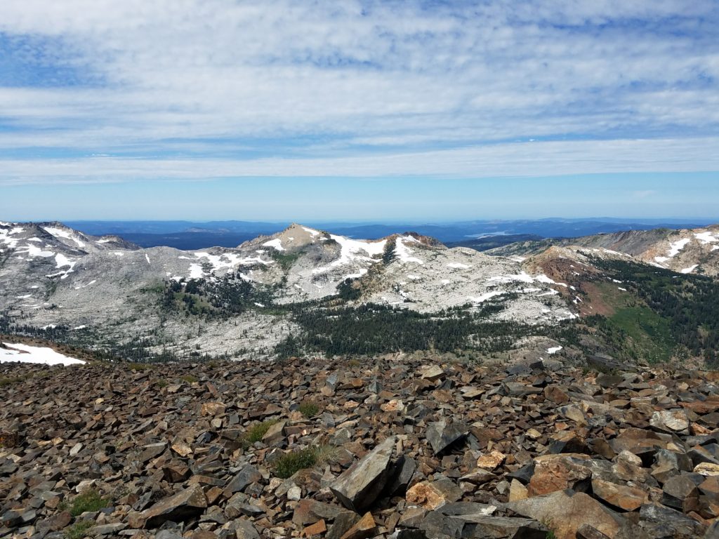
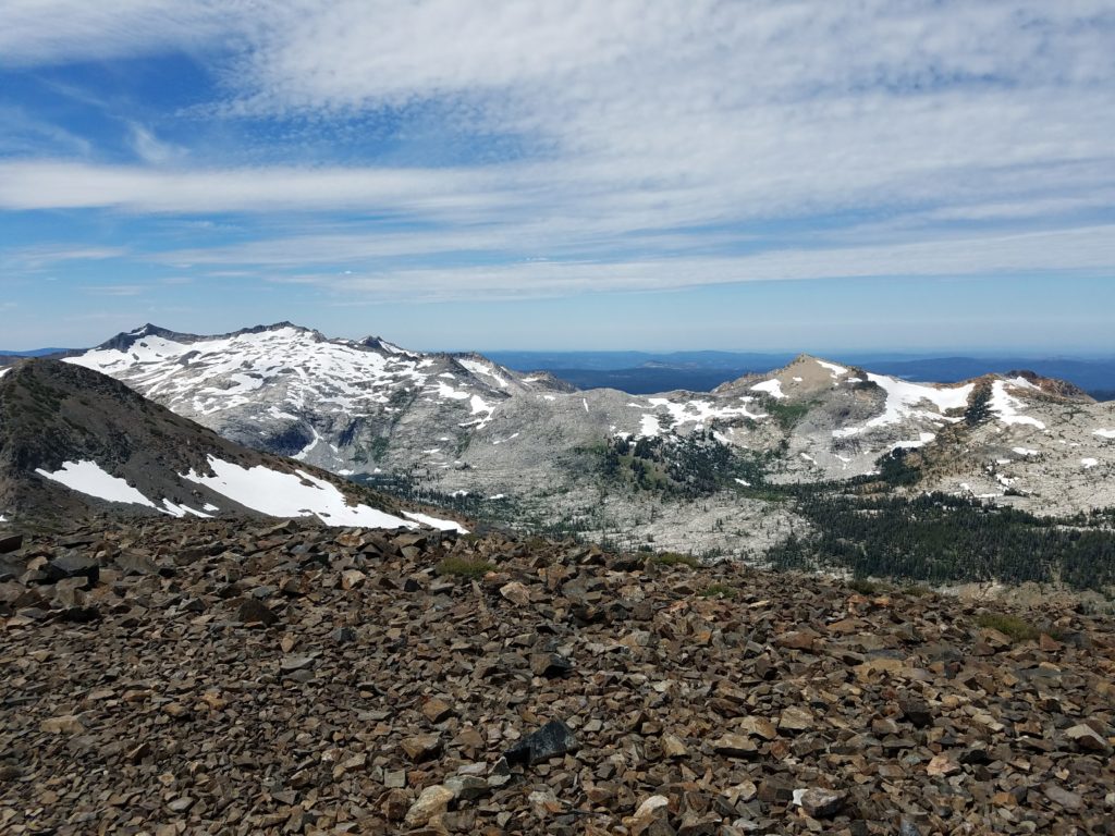
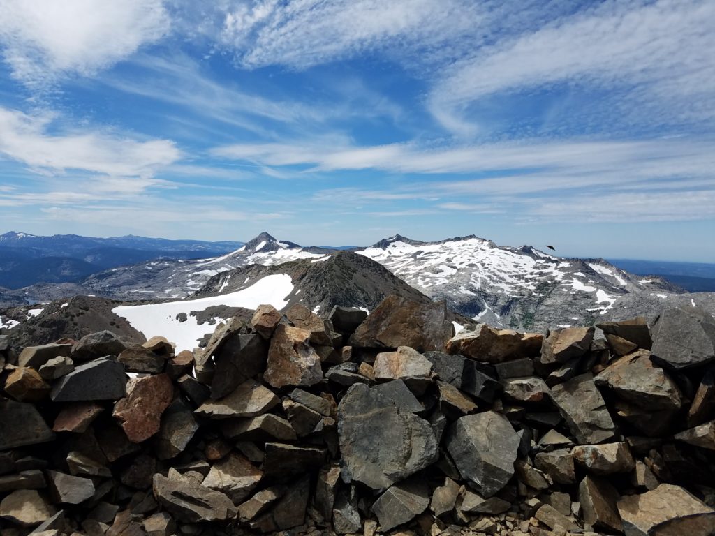
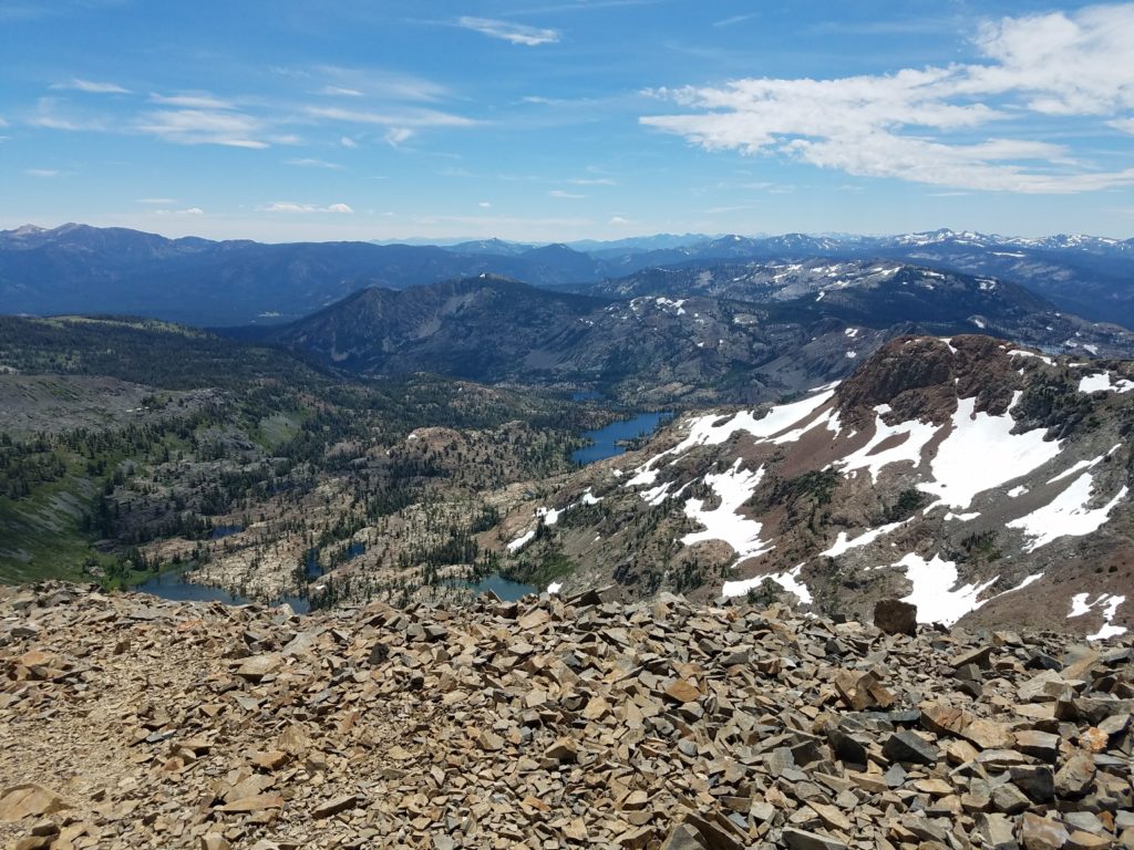
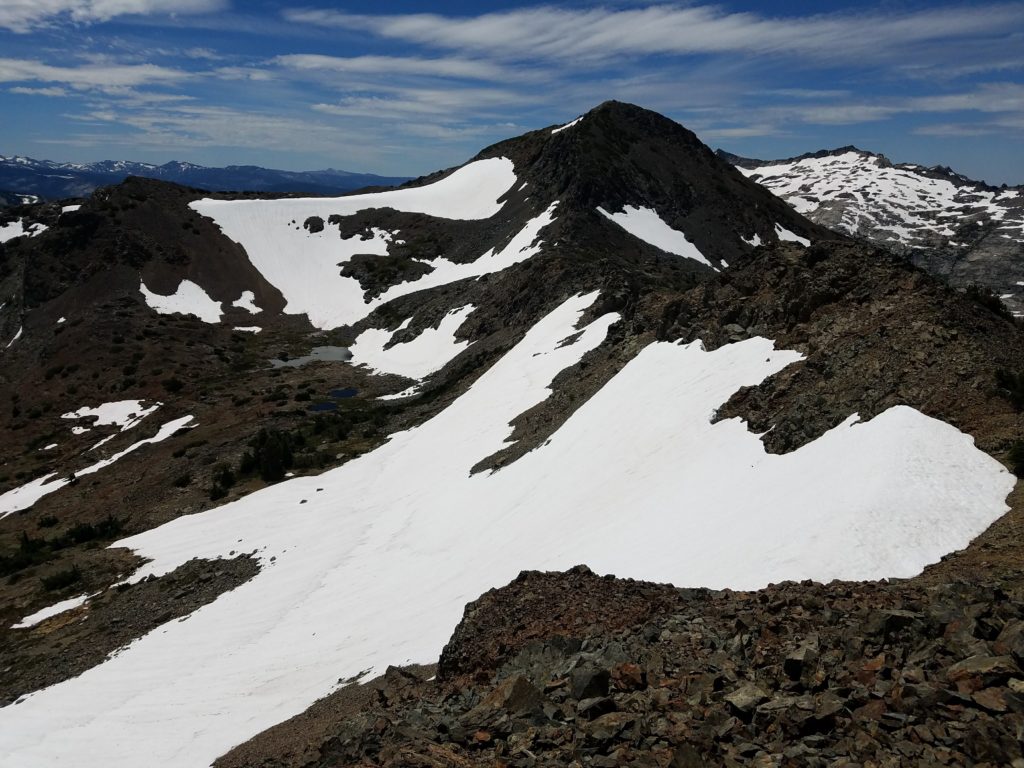
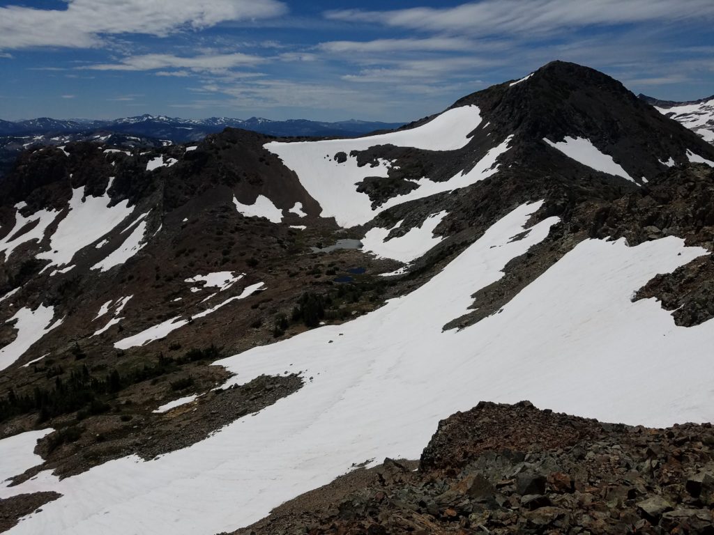
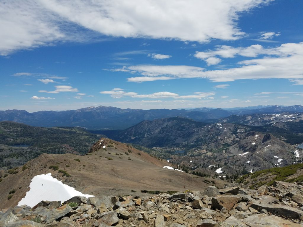
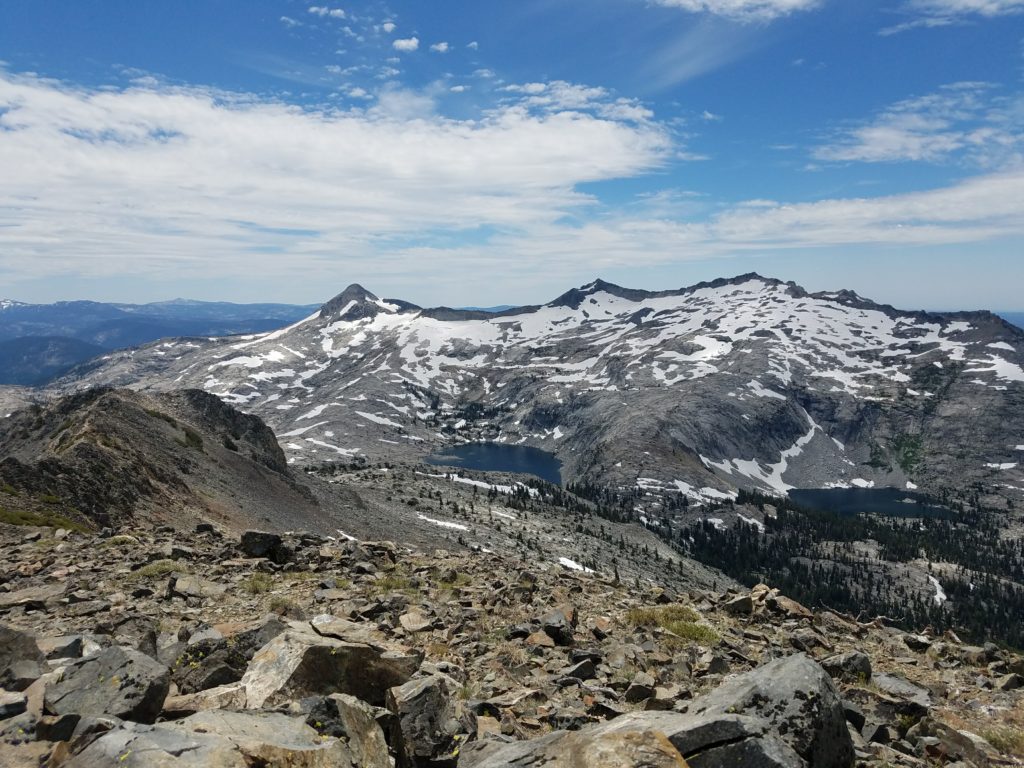
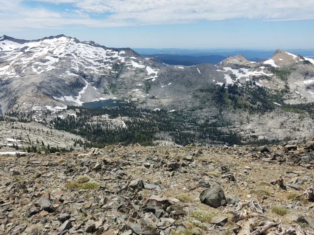
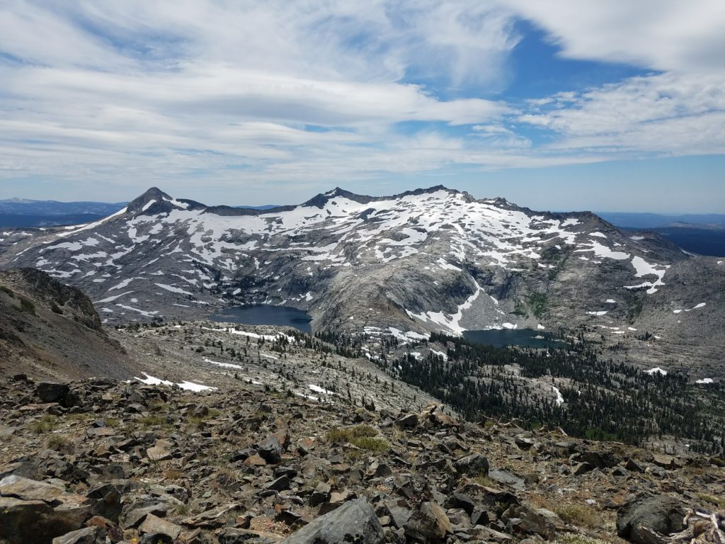
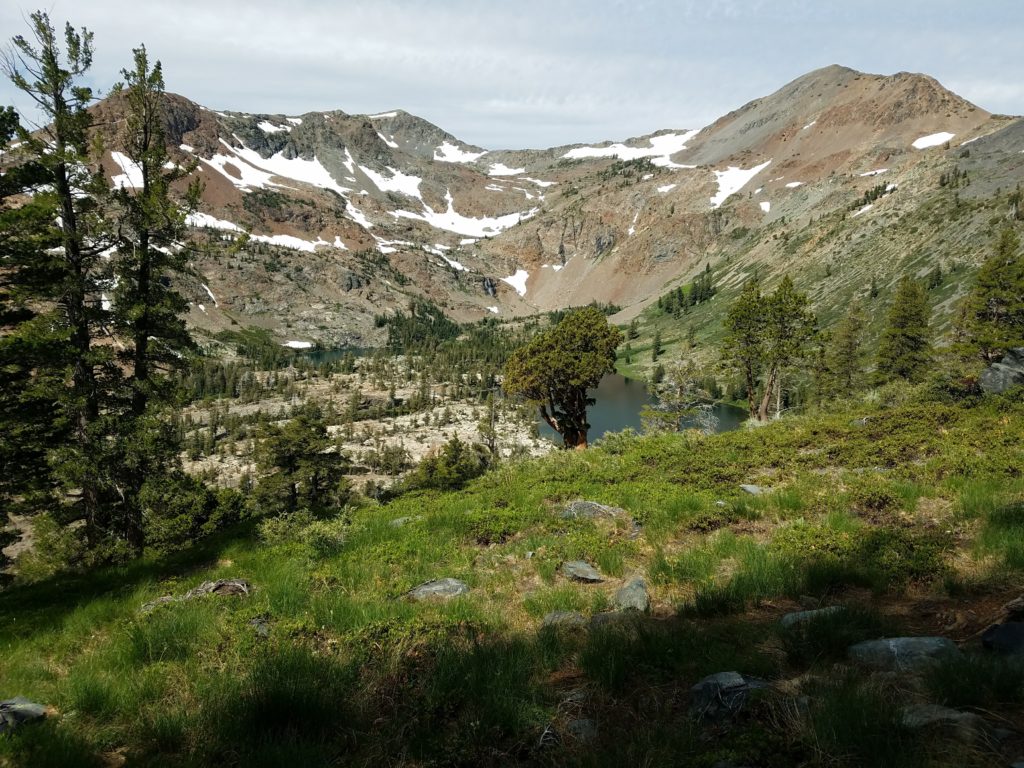
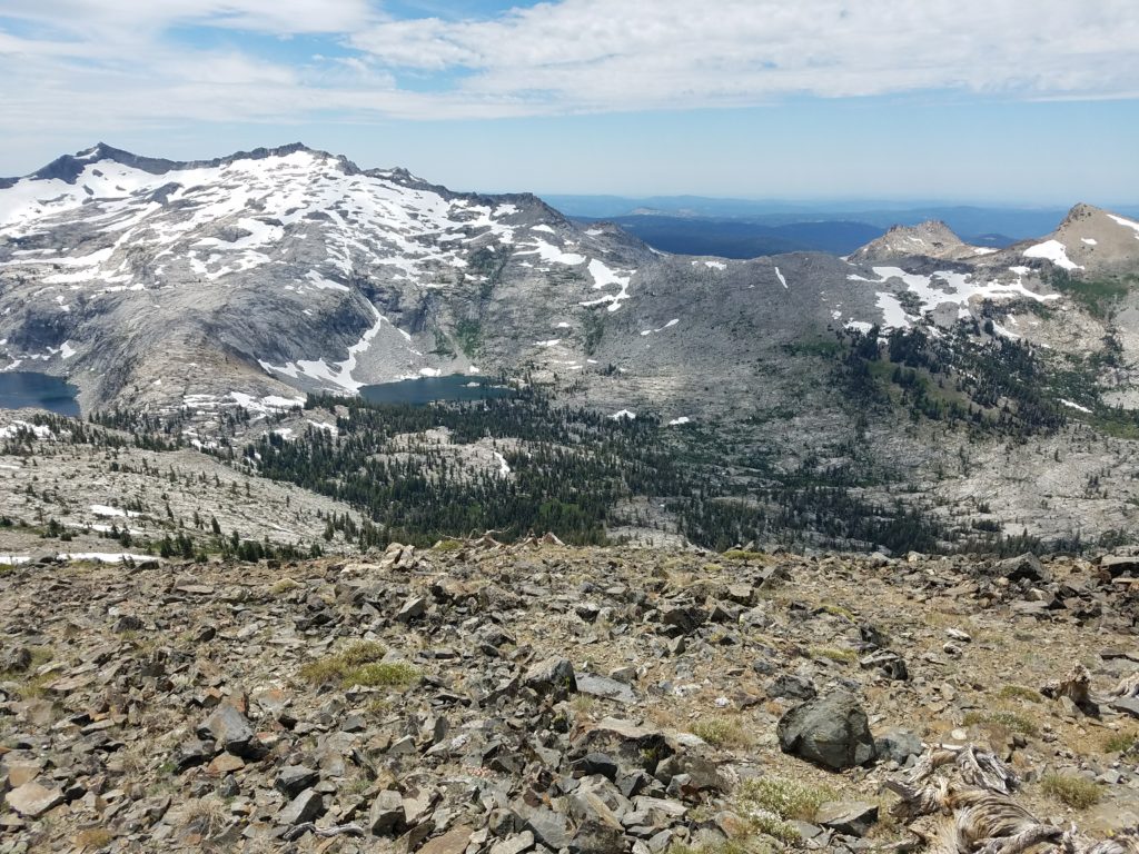
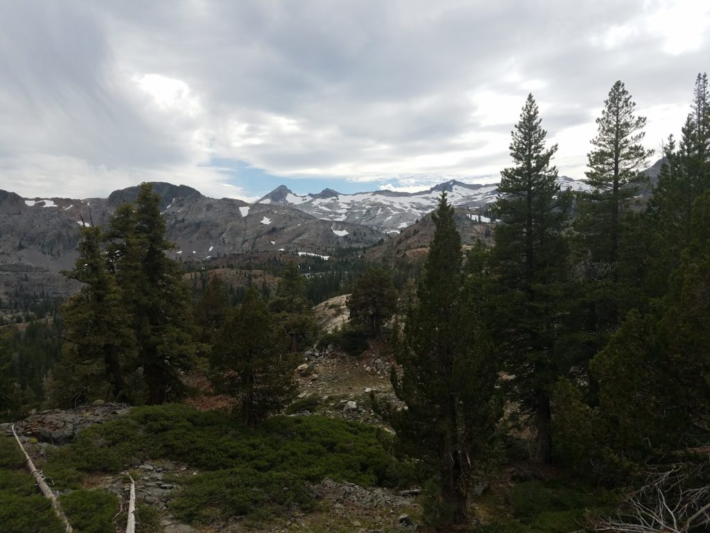
From there, simple rock scrambling with some pesky bushes leads up the final few hundred feet to Jack’s Peak. The summit offers a unique and stunning view of the unfolded Crystal Range, with Mt. Price separated only by Mosquito Pass, 1500 feet below. Snowbanks adorned the Crystal Range and seeing the aforementioned Mt. Price, Mt. Agassiz, and Pyramid Peak so distinctly – and so close – from an angle different than the usual views offered from Desolation Valley induced awe.
Lake Aloha shimmered in the bright sun; the Cracked Crag – a stretch goal for the day – looked unimpressive and short from Jack’s Peak. Dick’s Peak peered to the north with worrying grey clouds creeping to its summit.
Below, Half Moon Lake, Susie Lake, and Heather Lake all sat in deep blue.
I had been dehydrated and climbed slowly. What should have taken 30 minutes took close to an hour. On the summit, I ate, rested, and enjoyed being atop a new peak.
Cutting Jabu
As mentioned, I had hoped to climb down Jack’s Peak to Lake Aloha and loop to Jabu Lake – and perhaps even the Cracked Crag – before beginning the seven mile slog back to Fallen Leaf Lake. However, atop the summit I read some trip reports looking for beta on the route down and found that very few – if anyone – climbed down to Lake Aloha.
Typically, hikers ascend from Lake Aloha to Jack’s Peak. Though steep, the climb presents no technical challenges. It does, however, run into headwalls that, obviously enough, are cliffs on the way down. I didn’t particularly want to risk walking off a cliff, even though I assumed I would be able to safely spot and easily avoid most.
The cost-benefit didn’t quite add up. Lack of visible path would make a steep descent harder. So, Jabu and the Cracked Crag get saved for yet another year.
To Half Moon Lake
Instead, I decided to downclimb to Half Moon Lake. I did this partly because I didn’t want to again maneuver the talus slog and partly because a change of scenery would be nice. With grey cloud mass nearby – though not covering the sun and not really accumulating – I figured losing altitude and rockbound exposure would also be wise.
I climbed down Jack’s Peak, again had no problems on the one clear Class 3 move, and walked over the ridge to the Dick’s Peak saddle. There, I climbed lower than previously and aimed for a plateau underneath the summit shale.
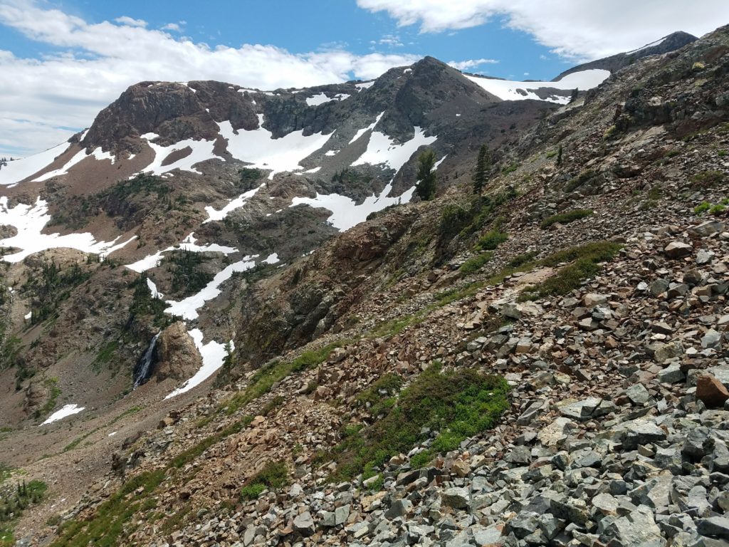
Doing so required going over a couple of long snowbanks, but neither were particularly steep and while slick, posed no challenges. I continued until I was maybe half a mile from Dick’s Pass. From there, I began scoping a route down to Half Moon Lake, which would be a roughly 1200 foot cross country descent.
Cross-Country Descent
My best route paralleled a stream fed by the still-remaining snow fields. This small chute led down to Half Moon Lake’s shores without running into cliffs or overly steep terrain. Its downsides included occasionally slick rock from the stream and a fair amount of brush and bushwhacking.
Overall, though, it wasn’t too difficult to work down to Half Moon Lake. By necessity of the steepness and some uncertainty in step (when covered by grasses or brush) I didn’t make good and soon tired of the cross country (as I had two days ago when descending off-trail from Angora Peak).
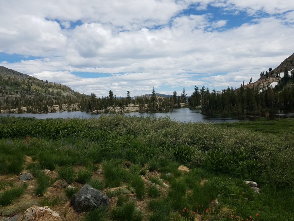
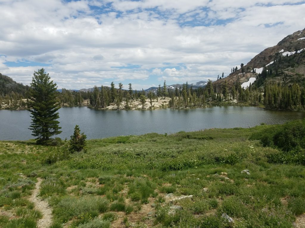
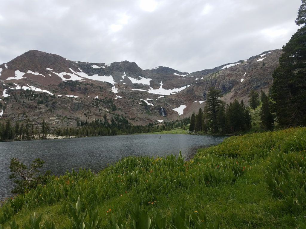
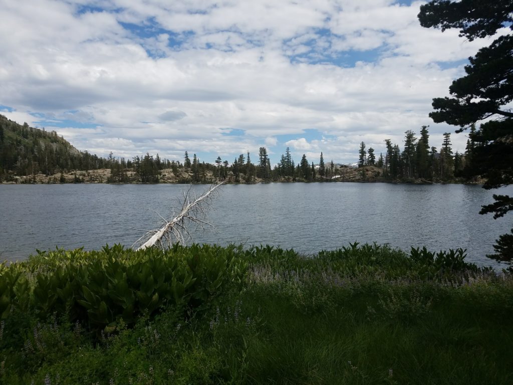
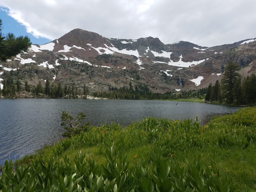
Half Moon Lake
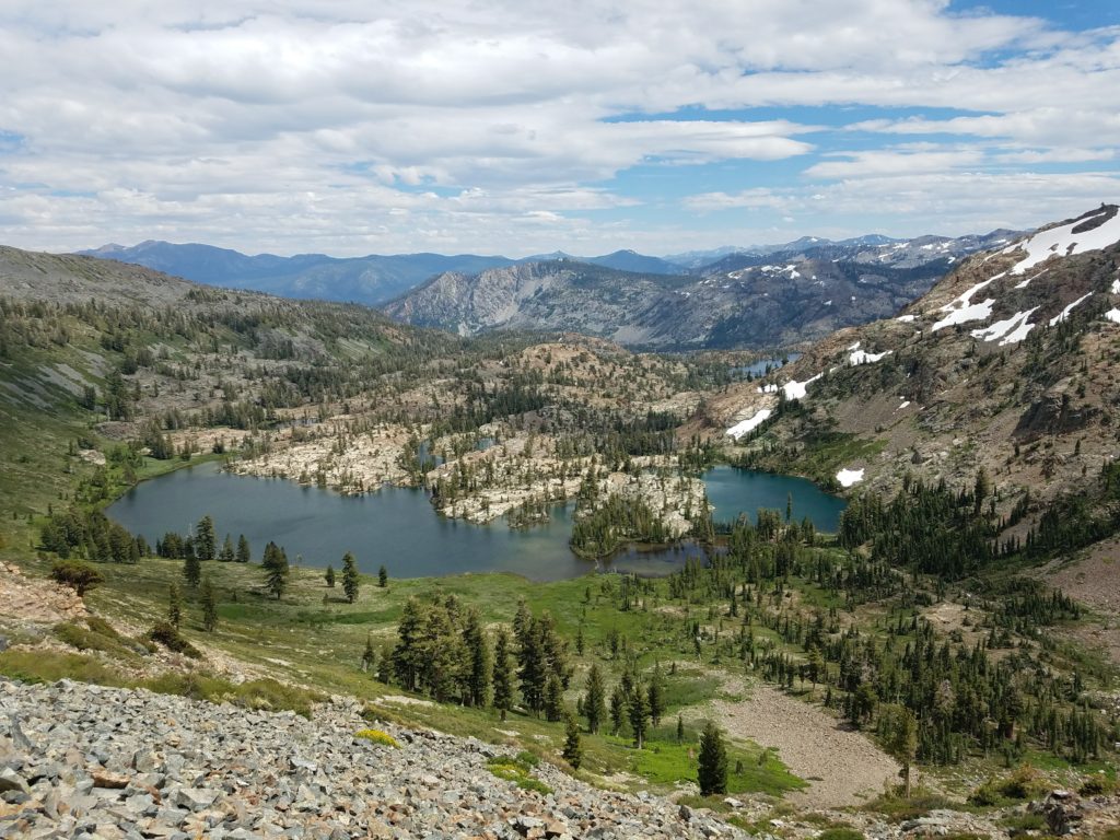
I reached Half Moon Lake around 3:00. Its basin looks up to Jack’s Peak, Dick’s Peak, and Dick’s Pass. A meadow surrounds the lake and transitions to forest away from the headwall from which snow melt falls. Given the high snow year, the meadow was marshy and I hiked through a fair amount of mud on final descent and after leaving my snack spot.
No one else was there – I hadn’t seen anyone in the four hours since I left the PCT. The sun had since been subsumed by clouds and the breeze increased a bit. As I hiked back, the sun would emerge again and I didn’t experience any weather. To the far southeast, though, a lightning storm flowed through and lingered into the evening hours.
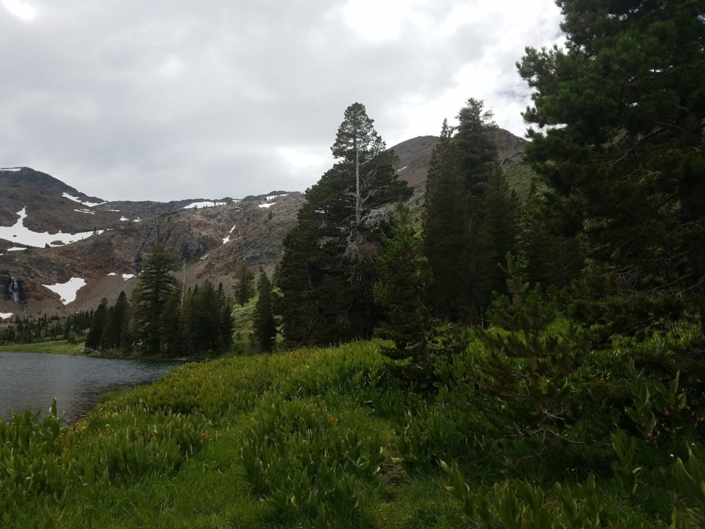
The hike along Half Moon Lake isn’t particularly pleasant. Overgrown in many places, muddy in others, and not well maintained, I ducked under-branches or plowed through shrubbery until the expansive entrails of the lake disappeared from view and I reunited with the PCT and Glen Alpine trail.
Returning via Glen Alpine
I had opted against hiking to the Lake Aloha basin to tag Jabu. The descent had worn down my legs and as time crept on, I didn’t want to hike the dull couple of miles to Lake Aloha. Besides, I would see it in a couple days when I hiked to Mt. Price and Mt. Agassiz.
I zipped along the Glen Alpine Trail as fast as I could and returned to Fallen Leaf Lake around 4:15 after 4,000 feet of climbing and 16-ish miles. (I really have nothing to report on the return hike. Glen Alpine is boring and my work-related thoughts on the trail not worth sharing.)
What I Learned on Dick’s Peak and Jack’s Peak
- Do a better job of reading beta across the entire route
- Don’t assume a climb is doable/smart on the way down because it’s easy on the way up
- Hydration matters a lot when climbing as the lethargy that can come from dehydration makes everything slower
- Find a better hiking shirt
Aside from those lessons, this was a good opportunity to get better at ridge traverses and cross-country descents. I will definitely be faster on it going forward and approach with less weariness.
Time Splits
Trailhead: 8:30a
Susie Lake: 9:30
Heather Lake: 10:00
Lake Aloha: 10:30
Slabs of Insanity: 11:05
Mt. Price notch: 11:50
Mt. Price summit: 12:15
Mt. Agassiz summit: 12:45 (I spent 15 minutes or so on Mt. Price)
Turned around: 1:30
Mt. Price ridge: 2:00
Slabs of Insanity: 2:45
Mosquito Pass: 3:15
Fallen Leaf Lake: 6:05
Equipment
None