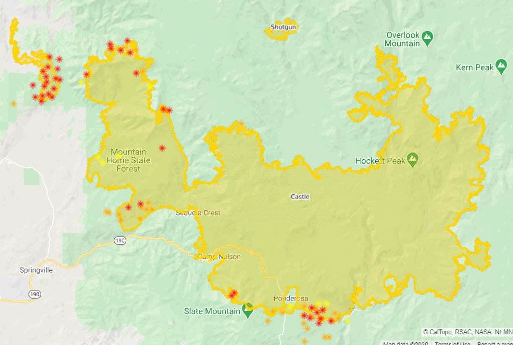
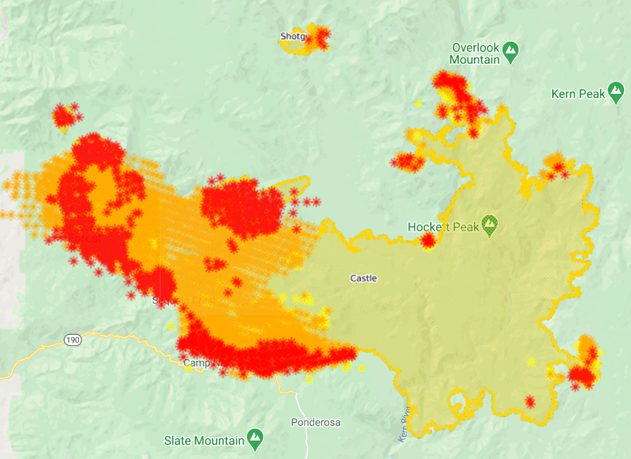
Tulare County Evacuation Map
September 23
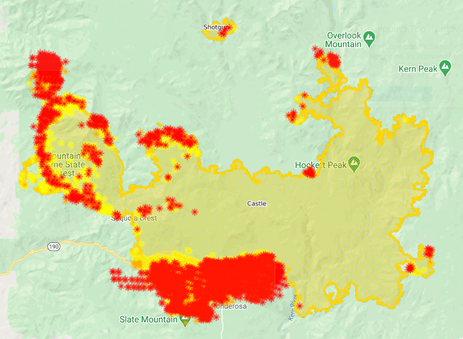
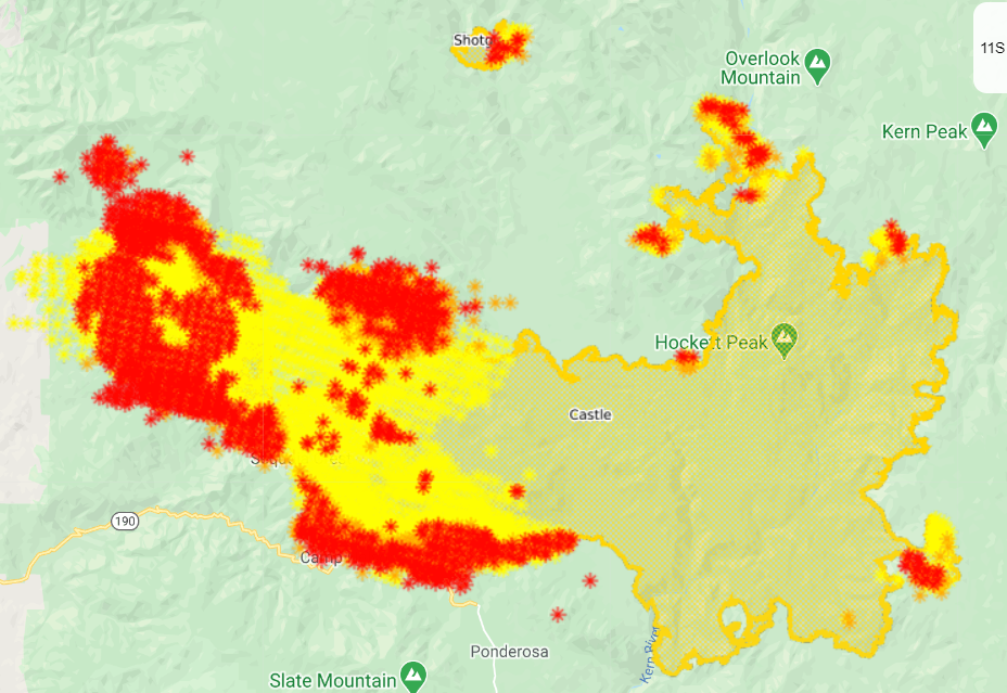
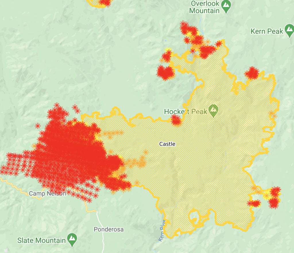
Complex is 145,000 acres and 33% contained.
East Castle Zone SQF Complex – Castle Fire: For over a week, all resource efforts were focused on the defensive tactic of providing structure protection. However, for the past two days, crews have been able to refocus efforts on constructing containment lines near the fire’s perimeter.
Today, work will continue in the areas near Ponderosa with the construction and improvement of containment lines to create a buffer around the community. Crews will provide structure protection as the potential for spot fires still exists. In Camp Nelson, firefighters will be patrolling the area looking for hot spots in an effort to eliminate threats from latent heat sources. Around the Tule Indian Reservation, crews will widen and improve containment lines.
Crews will also continue to patrol the communities in and around Alpine Village, Sequoia Crest, Cedar Slope, as residual heat sources remain a threat. Several fires, caused by blowing embers have been discovered and extinguished by patrolling crews as fire began to ignite exterior features of structures.
With no movement on portions of the southern and eastern flanks of the fire, containment remains at 33%. Air resources will continue to monitor these areas. On the northeast point, the fire continues backing to the west and is now one mile from Sequoia National Park. Backcountry structure protection groups remain ready to respond in the Casa Vieja Meadows area and direct line construction will continue in the Little Horse Meadows area.
Forecasted weather today brings the potential for active fire behavior on the entire perimeter. This will include surface fire activity with moderate rates of spread, single tree and group tree torching with spotting up to 1/2 mile.
Fire movement will primarily be on the southern end of the fire from Camp Nelson to the Kern River. Residual heat from the initial fire front continues to impact the communities of Cedar Slope, Alpine Village, Jordan Peak, and Sequoia Crest. Threats to structures/infrastructure include Peppermint Work Center, Camp Nelson, Pierpoint,Ponderosa, Rogers Camp, Mountain Aire, and the Tule Indian Reservation.
The east side of the fire continues to threaten infrastructure and physical assets at Osa, Beach, Casa Vieja and Beck Meadows as well as the US Geological Service seismic station, The Blackrock Ranger Station, and other infrastructure in the area. The cultural resources on Monache Mountain and in Monache Meadows will also be threatened. The fire in the Kern River Canyon on the north side will continue to threaten the Kern Canyon Ranger Station, private in-holdings and the Sequoia National Park. Overall fire growth is predicted to be the similar as the last 12 hours.
September 17
10:30a: 123,000 acres, still 12% contained. 150 structures destroyed and 3,500 threatened. 14 injuries and 3,000+ evacuated.
SQF COMPLEX-ALL ZONES: The entire complex is a total of 122,835 acres and contains the Castle Fire (122,011 acres) and the Shotgun Fire (824 acres), The complex is currently 12% contained.
East Castle Zone SQF Complex – Castle Fire: Point protection of structures in all communities will continue to be the top priority in the upcoming days and nights. The southwest corner of the fire has continued to experience active fire behavior through the night and early in the day, due to extremely low humidity levels during the day and poor overnight humidity recoveries. Firefighters are working night operations to provide as much protection for area communities as they are able.
Yesterday, the fire ran towards Ponderosa from the northwest and northeast, with multiple spot fires. Firing operations were used to increase a black defensive line around Ponderosa. In Quaker Meadow, the fire spotted south as it moved toward Peppermint. Active fire is on both sides of highway 190.
If conditions are appropriate Today, burnout operations will be implemented on the east side of Ponderosa.
Structure protection in the Kern Canyon Ranger Station area has been turned over to local fire personnel in Sequoia National Park. Further southeast, there was a ten-acre spot fire near Little Horse Meadows. Firefighters worked through the night to secure the area. Today, they will continue working direct near Lion Meadows to secure this fire finger.
East Castle Zone SQF Complex – Shotgun Fire: The fire continues to exhibit low intensity surface fire and is currently 824 acres.
Weather: An upper level disturbance will begin to move across the fire which will bring southwest winds and an increase in clouds. High temperatures will range from 80-89 degrees and humidity levels will be as low as 7-10%.
September 15
11:40a: 107,000 acres (+6,000), 12% contained (-).
Castle Fire: The western flank continues to be the top priority and is still exhibiting active fire behavior. Yesterday, a large spot in Jenny Creek caused additional evacuations northwest of the fire area.
On Monday, crews continued work on constructing indirect line from Quaker and Aspen Meadow south to the Kern River. The fire has crossed 190 near Cedar Slope in multiple areas. Through the night, firefighters worked in Doyle Springs.
Today, crews will continue to gather situational awareness and work to put together a plan from south of Cedar Slope to Coy Flat. Structure protection is being enacted for local communities, with point protection and defense being the priority.
Crews are preparing for the fire’s likely movement towards Ponderosa and Camp Nelson, and to maintain the viability of 190. Crews continue to make progress on the eastern finger of the fire between Little Horse Meadows and Lion Meadows. Despite additional growth on that area, crews are still able to construct direct line.
Structure preparation on the eastern flank of the fire is nearly complete, and crews plan to wrap up structure protection north around the Kern Canyon Ranger Station. Aerial resources continue to be used heavily on the fire with 237,000 gallons of retardant being dropped on Sunday, September 13th
September 14
11:10p: 101,000 acres (+10,000), 12% contained (unchanged). Lots of air activity today with VLATs aggressively defending communities.
Fire is burning hot tonight.
Poor relative humidity recoveries, warm temperatures, very low minimum relative humidity, atmospheric instability and winds produced critical fire behavior primarily to the west. The fire will continue to impact the Freeman Creek Giant Sequoia Grove, structure in the Pyles Boys Camp area, communities of Sequoia Crest, Alpine Village, Camp Nelson, and Cedar Slope. It will also impact the Mountain Home State Forest, The highway 190 corridor, USFS facilities and infrastructure in the area. The fire will threaten the community of Springville, Sequoia / Kings Canyon National Park, as well as structures scattered along the west slopes.
The East Flank of the fire will continue to threaten the Blackrock Ranger Station and other USFS facilities, as well as the cultural values and resources in the Monache Meadows area.
The north flank will continue to threaten the Kern River Ranger Station, Quinn Patrol adjacent private land and the Sequoia / Kings Canyon National Park.
Sequoia National Park now closed.
Cool video showing air attacks: https://www.facebook.com/SequoiaNF/videos/327075018602567
Thanks for reading! If you’re interested in supporting the work that goes into providing these updates, please visit https://www.buymeacoffee.com/rs44. I really appreciate your generosity.
3:15p: Three Rivers now under mandatory evacuation order. Voluntary evacuation warning in Springville.
9,200 acres of giant sequoia have now burned. Fire is part of the ecosystem, but high severity fires destroy rather than rebirth.
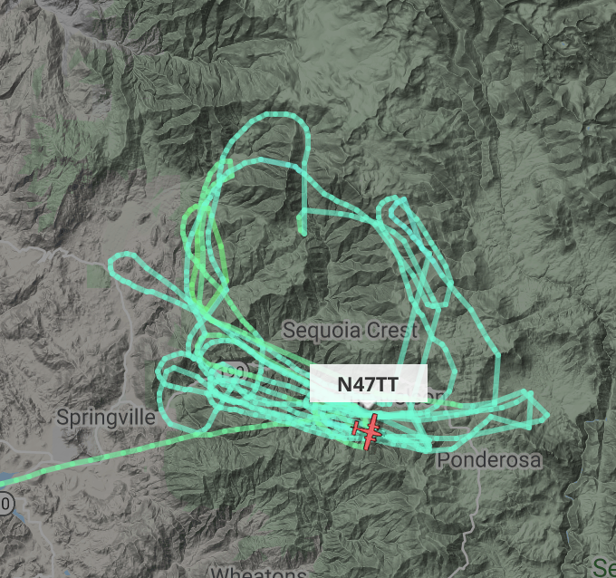
Huge air activity over the fire, including the 747 tanker. Seems to be focused south of 190, between Camp Nelson and Quaker Meadow.
11:10a: Cost so far: $21.3 million. 12 injuries, 1,600+ structures threatened. 62 have been destroyed. Nearly 3,500 have evacuated.
From the morning update:
The fire is currently 1.5 – 2 miles west of Mountain Home. Fire activity began early on Sunday, with the Jordan Peak Communication Tower being impacted just after midnight. Structure protection was engaged in Alpine Village, Sequoia Crest, and Doyle Springs. The fire gained momentum at this time with strong easterly winds pushing the fire down drainages towards the west with very rapid rates of spread. By 10 AM, the fire was intensely impacting those communities. Wind speeds of over 60 miles per hour impacted the ability to use aerial resources until mid-morning.
Resources were shifted from other flanks of the fire and moved over to the active edge to engage the fire to the extent possible. Late Sunday, firefighters were able to get into the Alpine Village area to provide protection to structures that had not been impacted. Due to remaining heat and impacted roadways in Sequoia Crest, resources were not able to get in to this community.
Resources on the ground and in the air will be coordinated and continually evaluated today. Aerial resources will continue to be used as long as they are safely able to fly and will be dropping water and retardant. Active surface fire with moderate rates of forward spread is in the fire behavior forecast, spotting up to a half mile is likely. Fire will again be active this morning. The priority is to protect values at risk in local communities, providing for firefighter safety first.
On the Sequoia National Park, structure protection at the Kern Canyon Ranger Station will be continued. This work will be completed within the next 1-2 operational shifts. Structure protection and assessment is complete in the Casa Vieja and Monache Meadows. On the eastern finger of the fire, crews have been able to go direct on both the north and south sides, and this area is close to containment. Contained lines on the southern flank will continue to be monitored by air.
Thanks for reading! If you’re interested in supporting the work that goes into providing these updates, please visit https://www.buymeacoffee.com/rs44. I really appreciate your generosity.
10:20a: 91,000 acres, 12% contained.
Generals Highway in Sequoia National Park is closed.
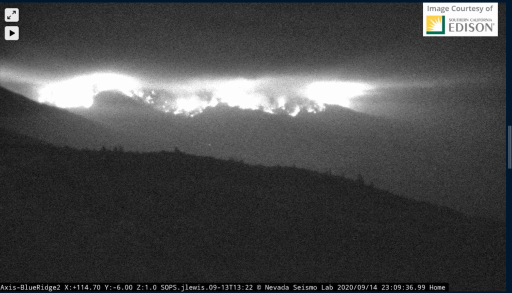
Infrared view of fire activity (from Sept 13).
September 13
10:20p: 89,000 acres, 12% contained. Lots of air action on the fire today.
Fire ran 8 miles today; crews responding by protecting newly-threatened structures. Looking to keep fire North of Highway 190 and Freeman Creek Road.
Projected activity for tomorrow, from the incident report:
Poor RH recoveries, warm temperatures, very low minimum relative humidity, atmospheric instability and winds produced critical fire behavior primarily to the west. The fire will continue to impact the Freeman Creek Giant Sequoia Grove, structure in the Pyles Boys Camp area, communities of Sequoia Crest, Alpine Village, Camp Nelson, and Cedar Slope. It will also impact the Mountain Home State Forest, The highway 190 corridor, USFS facilities and infrastructure in the area. The fire will threaten the community of Springville, the Blue Ridge National Wildlife Refuge and the CALFire repeater site in the area. Sequoia/Kings Canyon National Park, as well as structures scattered along the west slopes.
The East Flank of the fire will continue to threaten the Blackrock Ranger Station and other USFS facilities, as well as the cultural values and resources in the Monache Meadows area.
The north flank could impact the Kern River Ranger District, Quinn Patrol adjacent private land and the Sequoia / Kings Canyon National Park.
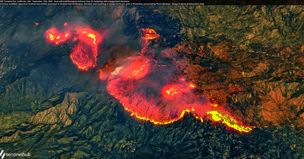
Infrared view of the fire.
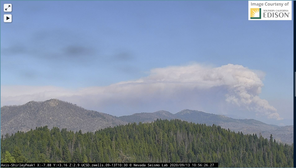
Timelapse showing the smoke plume and fire growth.
More forest devastation…
Video on the road up to Sequoia Crest.
Thanks for reading! If you’re interested in supporting the work that goes into providing these updates, please visit https://www.buymeacoffee.com/rs44.I really appreciate your generosity.
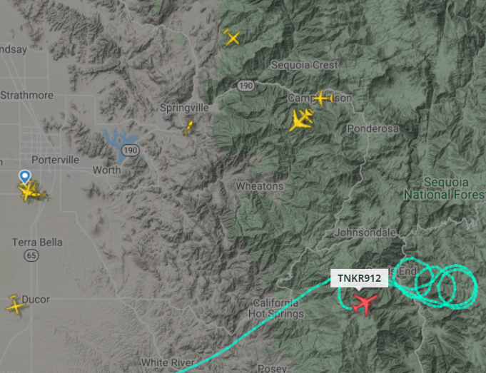
2:15p: Three VLATs currently assigned to and working on the fire.
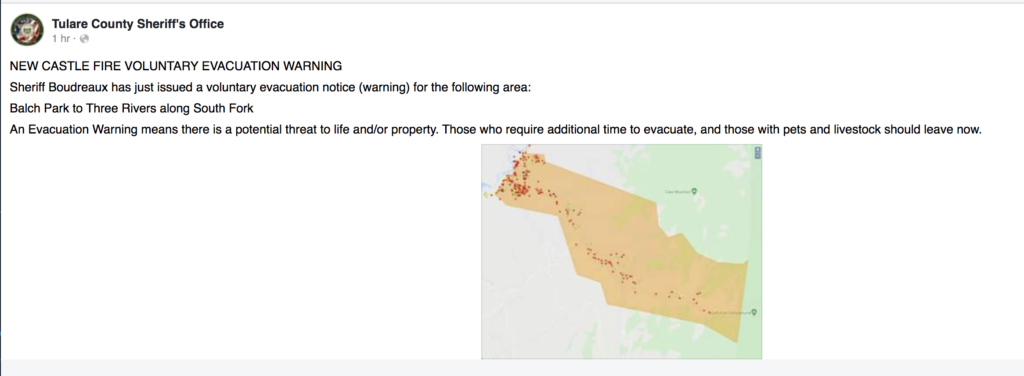
New voluntary evacuation warnings in Tulare County.
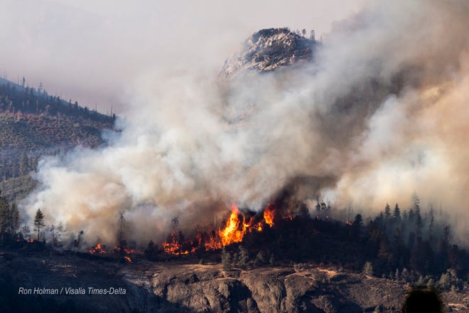
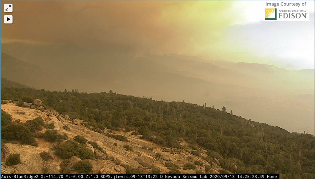
Tons of smoke coming off the fire.
12:45p: Fire looks like it’s making its way to the Balch Park area.
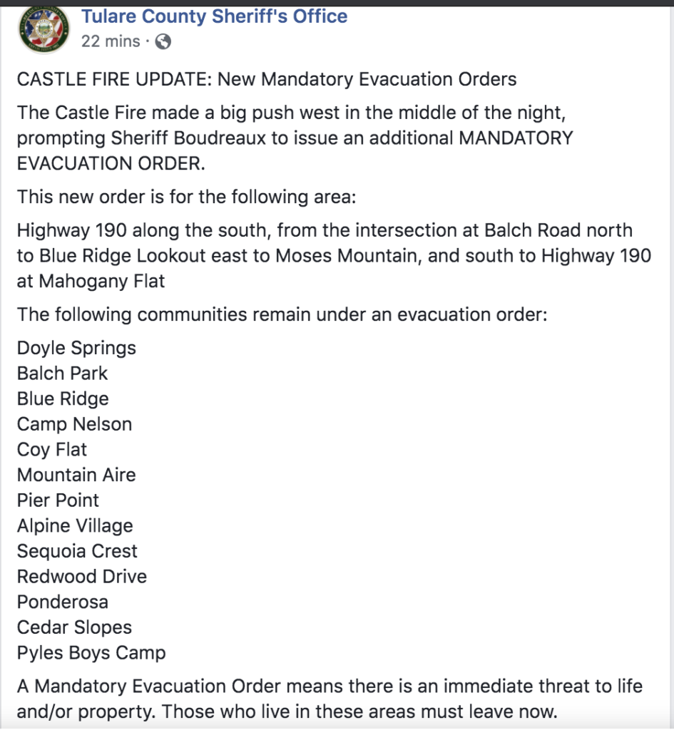
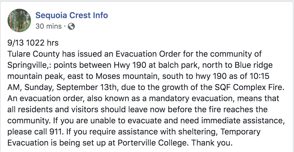
New mandatory evacuation orders in Tulare County.
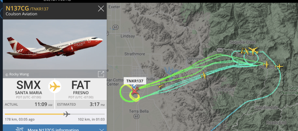
Lots of air activity. 737 passed through earlier; DC-10 and MD-87 there currently.
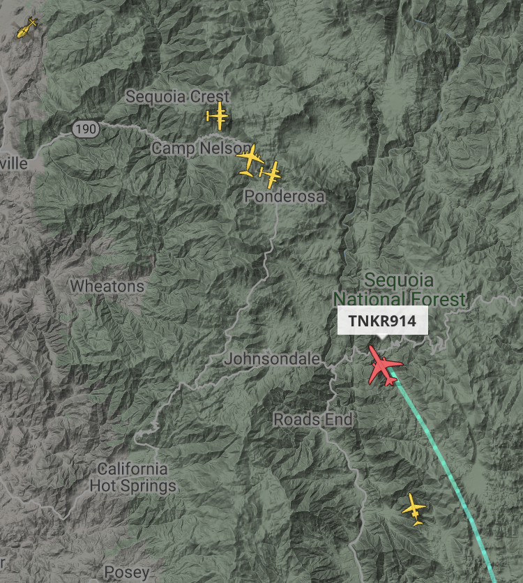
11:00a: Fire is making an aggressive run to the west, throwing lots of smoke early in the morning. New evacuation orders posted – do not wait to leave, this fire is moving quickly. Tankers working on that western front.
One thought on “Castle Fire/SQF Complex Fire Updates”
Comments are closed.