September 22
Fire is 1,667 acres and 70% containment. Full containment was expected yesterday – no word on an updated timeline.
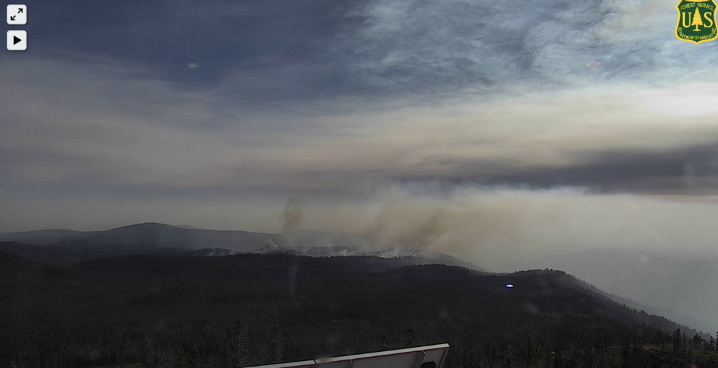
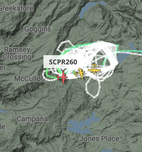
Two Super Scooper aircraft dropped 34,000 gallons of water on hotter-burning areas difficult for firefighters to reach.
Crews working on felling snags and other tree hazards; also mopping hotspots.
Some crew starting to demobilize to be deployed elsewhere.
September 17
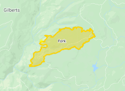
10:15a: Fire has not experienced “significant” growth in the last 3 days. Still 1,750 acres, now 34% contained.
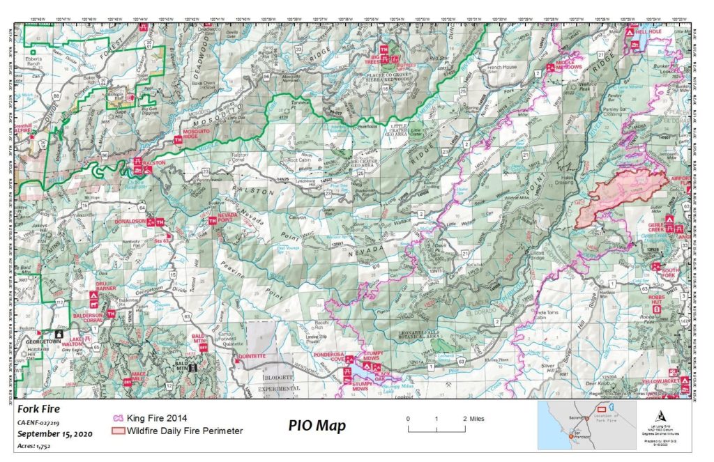
September 15
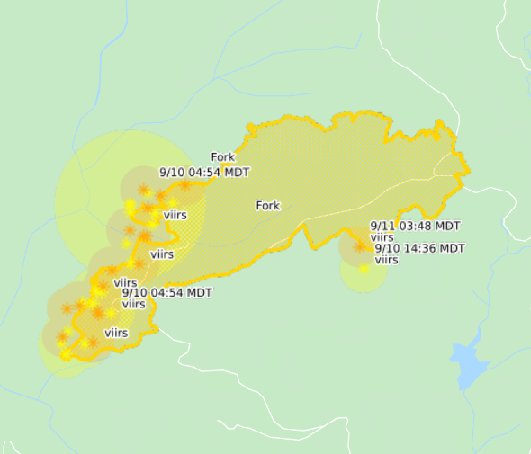
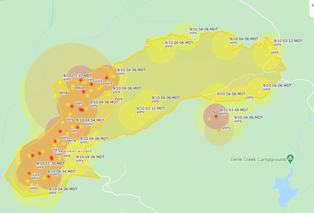
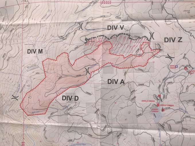
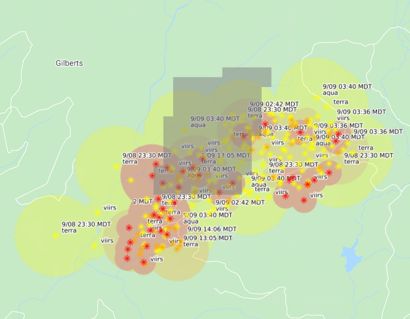
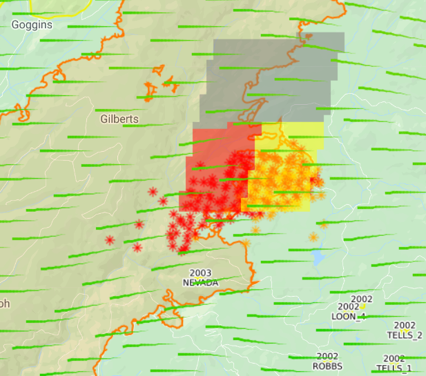
10:20a: Updated incident map.
September 14
11:00p: 1,752 acres, 7% contained. Smoke kept fuel temps down, dulling activity.
Expected increased wind speed will lead to increased spread through uphill runs towards Hell Hole Dam.
Monday night: Downslope flows will develop, and ridgetop east to southeast winds will lead to poor relative humidity recovery and warm temperatures.
Tuesday: Warm and dry conditions persist, with afternoon temperatures around 80 and relative humidity in the mid teens. Gusty afternoon southwest winds will develop on ridgetops and aligned drainages.
Thanks for reading! If you want to support the work that goes into providing these updates, you can do so here: https://www.buymeacoffee.com/rs44. Thank you so much for your generosity.
10:00a: Crews have made progress making containment lines on the eastern side to secure the Airport Flat area. Some pockets of heat within the containment line; these, and standing dead fuel, pose safety risk to firefighters.
Contingency lines – in case fire activity picks up dramatically – created around Little Dear Creek to the fire’s north. On the southwest, teams began clearing hazardous trees to allow for safer access to the fire. Line now extends 0.5 miles down the ridge near the South Creek and South Fork of the Rubicon.
Critical fire conditions coming this afternoon.
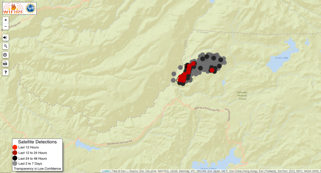
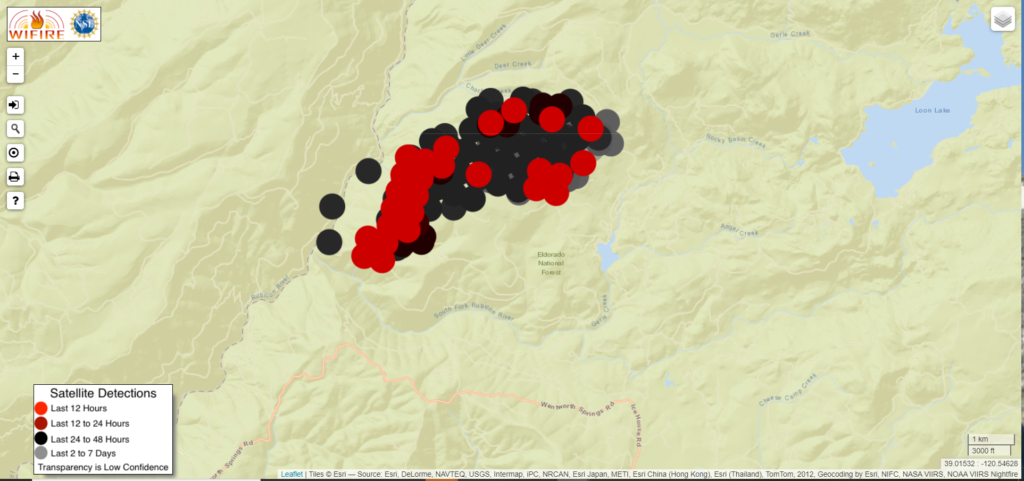
Satellites haven’t picked up any hot spots in 24 hours.
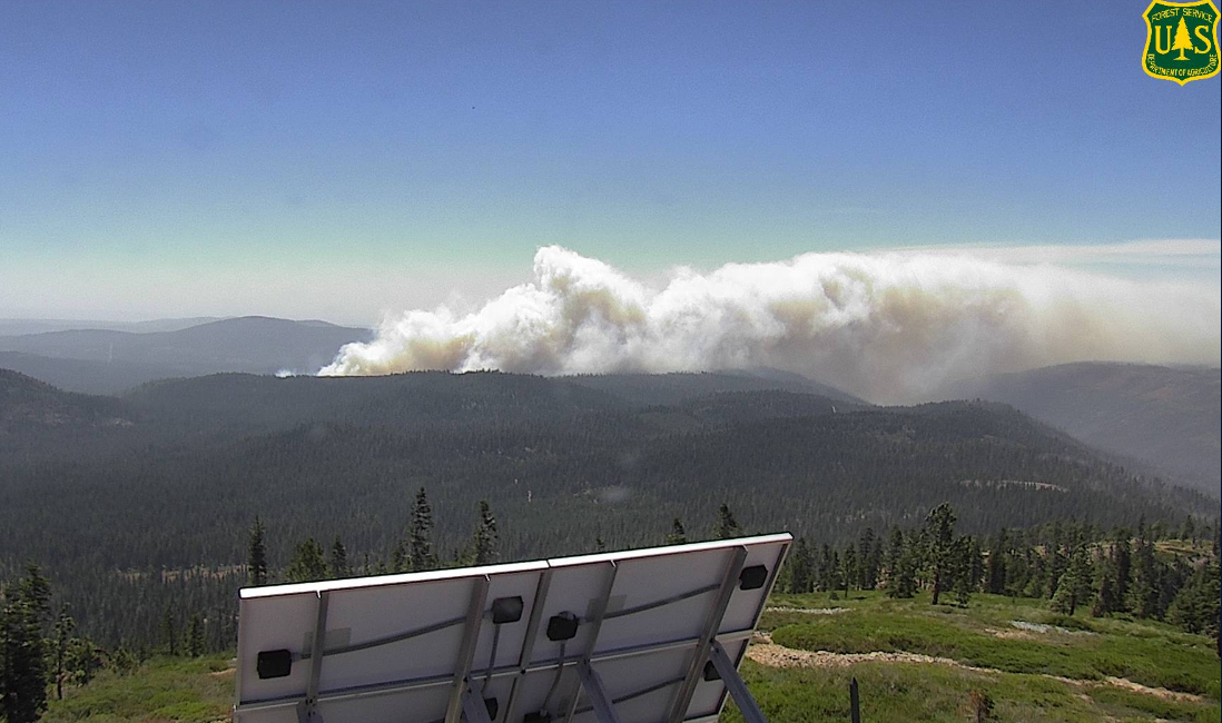
Lots of smoke coming from the Creek Fire and Castle Fire.
Thanks for reading! If you want to support the work that goes into providing these updates, you can do so here: https://www.buymeacoffee.com/rs44. Thank you so much for your generosity.
September 13
10:00p: Little is burning hot. Fire has checked itself on reaching the King Fire scar. Some backing on the southwest ridge.
However, critical fire conditions return Monday. Winds will increase uphill runs to Hell Hole Dam. From the incident page:
Warm and dry conditions with poor overnight humidity recovery will continue over the next several days. Low pressure drifts toward the coast, gusty southwest winds will develop Monday afternoon, with near critical fire weather conditions occurring across ridgetops and aligned drainage.
Sunday night: Downslope flows will develop, though ridgetop east to southeast winds will lead to poor relative humidity recovery and warm temperatures.
Monday: Warm and dry conditions persist, with afternoon temperatures in the low 80’s and relative humidity in the low teens. Gusty afternoon southwest winds will produce near critical fire weather conditions on ridgetops and aligned drainages.
Firefighters working to establish direct control lines where possible, using indirect control line where direct control lines aren’t feasible. They’re holding and monitoring existing lines along current perimeter and providing structure defense to residential structures in the threatened communities.
Thanks for reading! If you want to support the work that goes into providing these updates, you can do so here: https://www.buymeacoffee.com/rs44. Thank you so much for your generosity.
10:00a: Critical fire conditions coming today. With clearing smoke, firefighters hope for tanker passes on hot spots on the fire’s northeastern front.
Operations update: Yesterday, crews focused on strengthening the lines east and south on the Fork Fire to prevent fire movement toward Gerle Creek and Airport Flat.
Today, firefighters will shift their work toward the north and east where winds may push fire activity and test containment lines. Crews will continue to mop up and hold the south side of the fire area.
Firefighters have identified a planned fire line near the southwest edge of the fire toward the South Fork of the Rubicon River. Crews continue to scout for safe containment options further west across the Rubicon River, although steep topography and weakened snags present many potential challenges.
On the northeast side near Little Deer Creek, a containment line was established and improved. In preparation for the critical fire conditions, the crews will attempt to use helicopters and Super Scoopers to cool active fire spots along the northeast edge, if weather permits.
Thanks for reading! If you want to support the work that goes into providing these updates, you can do so here: https://www.buymeacoffee.com/rs44. Thank you so much for your generosity.
September 12
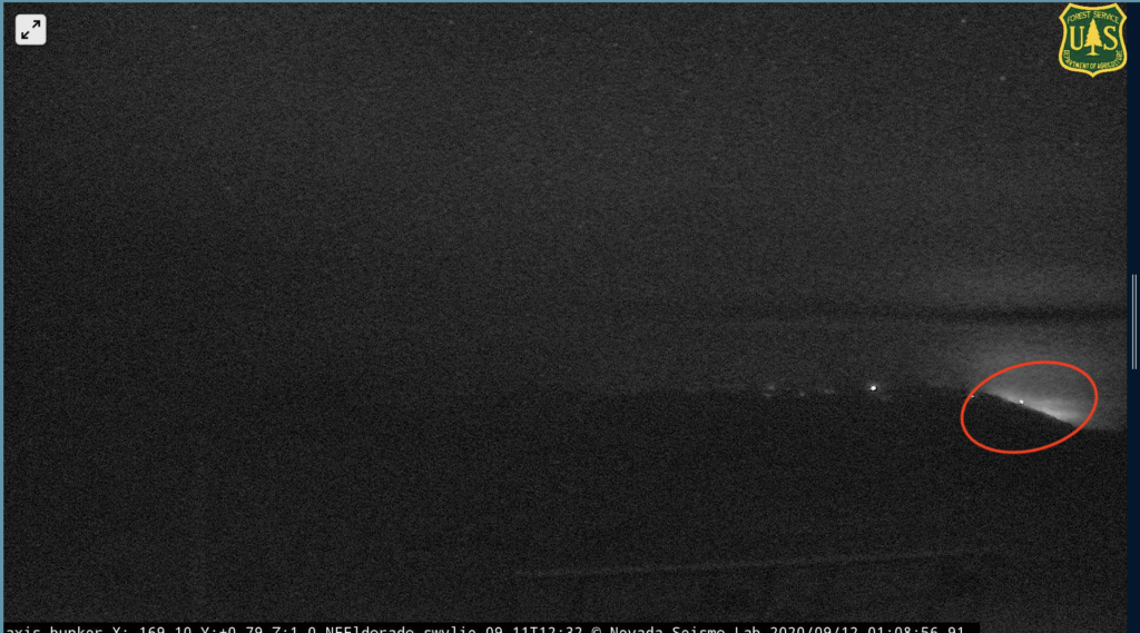
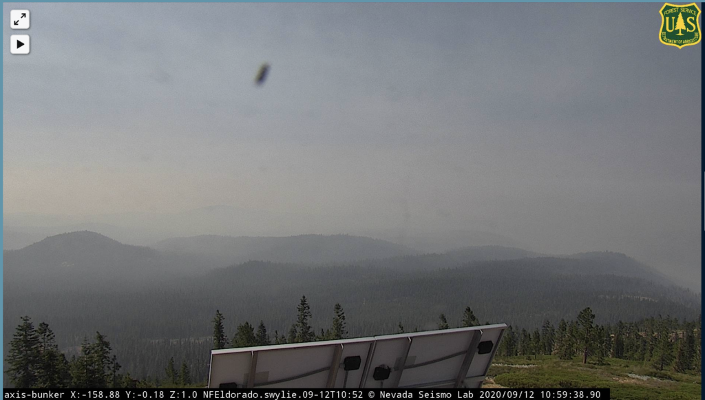
10:30p: 1,700 acres, 7% containment. Satellites still not picking up any heat; nothing visible in tonight’s camera.
Fire is in the Rubicon drainage and King Fire scar. Sparse fuel has slowed it.
Weather: Saturday night: Downslope flows will develop, though ridgetop east to southeast winds will lead to poor relative humidity recovery and warm temperatures. Sunday: Warm and dry conditions persist, with afternoon temperatures around 80 and relative humidity in the teens. Gusty afternoon southwest winds will produce near critical fire weather conditions on ridgetops and aligned drainages.
11:00a: No change in acreage or containment (full containment expected September 22). Satellites not picking up any major heat in the last 24 hours.
Warm and dry conditions with poor humidity recovery will continue and nearby high pressure will lead to light, mainly diurnal upslope and downslope winds through Saturday night. Low pressure approaching the coast will produce increased southwest winds on Sunday and Monday, with critical fire weather conditions possible.
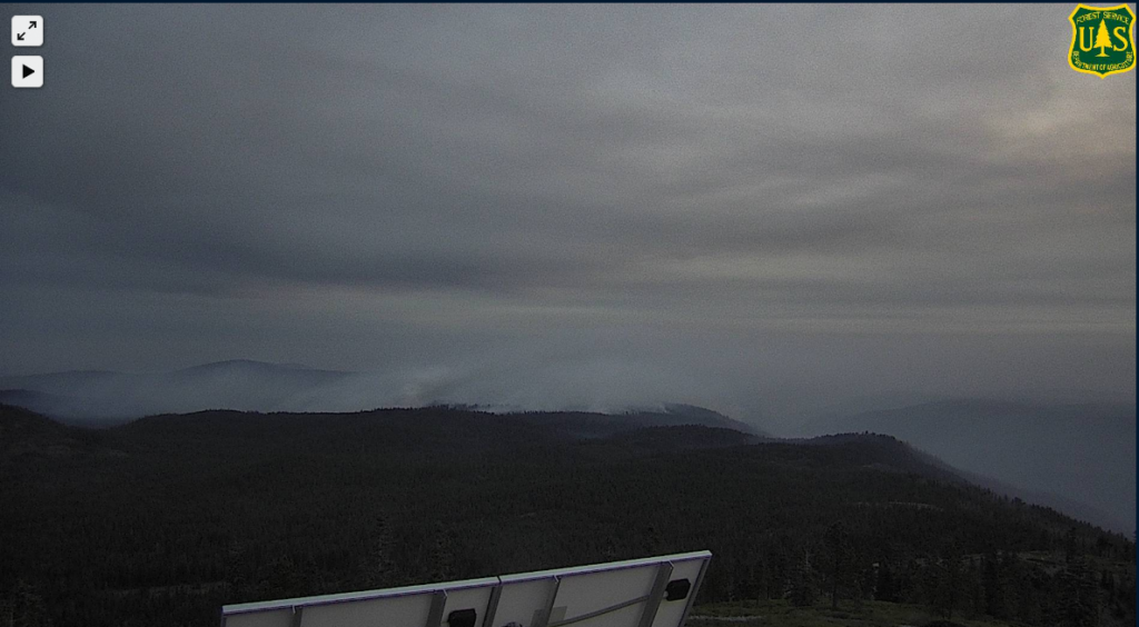
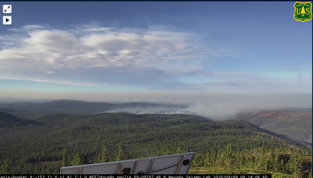
Fire was possibly visible last night on the Bunker Hill cam; this morning, no flames can be seen and little smoke. Overall conditions clearing a bit.
Thanks for reading! If you want to support the work that goes into providing these updates, you can do so here: https://www.buymeacoffee.com/rs44. Thank you so much for your generosity.
September 11
11:50p: Aerial mapping today – no air attacks because of visibility – puts the fire at 1,600 acres, versus yesterday’s estimate of 2,200. 7% containment. Smoke layer and low winds meant little fire activity (satellite doesn’t pick up new hot spots). However, the smoke will likely start to clear tomorrow afternoon and winds will pick up Sunday into Monday, potentially leading to increased fire activity.
Mandatory evacuation orders lifted – now evacuation warnings.
Thanks for reading! If you want to support the work that goes into providing these updates, you can do so here: https://www.buymeacoffee.com/rs44. Thank you so much for your generosity.
4:45p: Little heat coming from the fire. Press conference at 6p PDT, which will hopefully provide more details.
11:45a: Heat detection only picking up one new hotspot in the last day, this one on the fire’s south east end. Bunker Hill camera now oriented away from the fire, so hard to tell what smoke’s being thrown.
Another satellite image showing little activity
Ongoing mapping activity (fire currently estimated at 2,200 acres).
September 10
10:00p: Two minor injuries confirmed.
9:45p: Fork Fire size revised up to 2,200 acres (weather conditions have prevented accurate mapping; this is based on drone and on-the-ground data). It’s burning in the Rubicon River drainage and King Fire burn scar. Rugged terrain makes firefighting difficult and dense timber and fuel from trees killed in the King Fire aided initial spread.
Operational goals are to protect private property and nearby communities. Operational objectives are to keep the fire west and north of Wentworth Springs Rd., east of 11 Pines Rd. and south of Hell Hole Reservoir.
Thanks for reading! If you want to support the work that goes into providing these updates, you can do so here: https://www.buymeacoffee.com/rs44. Thank you so much for your generosity.
4:15p: Fire still burning in the Rubicon Canyon with some activity in the King Fire burn scar.
Communities of Stumpy Meadows, Quintette, and Volcanoville still under a mandatory evacuation order.
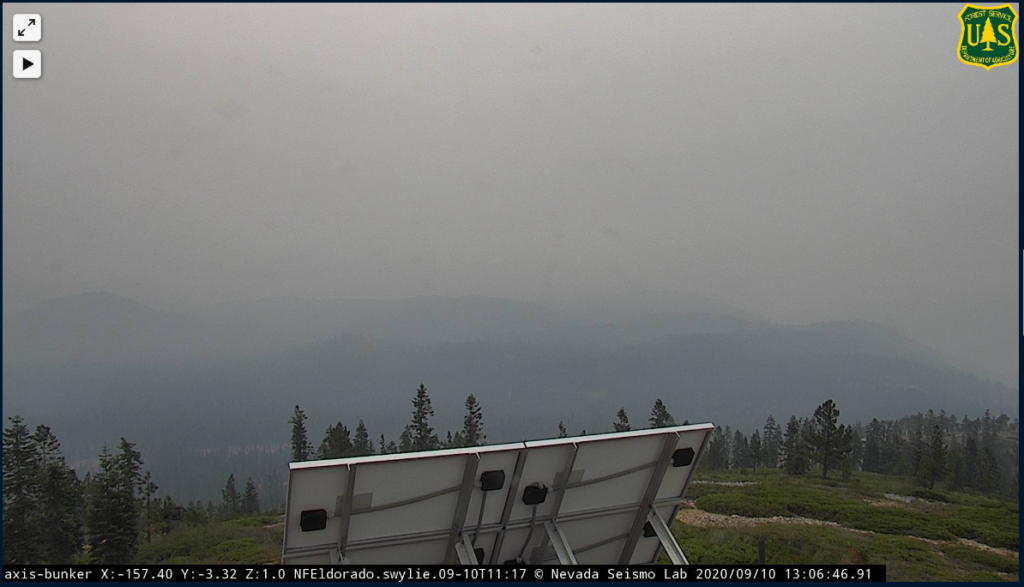
1:00p: Not much to update. No planes in area, no notable recent hotspots per heat-detecting satellites. Bunker Hill camera is back online. There doesn’t look to be much smoke rising from the burn area, but it’s also difficult to tell because of the all-around smokey conditions and the possibility that the smoke is lying low to the Rubicon River drainage area.
11:00a: Fire revised down to 2,000 acres. Wind has shifted to blow lightly from the west. Official map shows that wind and expected fire movement into Div V lines.
Few new hot spots detected via satellite in the last 12 hours. Unfortunately, the best camera angle of the fire is stuck on an image from the early morning.
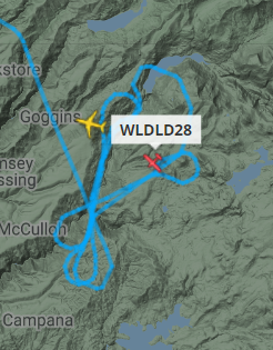
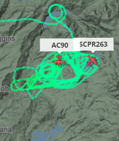
7:20a: Yesterday, firefighters built 2.5 miles of dozer line on the South/Southeast side of the fire. That line is currently holding. Two medium super scoopers dumped from Loon Lake onto fire hot spots.
Smoke is still down from a couple days ago.
Thanks for reading! Hoping to provide useful information about the Fork Fire. Would appreciate any coffee to listen to the scanner later into the night 🙂 https://www.buymeacoffee.com/rs44
According to GOES-17 satellites, nothing in the fire is burning particularly hot, a testament to the aerial work done yesterday.
September 9
10:00p: Officially 2,500 acres, 0% containment. Winds shift in the next 12-18 hours to come from the west/southwest, though they should stay light (~10mph). There is risk that this pushes the fire out of the Rubicon drainage and King Fire scar and into areas that haven’t seen recent burns.
Thanks for reading! Hoping to provide useful information about the Fork Fire. Would appreciate any coffee to listen to the scanner later into the night 🙂 https://www.buymeacoffee.com/rs44
5:10p: Fire cams continue to show less smoke activity. Satellite maps not indicating expansion, but important to note the fire is still officially 0% contained. Three tankers working on the fire.
All 18 national forests in California are now closed because of extreme fire conditions.
2:00p: Some air activity of the fire. Smoke creeping into the Tahoe Basin, visible near Emerald Bay.
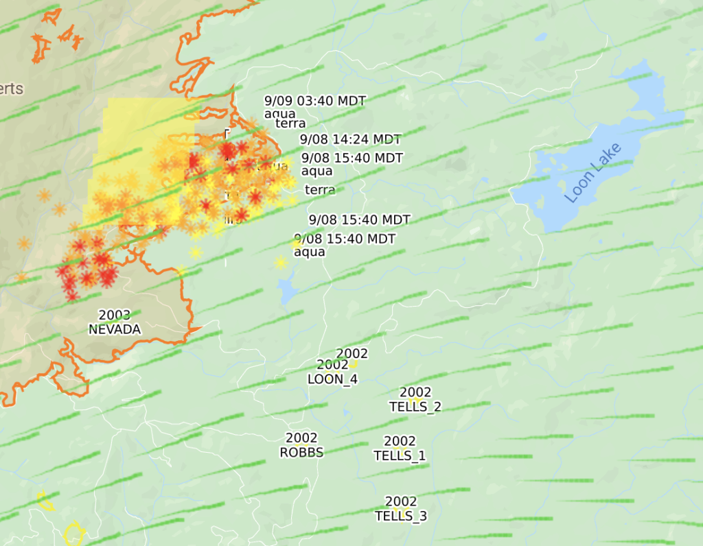
10:10a: Mapping the burn area, as detected by satellites, shows the fire close to 3,500 acres. Parts of it has jumped the Rubicon River, not sure if it’s established on the other side yet.
Camping prohibitions in place across Tahoe Basin. Also restricting day-use areas, campgrounds, and beaches.
8:15a: Fire still burning at 500 acres with 0% containment. Temperatures fell overnight and wind is currently around 10mph to the west, blowing the fire to a burn scar.
Smoke is down substantially from yesterday.
Satellite mapping shows the fire in the King Fire scar and active on the fire’s western front. Doesn’t seem like too much spread, though. Evacuations in place for the Upper American River watershed. I don’t believe there are many structures in the area.
8:45p
Fire is 500 acres with 0% containment. Winds have calmed down a bit but the area remains under a Red Flag warning through tomorrow. The fire is pushing into the 2014 King Fire scar.
2:35p PDT, Sept 8
The Fork Fire, which quickly jumped to 500+ acres, is burning near the burn scar from the 2014 King Fire. Wind is gusting towards that scar, which, with luck we haven’t had in 2020, may slow its spread. Aircraft not currently working on the fire, reportedly because of high wind.
2:01p PDT, Sept 8
Right as I posted the below, AA500 put the fire at 500-600 acres, well above the just-reported 100 acres. This thing is growing fast.
Thanks for reading! Hoping to provide useful information about the Fork Fire. Would appreciate any coffee to listen to the scanner later into the night 🙂 https://www.buymeacoffee.com/rs44
2:00p PDT, Sept 8
Fork Fire up to 100 acres with “serious growth potential.” Evacuations for Loon Lake, Gerle Creek, and Rubicon trail.
Some reports of crowning – when the fire races to a tree’s top and hops along the canopy – that would make the blaze even more difficult to control.
Wind currently around 30mph and won’t slow down for the next 18 hours.
1:00p PDT, Sept 8
The Fork Fire near Loon Lake west of Lake Tahoe has burned 75 acres in Eldorado National Forest. Crews on scene. Live cam available here: http://www.alertwildfire.org/tahoe/index.html?camera=Axis-Bunker&v=81e002f.