2:45p PDT, 9/2
Up to 811 structures destroyed as crews were able to go in to some places and assess damage.
With better air conditions there have been more active air attacks on the fire throughout the day, especially in the Wrights Lake and Kirkwood areas.
Structure protection ongoing at Wrights Lake with the fire moving N/NE, into the Desolation Wilderness, though bounded on the east by the granite mastiffs of the Crystal Range.
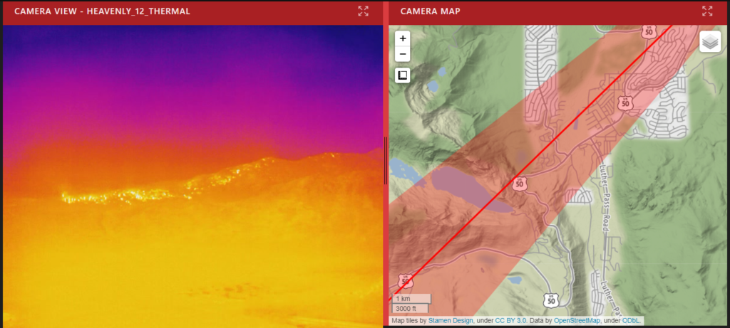
Northeast side of the fire has slowed though it is abutting, or at least close to, the Heavenly ski area.
Firefighters have constructed a dozer line on the fire’s northeast side to protect structures in South Lake Tahoe. They anticipate being able to hold that line.
Kirkwood structure protection a priority today as the fire is currently hung up on a ridge near the ski area.
7:45a PDT, 9/1
Fire is 204,390 acres and 20% contained. Rate of spread slowed yesterday despite the red flag conditions (continuing through tonight at 11p). 544 homes destroyed along with 12 commercial properties and 173 minor structures.
10:35p PDT, 8/31
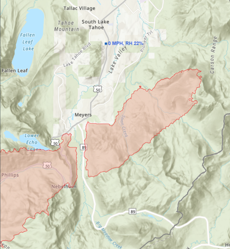
Caldor Fire continues to burn the east ridge of Christmas Valley, south of populated areas. So far there’s a distinct gap between two flanks of the fire where amazing work by firefighters has kept the inferno from burning along 89 to structures in Meyers.
Here’s another view of that gap.
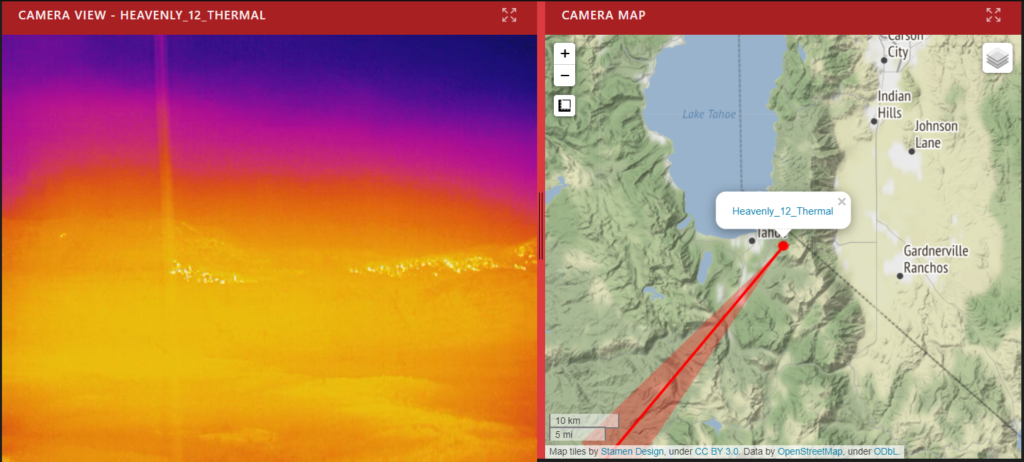
Fire is about 2 miles from Heavenly ski resort. Firefighters hope to move it around Heavenly should the fire approach it. Snow making machines – used previously to protect Sierra-at-Tahoe – will play an important role in such efforts.
Still burning and torching trees between Meyers and Echo Summit on 50.
Earlier air attacks featuring retardant lines holding the fire by Kirkwood. Some spots by Kirkwood Lake, but “within objectives.”
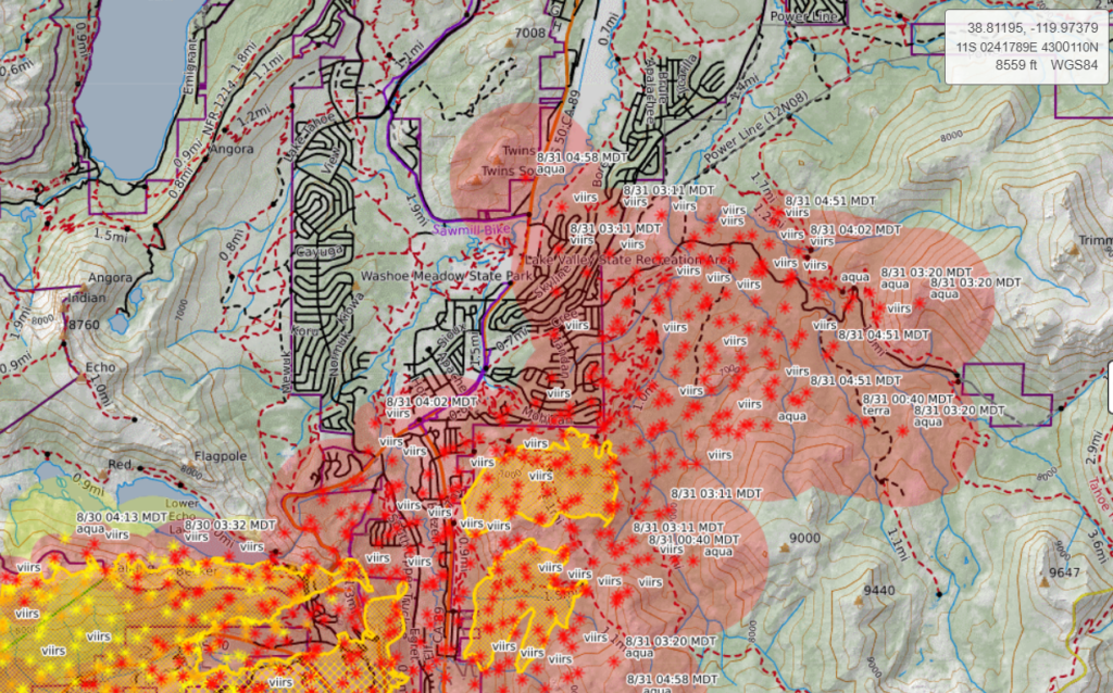
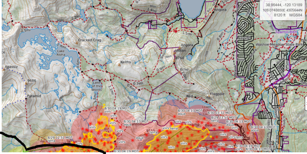
So far, infrared shows no spotting in the Desolation Wilderness towards Fallen Leaf Lake.
Major concern is for a shift in winds to push the fire north towards Meyers and South Lake Tahoe.
12:55p PDT, 8/31
South Lake Tahoe CHP reporting no structure losses.
11:15a PDT, 8/31
Winds picking up, blowing embers from the fire – which is burning up ridges east of 89 into the Carson Range – into Meyers where ground crews are putting them out as they land on roofs or start spot fires.
9:00a PDT, 8/31
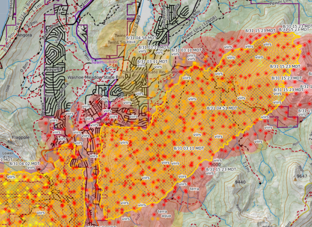
Satellite heat detection has the fire SE of Meyers burning along a forested ridge close to the neighborhood.
9:45p PDT, 8/30
Fire pretty firmly established in Christmas Valley and the Tahoe Basin.
7:00p PDT, 8/30
Fire has spotted into Christmas Valley, heading towards Highway 89.
Flames both sides of 50 1.5 miles south of Meyers.
6:45p PDT, 8/30
The fire has crossed Highway 50 east of Echo Summit.
5:30p PDT, 8/30
Some good news from the community briefing: After a firefight 36-48 hours ago, there is no known structure loss at Strawberry.
North side of the fire is slowing due to sparser fuels. Presumably this refers to the crawl up Ralston Ridge last night and the spot fires near Lake Aloha.
1:50p PDT, 8/30
Fire is in the Tahoe Basin, currently hung up on the ridges. There are spots in the Desolation Wilderness by Lake Aloha (last night the fire was spotting to and over Ralston Ridge) and around Lower Echo Lake.
1:00p PDT, 8/30
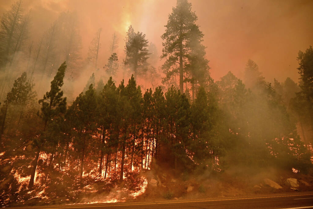
Two hours into the Red Flag warning and there fire is generating a huge pyrocumulus cloud.
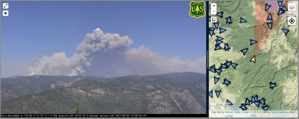
12:35p PDT, 8/30
The Caldor Fire keeps creeping down Echo Summit towards the Tahoe Basin. Some 12 hours ago it was just poking over the top of the ridgeline.
11:45a PDT, 8/30
In a bit of good news, firefighters saved Camp Sacramento.
11:30a PDT, 8/30
All of South Lake Tahoe now under mandatory evacuation orders.
11:00a PDT, 8/30
Red Flag warning now in effect through 11p Wednesday (this has been extended). Covers Dixie and Caldor Fires. Winds blowing right into South Lake Tahoe.
10:30a PDT, 8/30
Update from Sierra-at-Tahoe, provided by a Sacramento Bee reporter.
Lots of structure damage on Mt. Ralston Road.
Lost homes in Sierra Pines.
Homes lost at Tamarack Pines.
10:15am PDT, 8/30
Evacuation orders in the Lake Tahoe Basin, expanding on last night’s in the Meyers area. This covers almost the entire basin.
Fire looks well-established past Echo Summit.
Spot fires in the Desolation Wilderness (boundary drawn in black). Fire climbed Ralston Ridge overnight and is heading towards Ralston and Tamarack Lakes. There’s obviously a lot of granite in Desolation, but still plenty of forests for runs or spotting, especially given how well it has threaded granite before.
Reports of one structure loss (potentially a parking garage) at Sierra-at-Tahoe. Otherwise the resort seems okay.