Result: Summited Mt. Price and Mt. Agassiz
Class: 3-4 on the upper approach; 2 on the Slabs of Insanity and ridge; 1 elsewhere
The Plan
Sometimes familiarity breeds not contempt but undying love. Such I have for the Crystal Range, which for years loomed beyond my reach – and interest – as the unattainable backdrop to Desolation Wilderness.
That had changed in recent years as I began hiking and this year I hoped to make a traverse of the three main peaks, hiking to Mt. Price from Lake Aloha, crossing to Mt. Agassiz (not to be confused with the Mt. Agassiz in the Palisades), and then gaining Pyramid Peak before looping back and returning to Fallen Leaf Lake.
This would be an audacious day hike and on the previous day as well as morning of I rather lost interest in the full hike. Waking late and not hitting the road leading to Lily Lake and the Glen Alpine trailhead until 8:30 solidified my decision to take Pyramid Peak off the list. I had to return to Fallen Leaf Lake no later than 6:45 if I wanted to eat that night, so I couldn’t make up the late start by finishing at dusk or night.
My amended plan would take me from Fallen Leaf Lake’s shores to Lake Aloha, up the so-called Slabs of Insanity to Mt. Price, from which I would make the easy traverse to Mt. Agassiz before descending back to Mosquito Pass and Lake Aloha and hiking the 7-8 miles back to camp.
Glen Alpine
As mentioned, I began hiking at 8:30 and reached Glen Alpine some 15 minutes later. Glen Alpine is a bore. I’ve hiked it more than a dozen times and know it better than I care to know any trail.
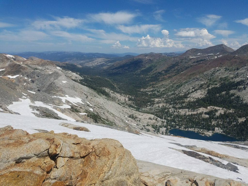
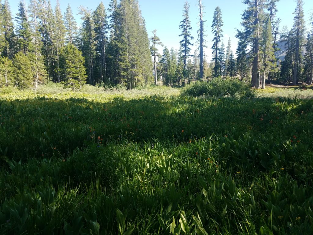
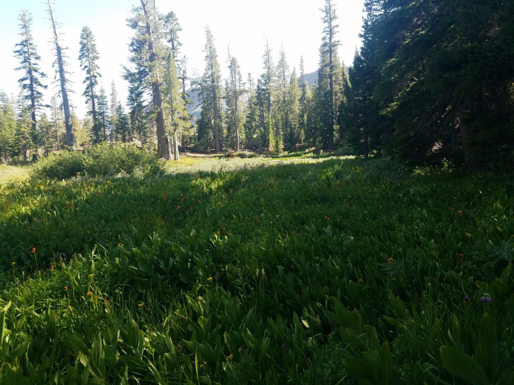
It meanders through the ravine bordered on one side by a soft line of low peaks that lead to the Cracked Crag and the eastern flank of Desolation Wilderness and, on the other, by Cathedral Ridge and Mt. Tallac. Naturally enough, the trail follows the Glen Alpine Creek, which collects much of Desolation Wilderness’ runoff and deposits it in Fallen Leaf Lake.
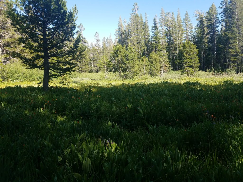
Thankfully, the trail is fast. It gains little elevation and has no challenges whatsoever – as easy as Class 1 gets. I made good time, leaving a water bottle in a fallen tree trunk after passing the trail split for Lake Gilmore. Now on the PCT, beauty rapidly increases as lily pad covered ponds, small meadows, and ultimately a line of lakes grace the trails.
Susie Lake and Heather Lake
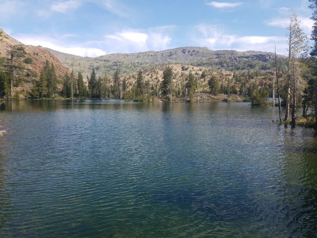
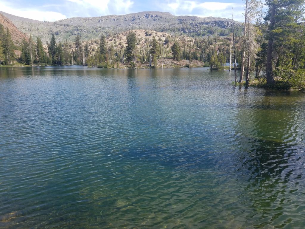
I reached the first, Susie Lake, around 9:45. A beautiful subalpine wonder, Susie Lake boasts a sprawling shoreline with numerous spots to camp and plenty of vistas of the Jack’s Peak, Dick’s Peak, and Dick’s Pass. It’s worth a few minutes to enjoy the Desolation Wilderness’s beauty.
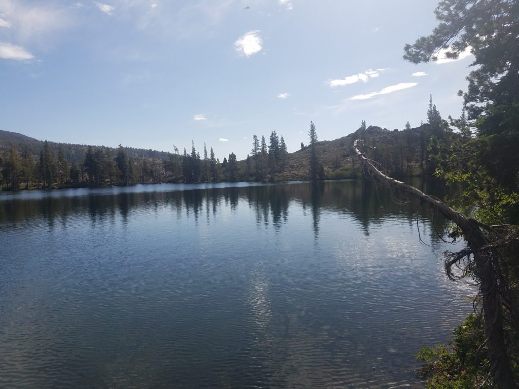
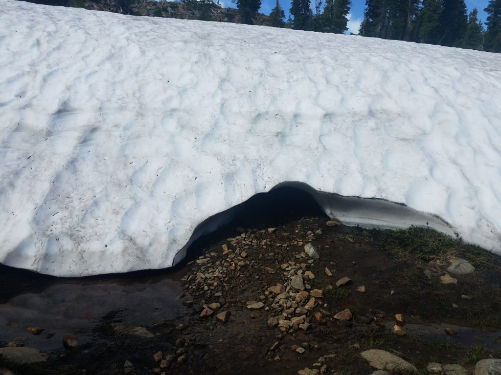
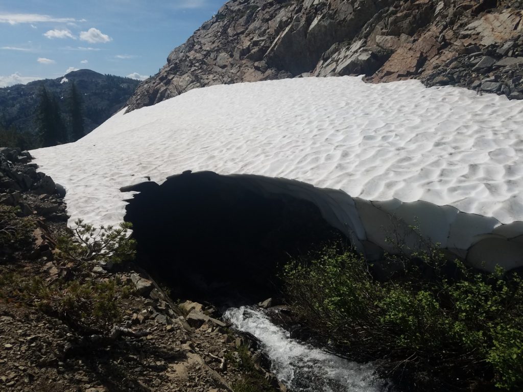
From there the trail continues with ease and a slight downhill to a deep unnamed tarn. Past it the connecting creek pounds after heavy snowfall and forges tunnels through remnant snow fields, a remarkably fun sight. Heather Lake appears after some switchbacks. Less remarkable than Susie Lake, its deep blue waters still lend to nice photography.
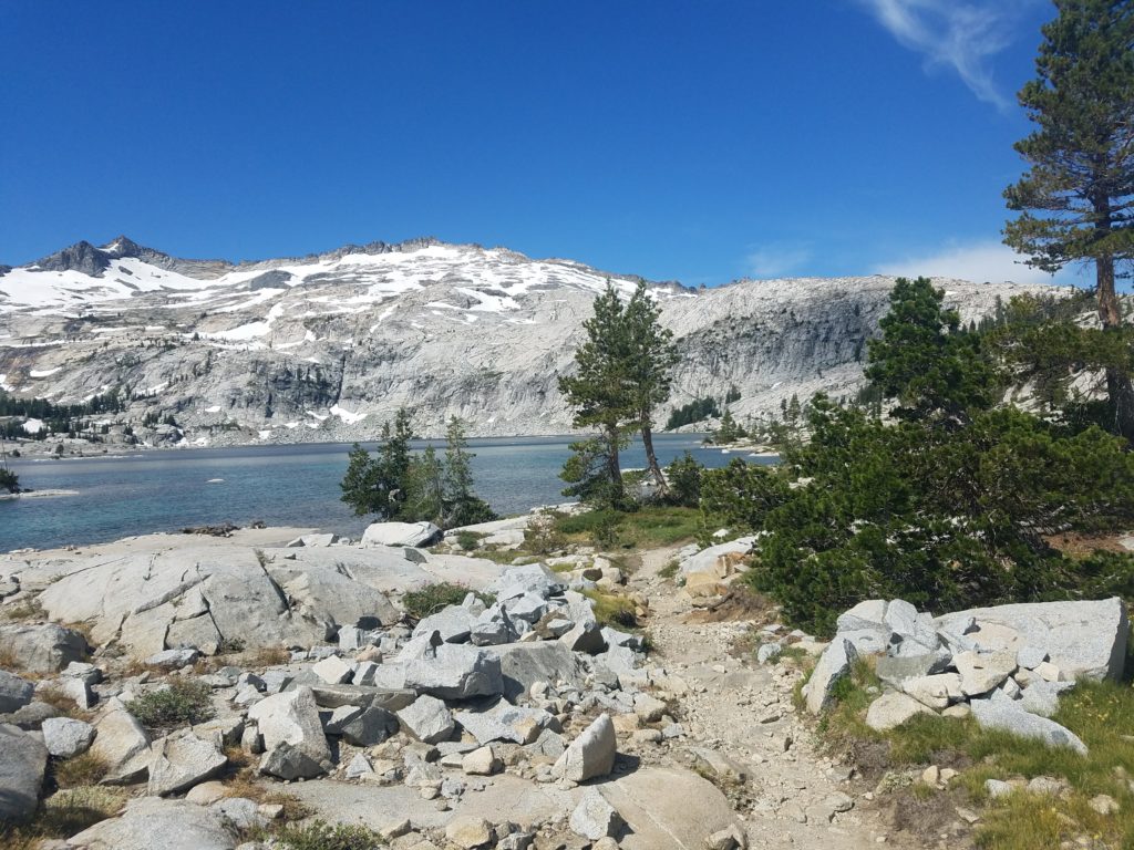
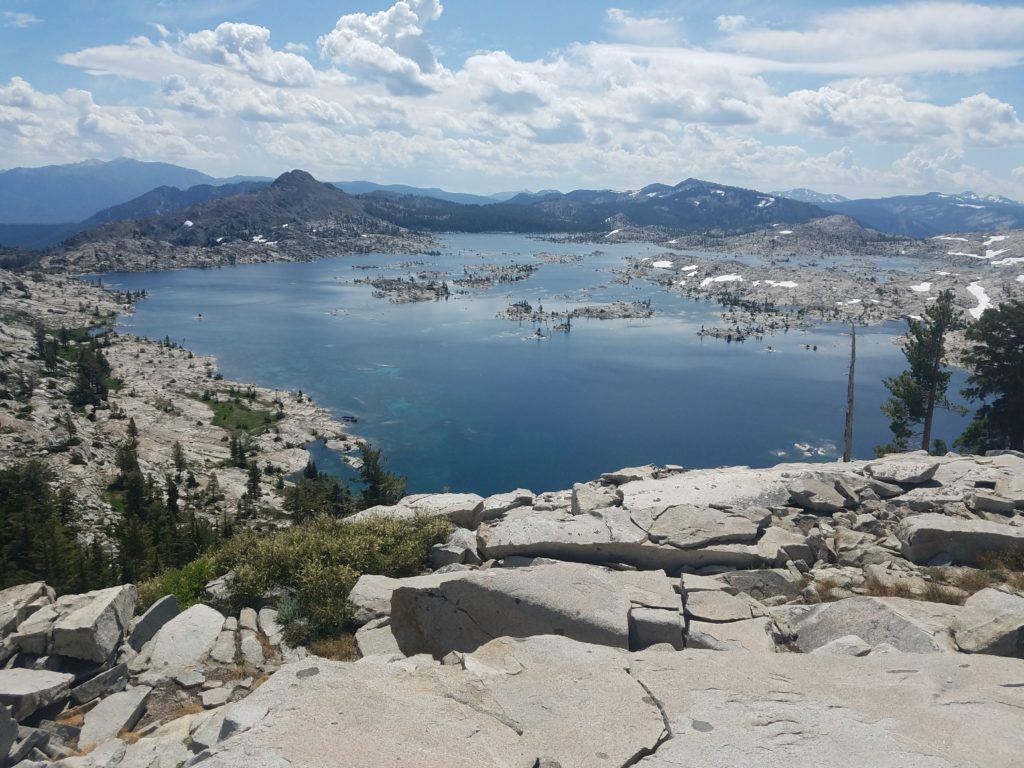
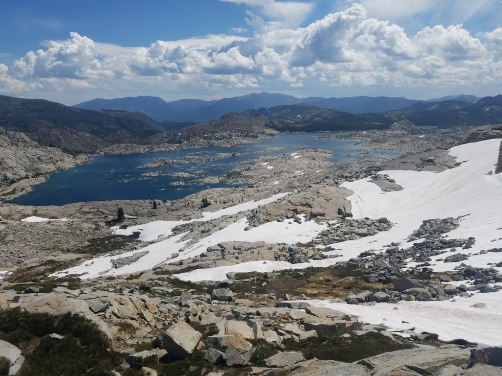
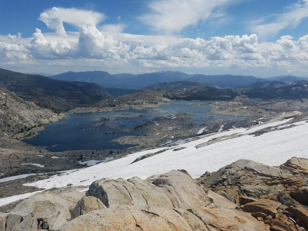
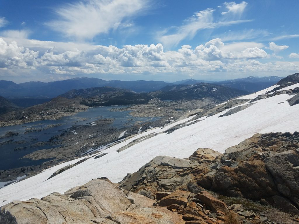
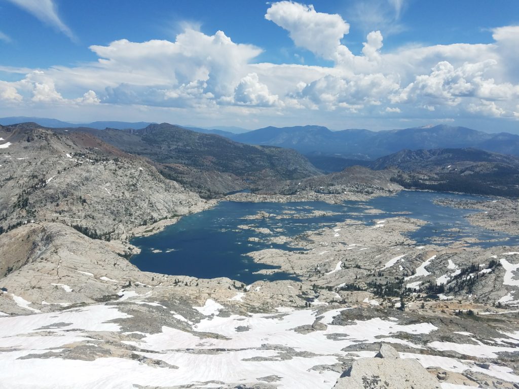
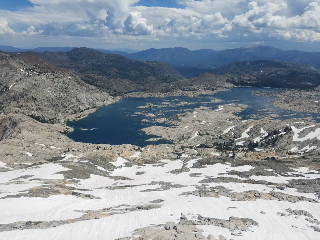
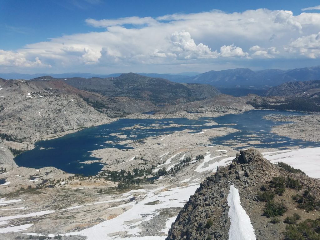
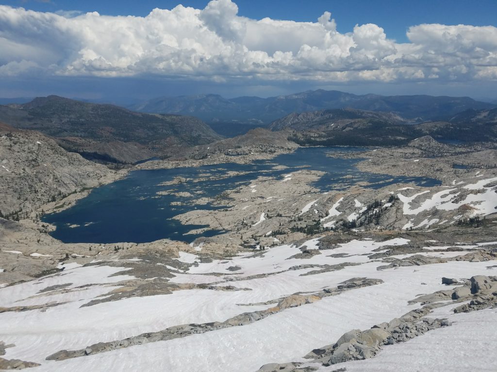
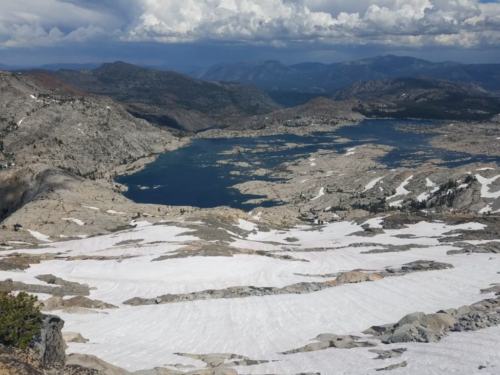
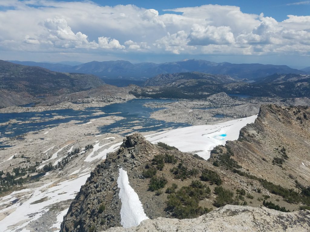
Lake Aloha
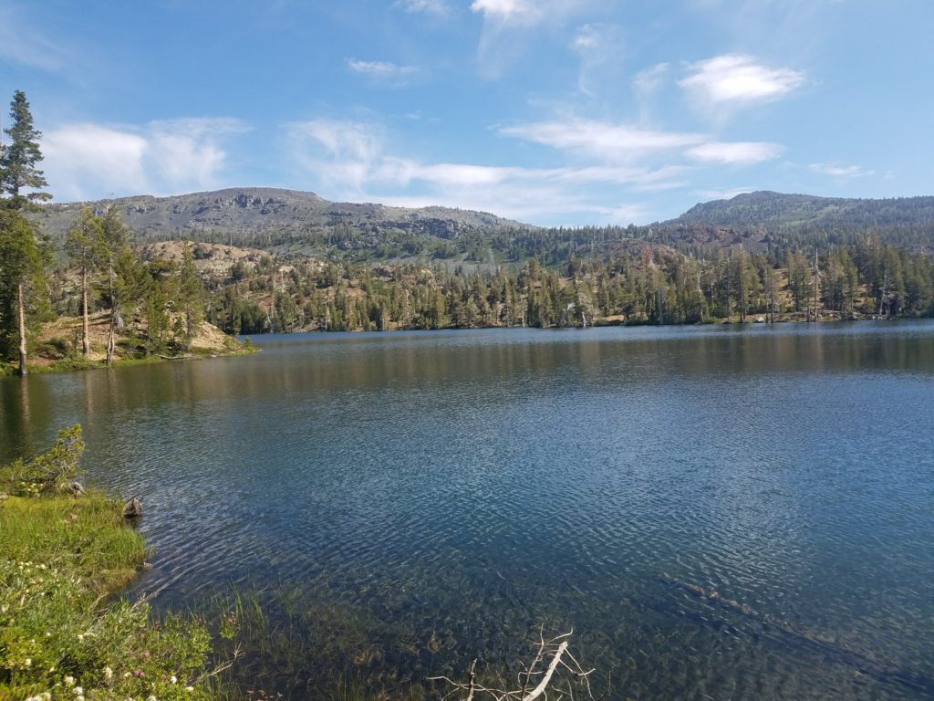
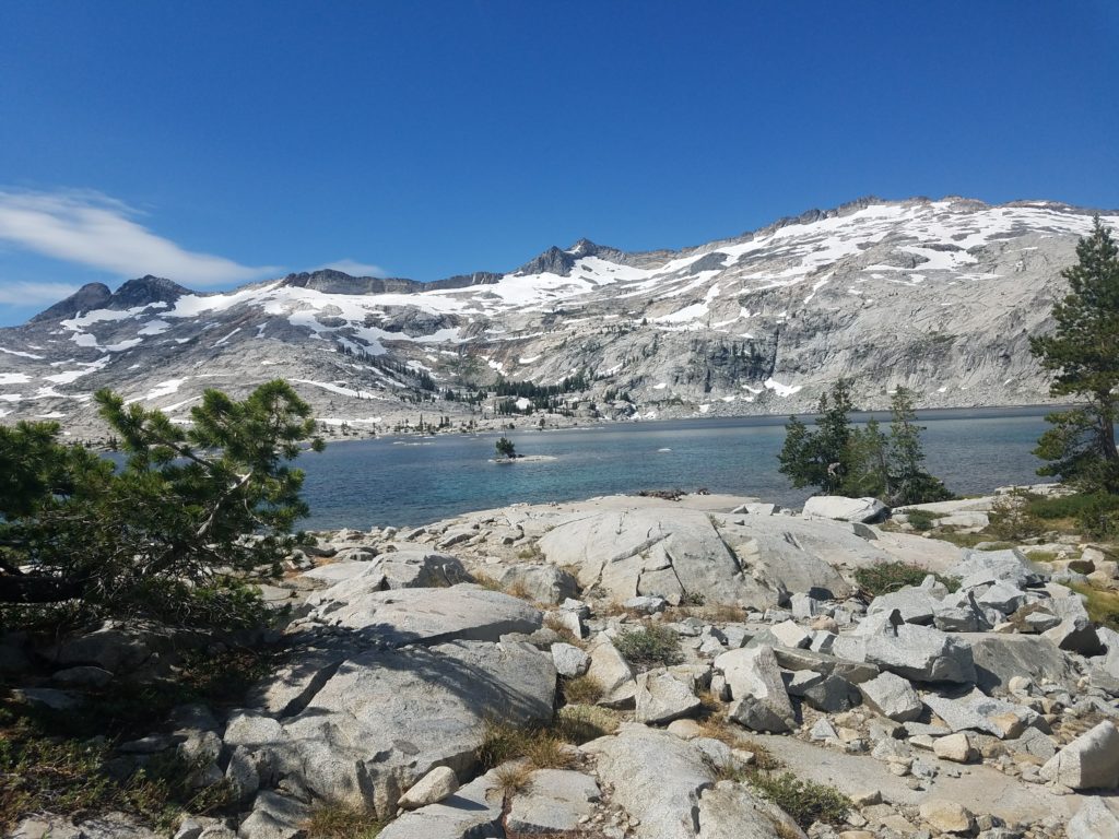
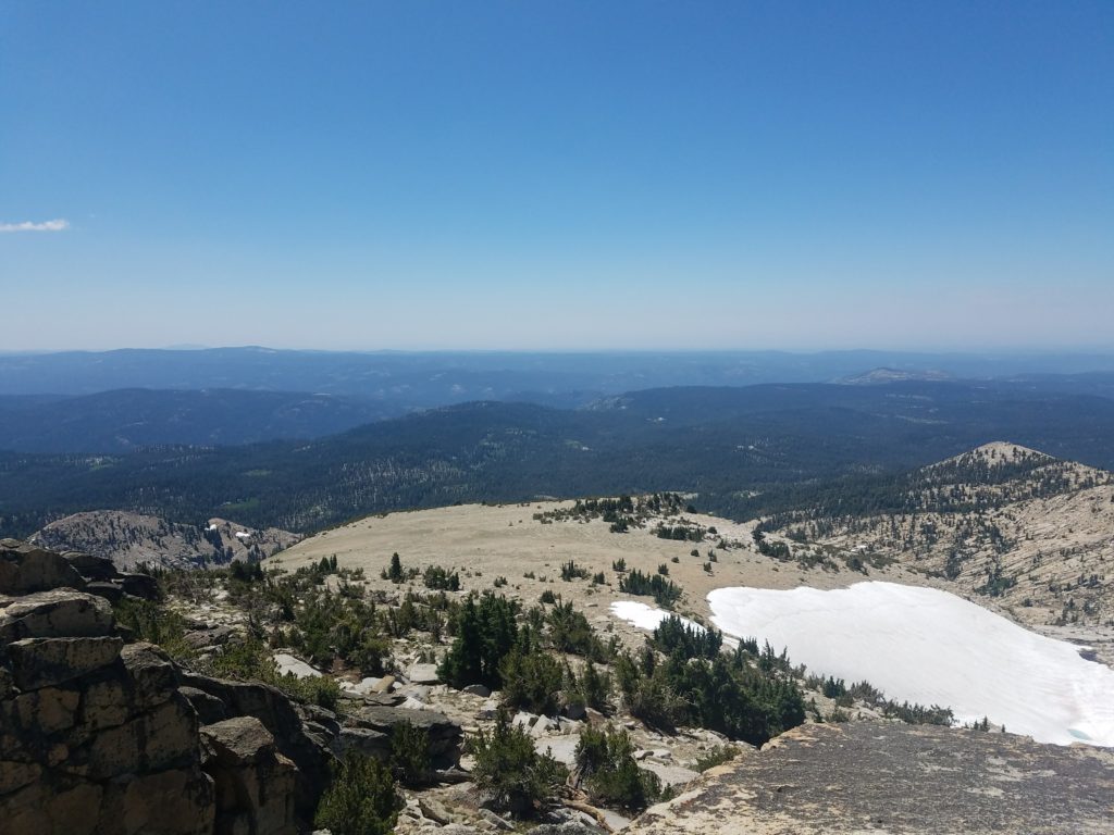
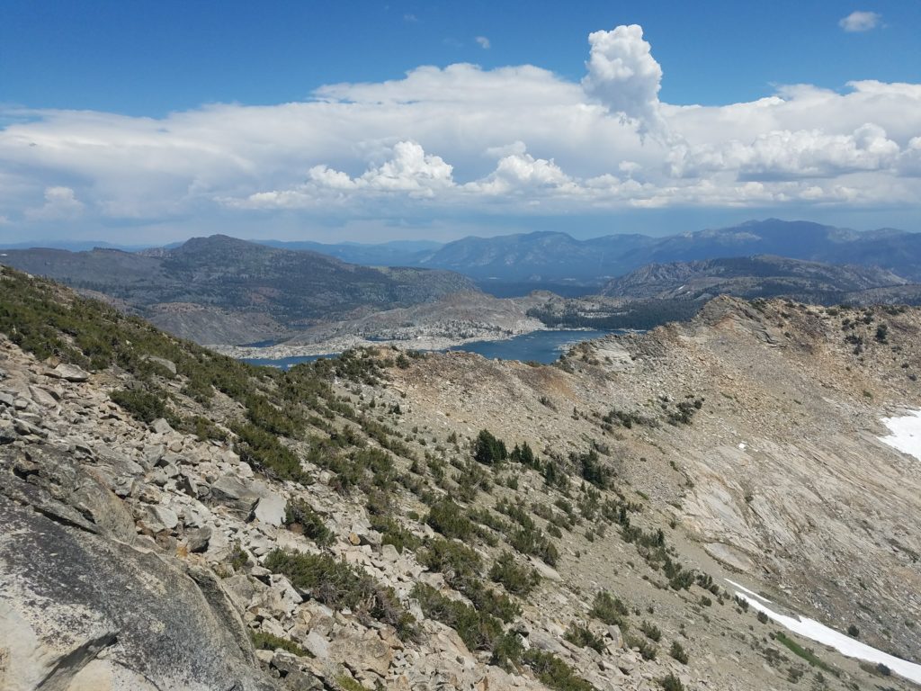
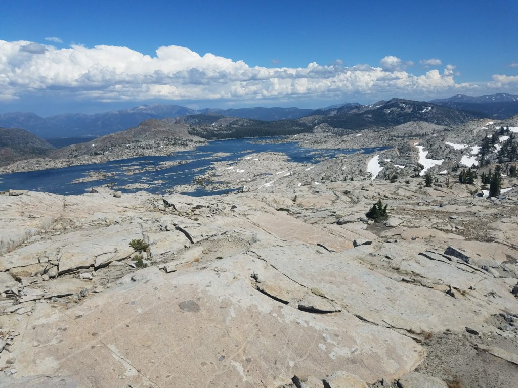
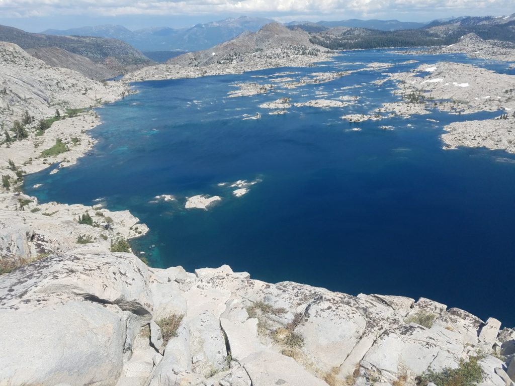
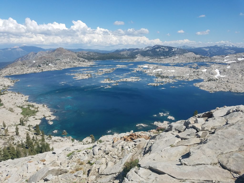
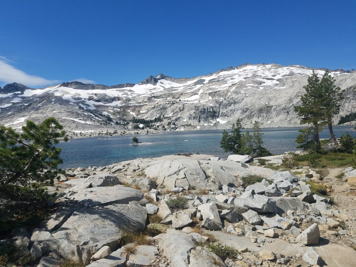
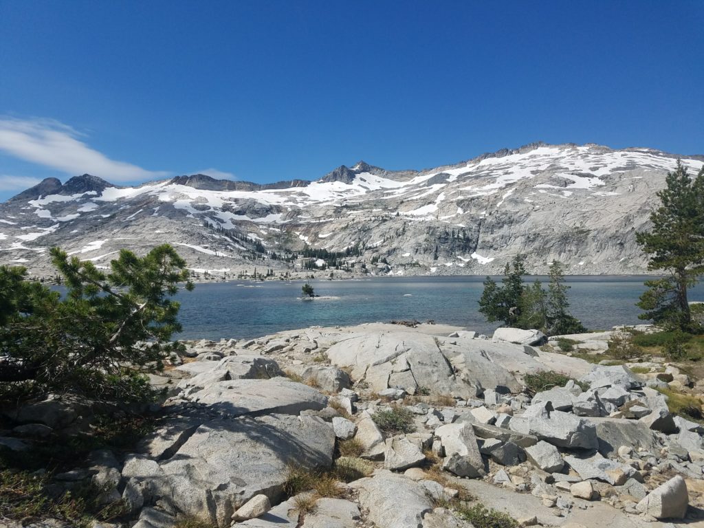
Finally Lake Aloha emerges. Lake Aloha rarely, if ever, looks the same twice. A man-made reservoir drowning desolation valley, the number of visible islands and its shoreline depend on the season and snowfall.
In years like 2017 and 2019, few islands peer above the surface and snow still sits scattered about the rocks. But in drier years, like 2018, islands are a dime a dozen, poking above the shallow waters and creating a fun swim environment.
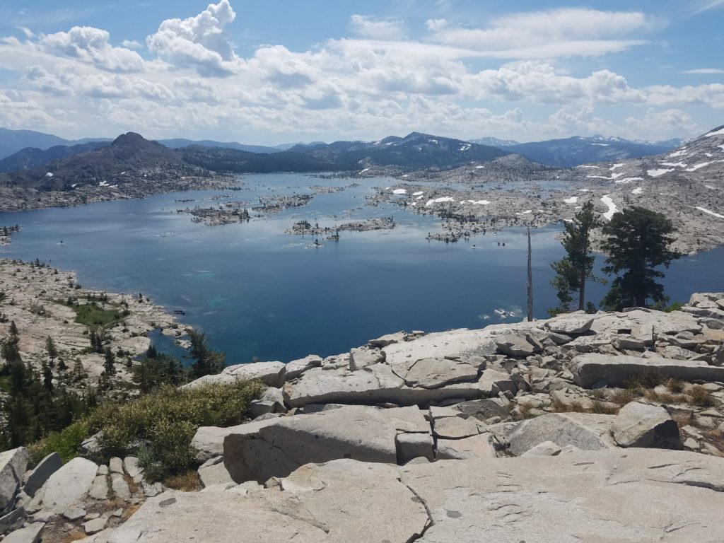
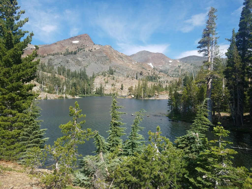
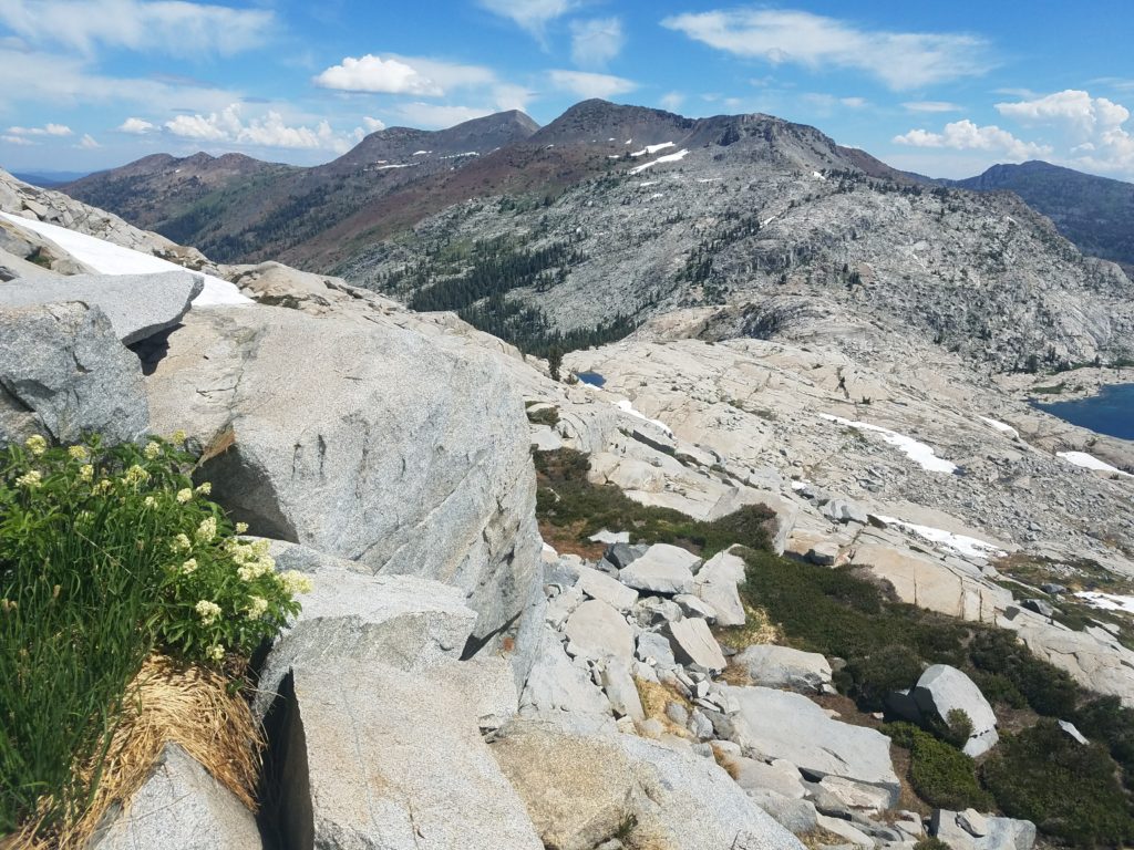
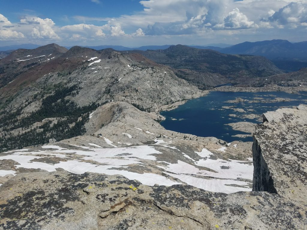
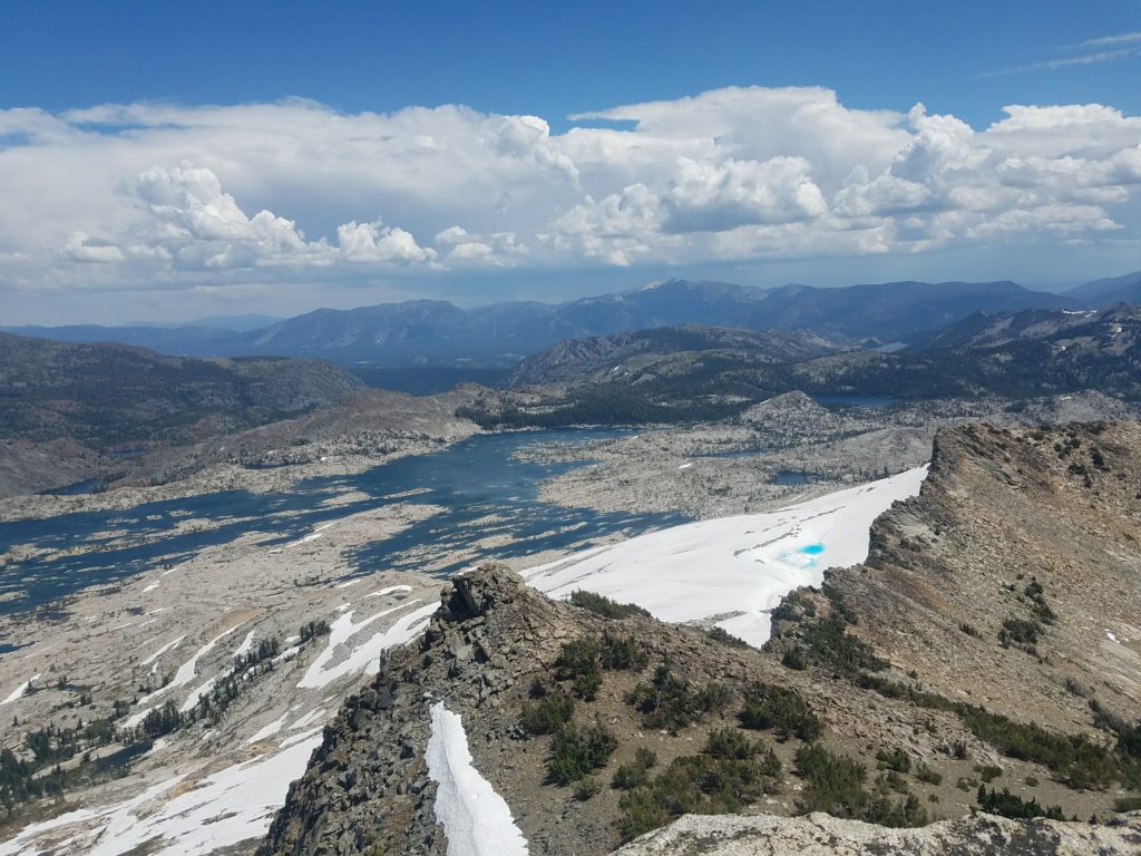
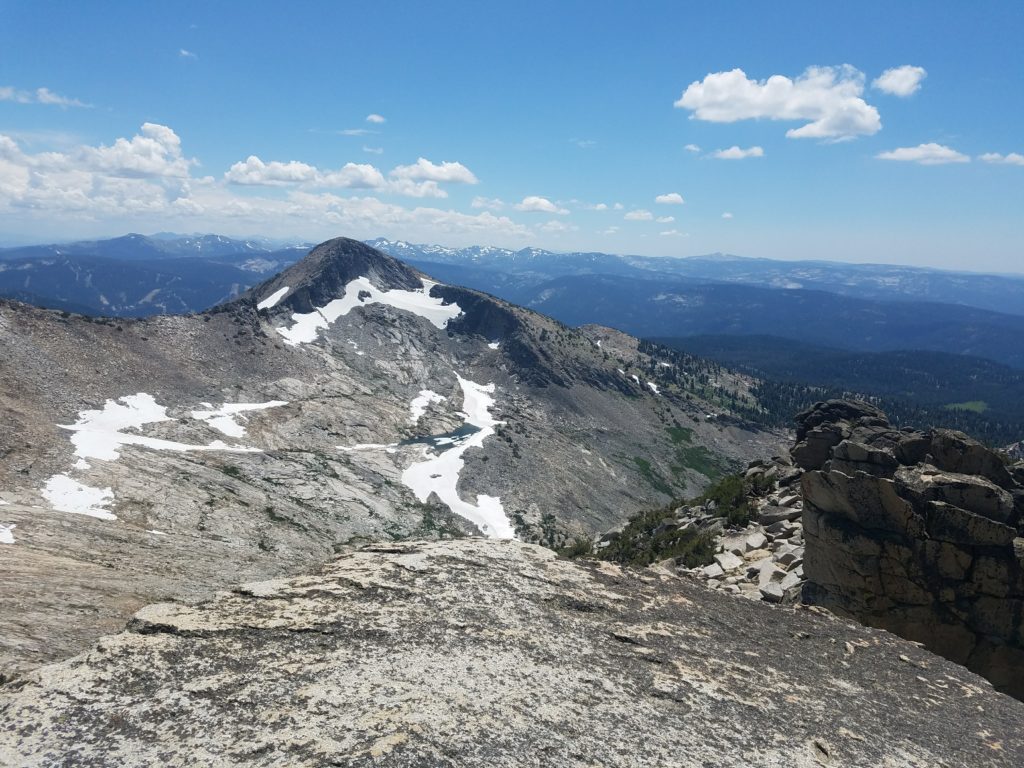
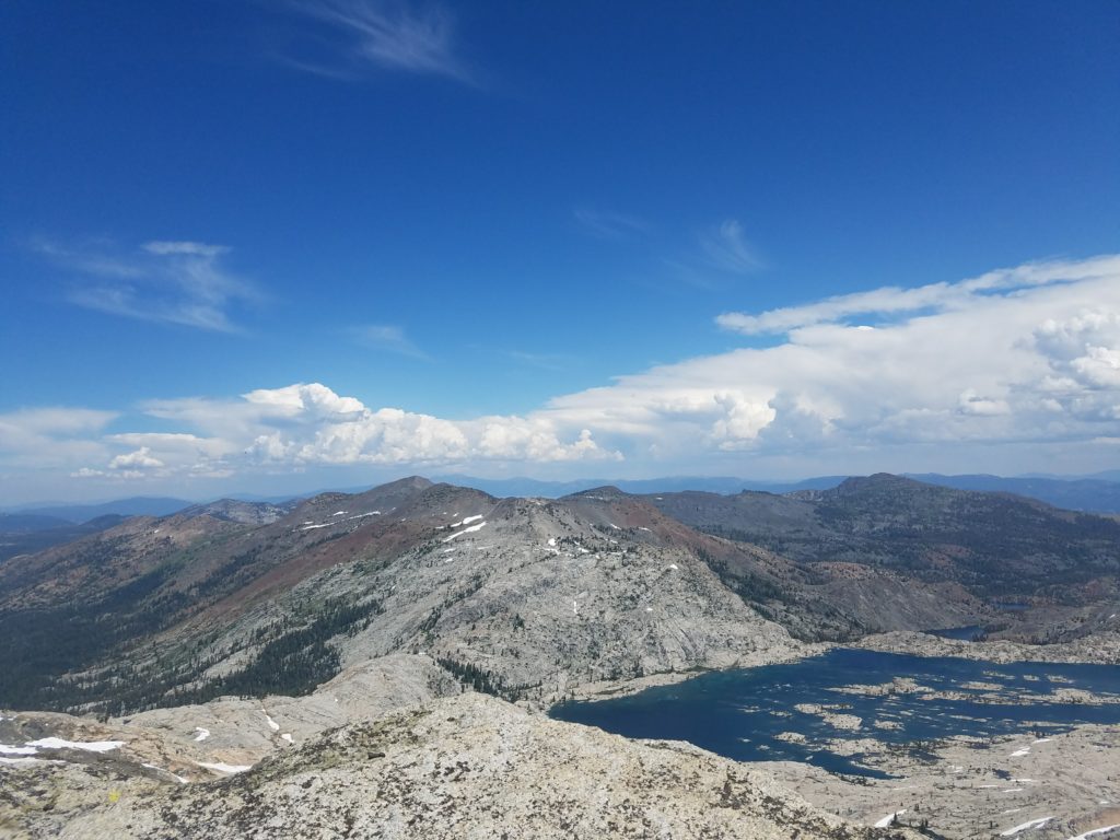
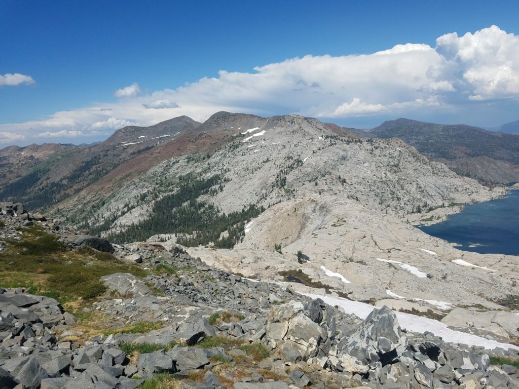
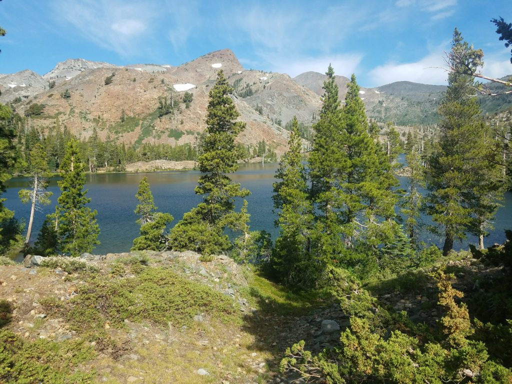
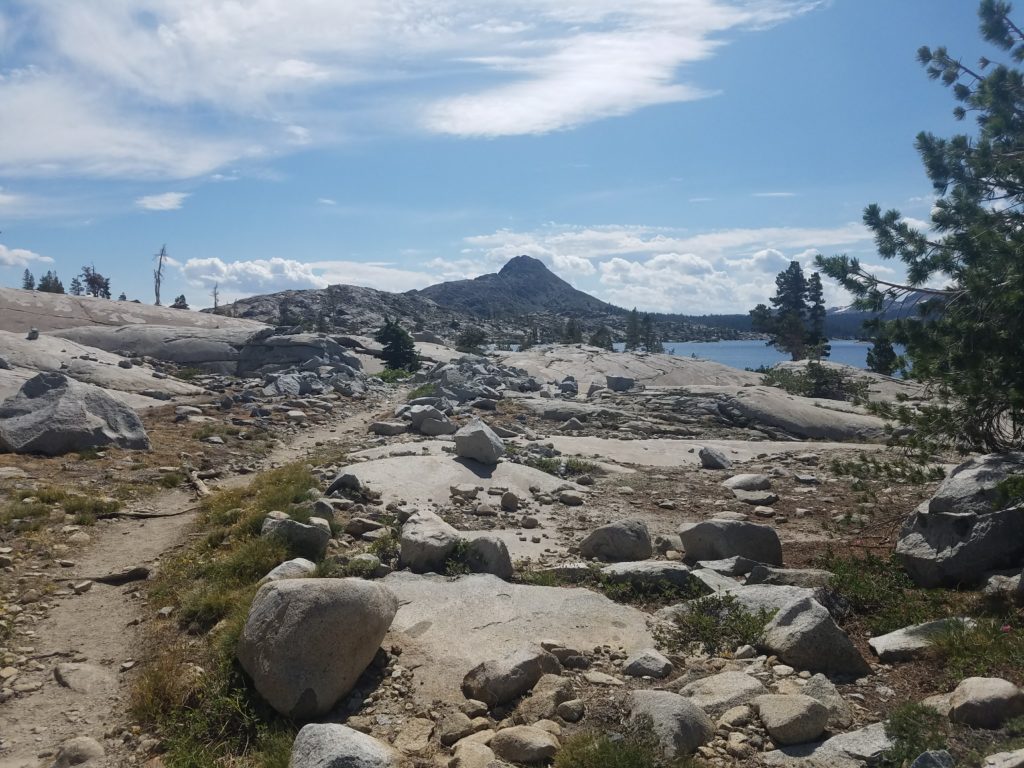
Immediately ahead lies the Crystal Range. Mt. Price looks an imposing behemoth with an unforgiving broad flank protecting its summit from hikers. Agassiz sits as a wave cresting over Desolation Valley. From here, Pyramid Peak looks far and almost small.
The trail then splits – south to continue on the PCT and head towards the Echo Lakes, north to the Rubicon Trail over Mosquito Pass and into Rockbound Valley. I arrived at 10:30 – covering 7.3 miles in 2 hours – stashed a bottle and took a quick snack before continuing towards Mosquito Pass.
Mosquito Pass
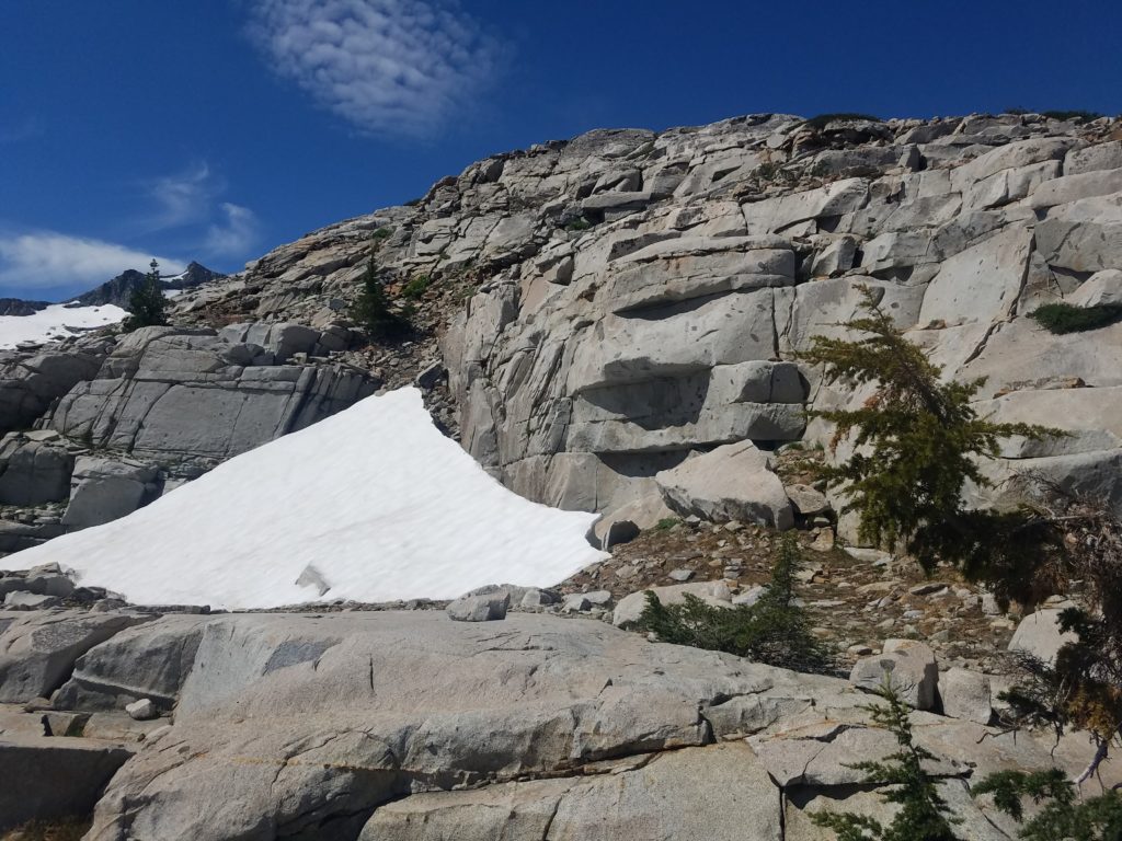
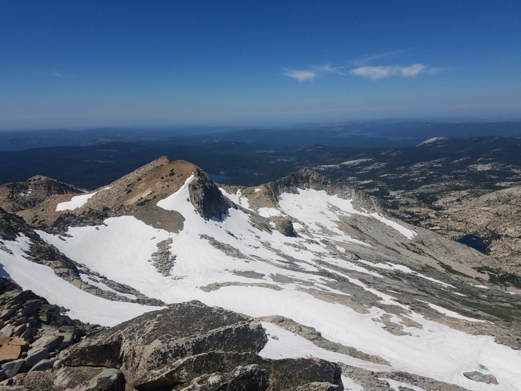
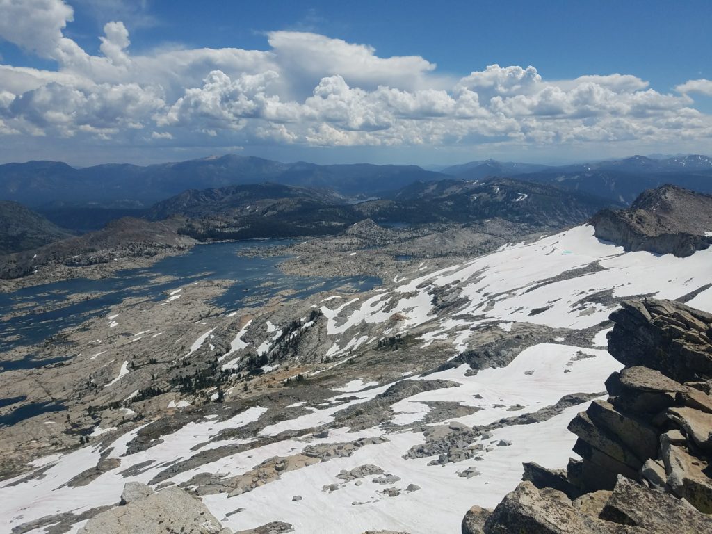
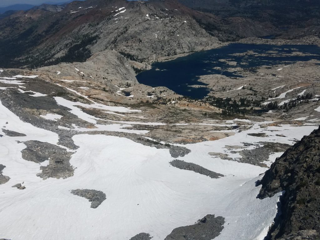
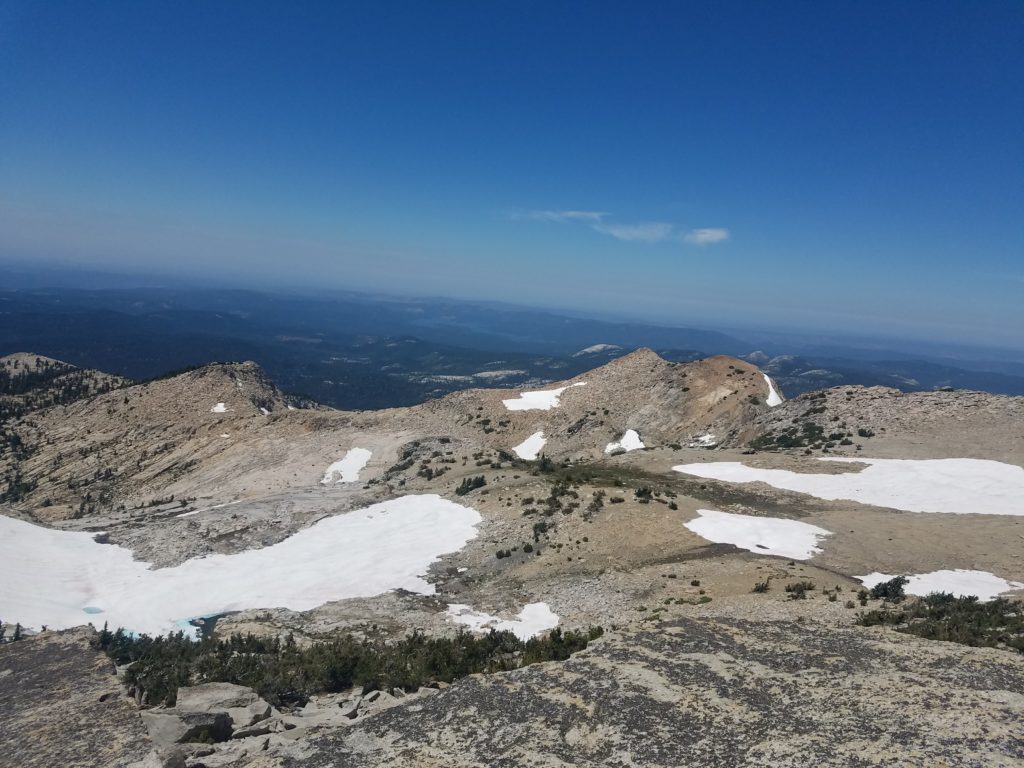
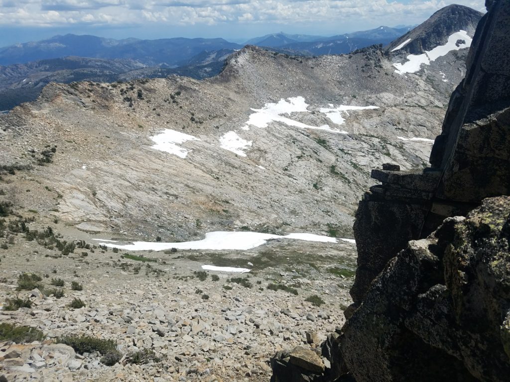
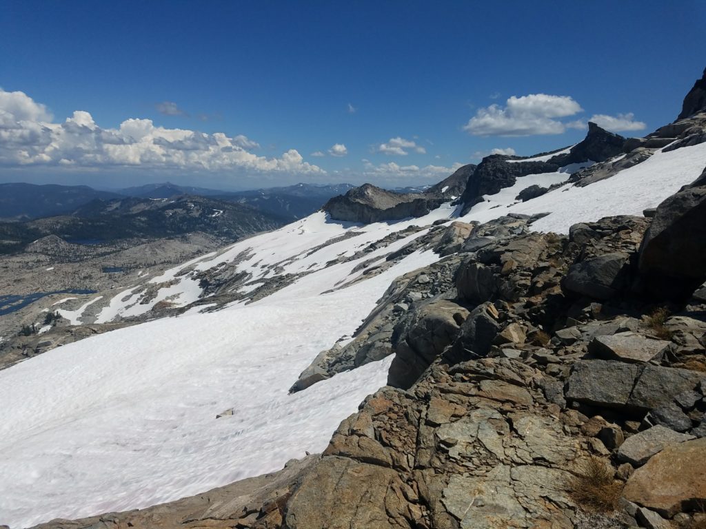
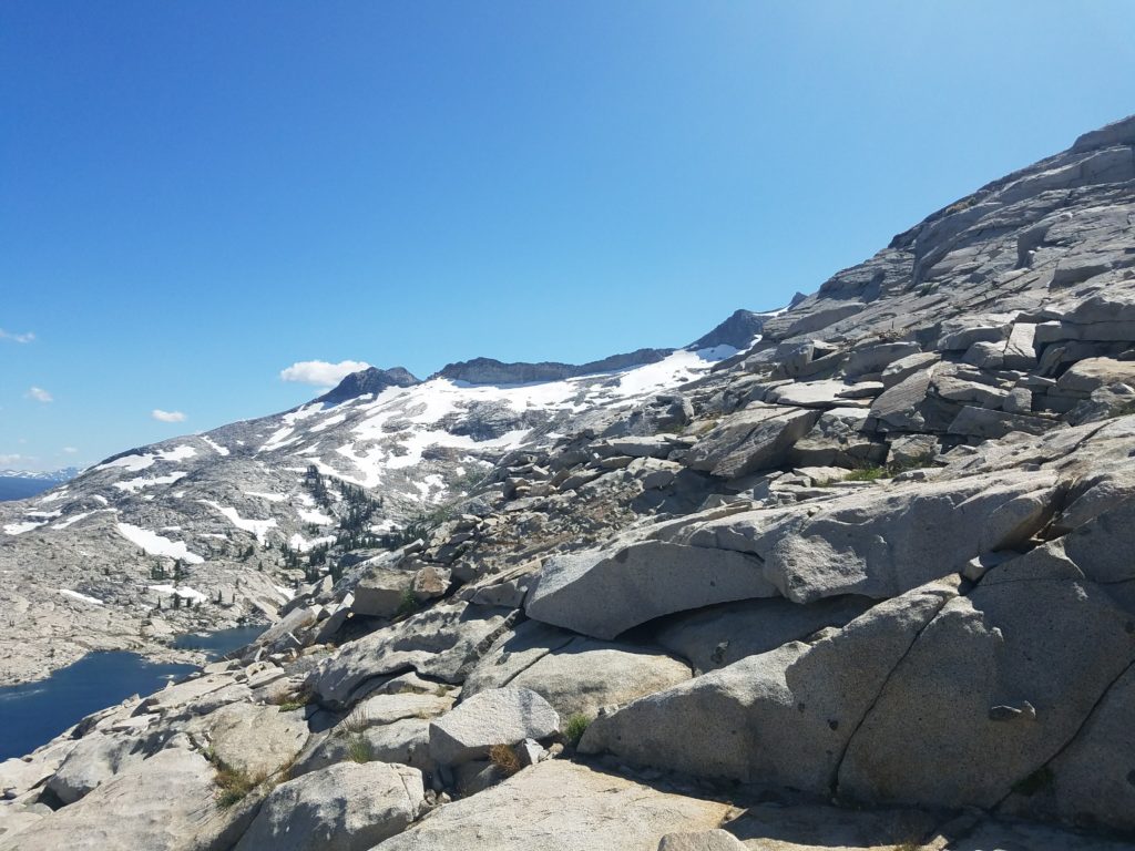
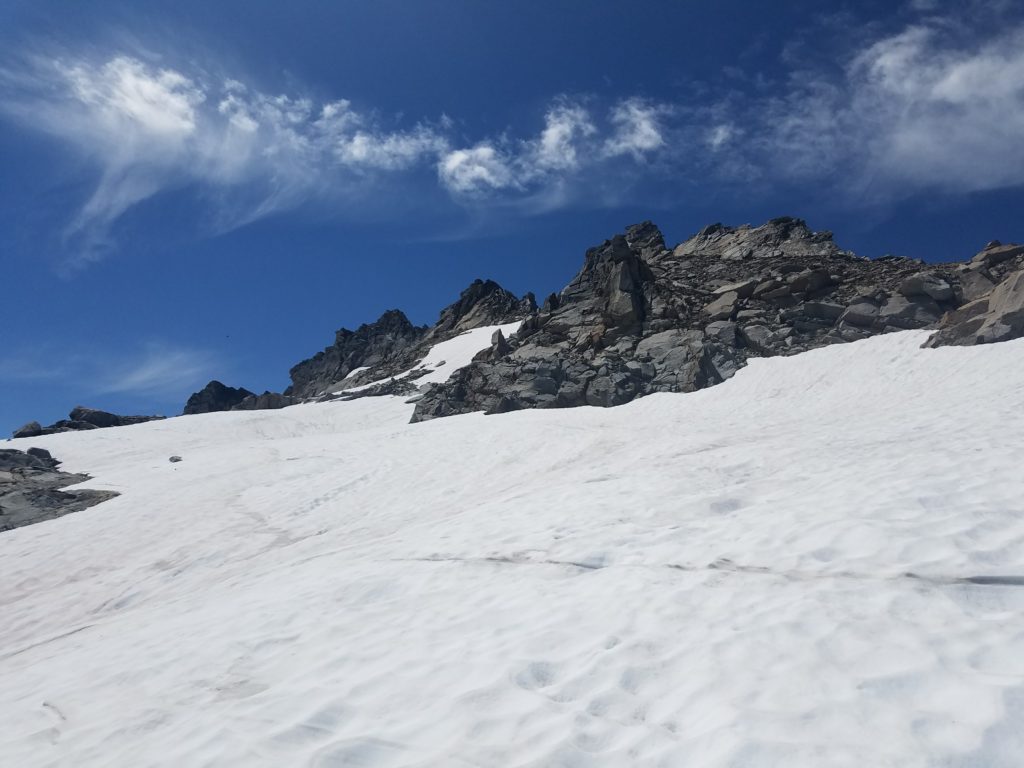
It’s about a mile to Mosquito Pass, all on rock exposed to sun’s heat. Cairns guide hikers over the smoothed granite. A waterfall appears in the distance with snow from the Crystal Range. Like in 2017, much, if not most, of the range still contained steep snow fields.
I had obviously noticed this when climbing Dick’s Peak, Jack’s Peak, and Mt. Tallac on previous days. Beta received from outdoor counselors at camp said no ice equipment would be necessary for climbing. Visual recon caused me to doubt that.
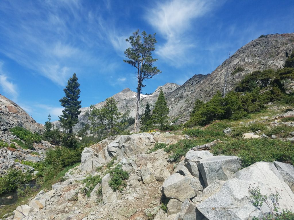
I reached Mosquito Pass 15 or 20 minutes later. There the trail gains elevation pretty quickly from Desolation Valley, jumping a fast 300 feet through an out-of-place forest. At the pass’s height – roughly in the middle, around the sign pointing to China Flats – veer left and begin the off-trail climb.
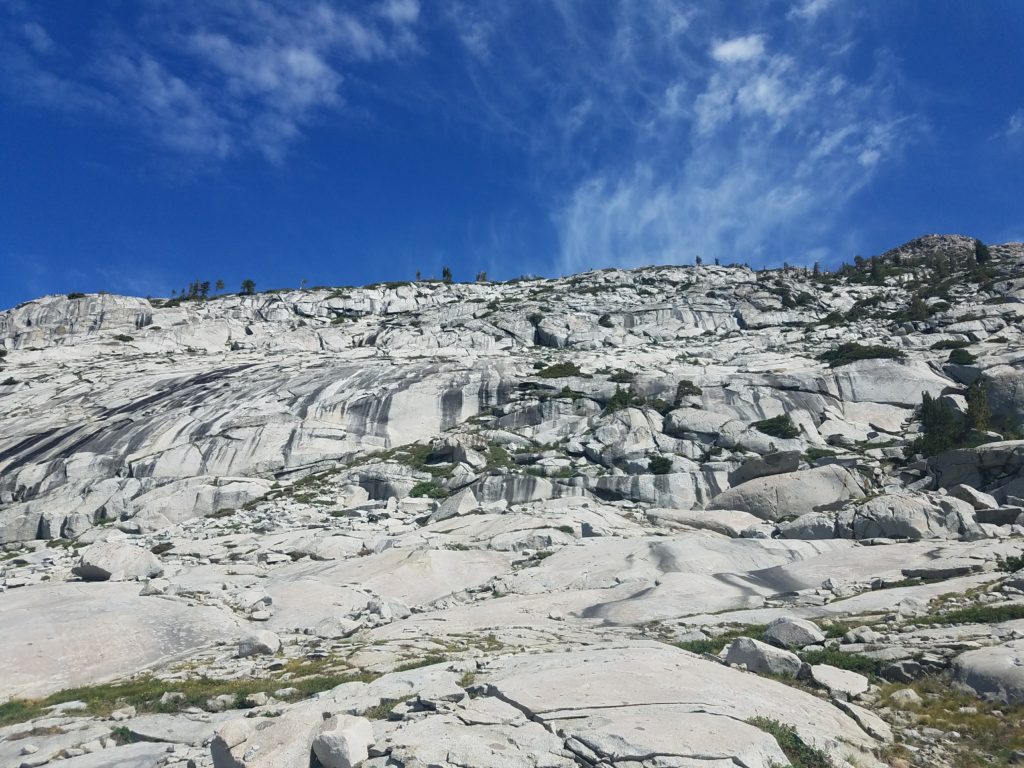
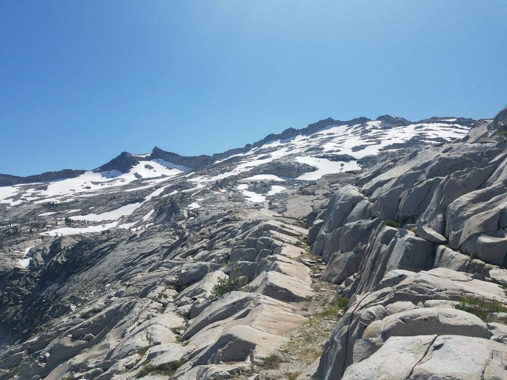
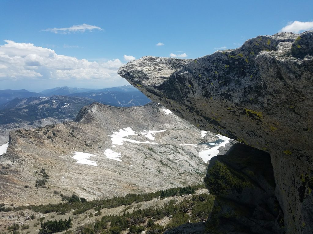
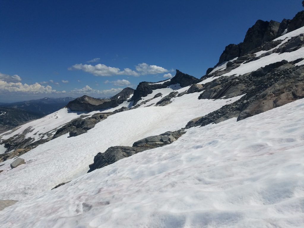
The Slabs of Insanity
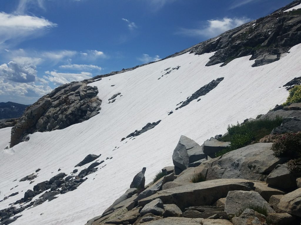
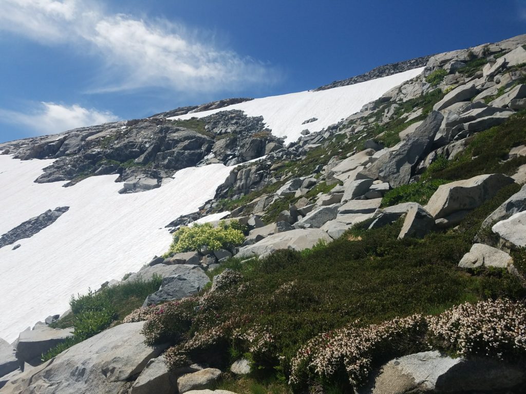
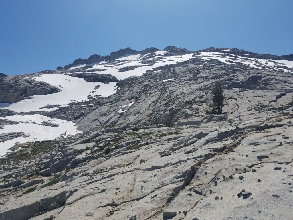
Boulders, boulders, and more boulders. The Slabs of Insanity stretch onto Mt. Price’s flank, itself a rock and boulder scramble up 1000 feet. A few potential paths emerge from the talus.
The rib presents the most obvious. Head straight up from Mosquito Pass and follow it as it works up the mountain, aiming for a notch in the ridge.
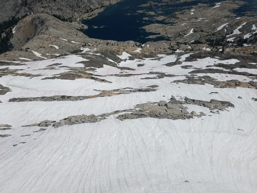
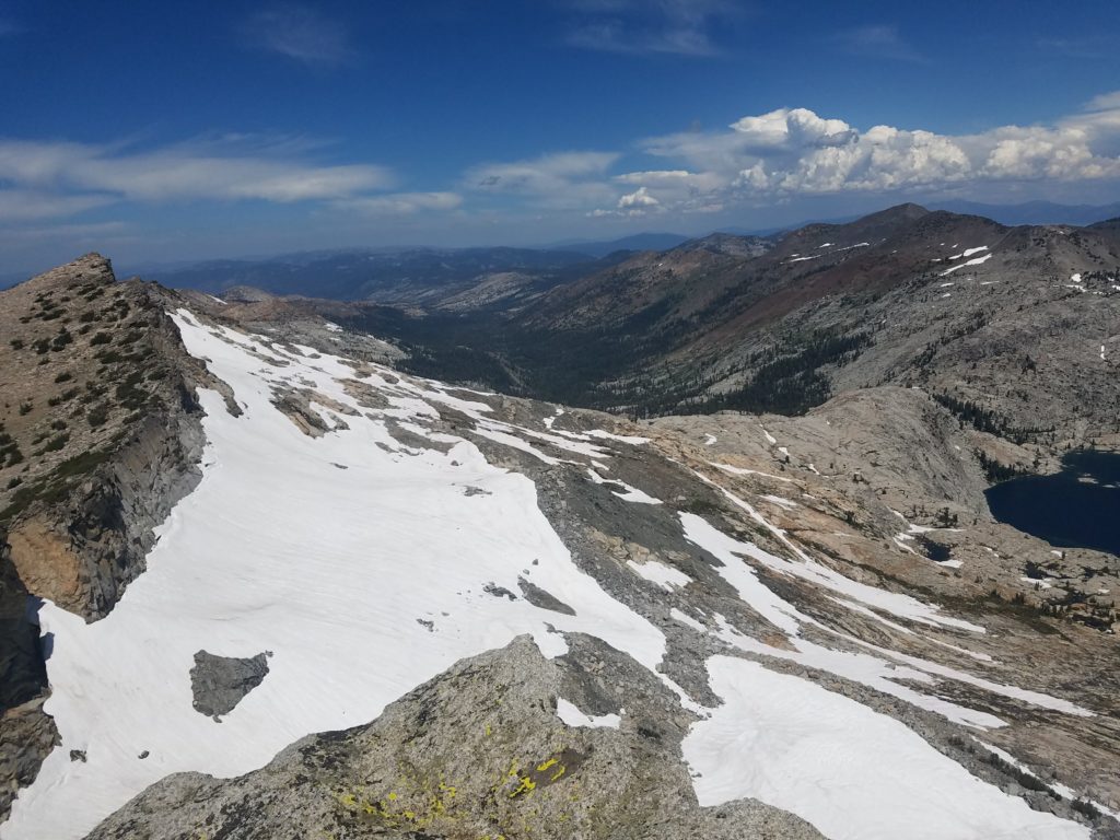
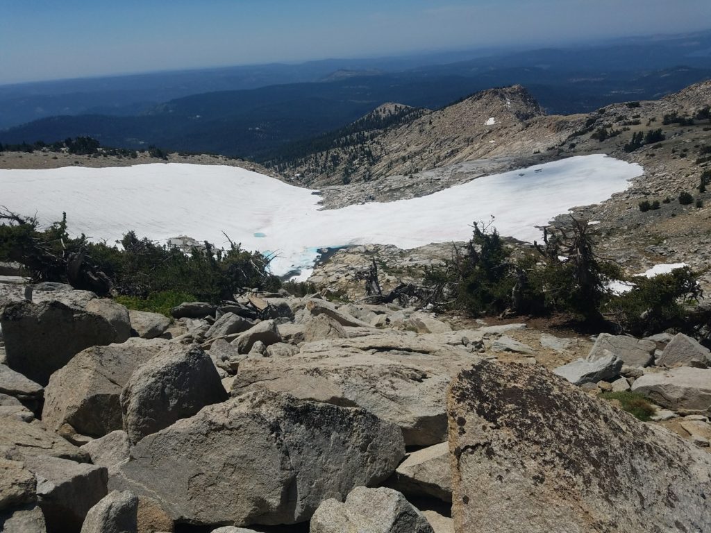
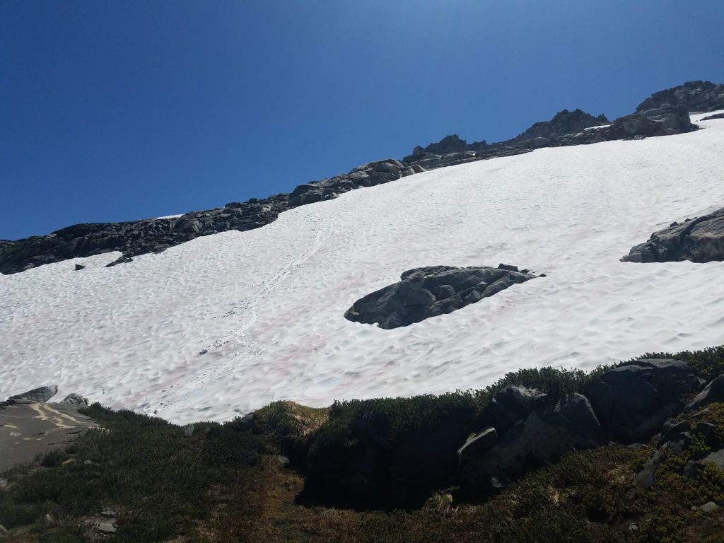
Unfortunately, the rib had many snowfields on it this August and I figured I would have an easier time maneuvering to my left and winding from almost directly below the summit and climbing at a rightward diagonal angle to the notch.
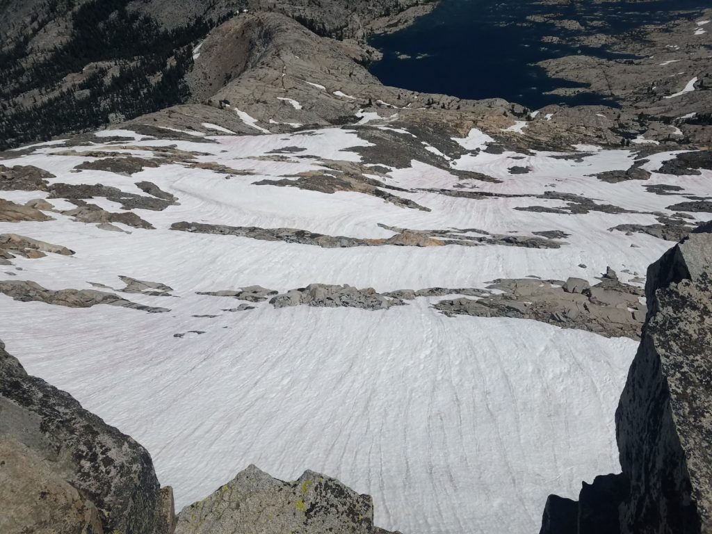
This didn’t work quite as expected. There didn’t emerge an obvious path and I worked my way up slopes steeper than needed, crossing some snow and circling around other. Snow conditions weren’t great – generally icy but with enough suncups to use for traction…and to lose balance.
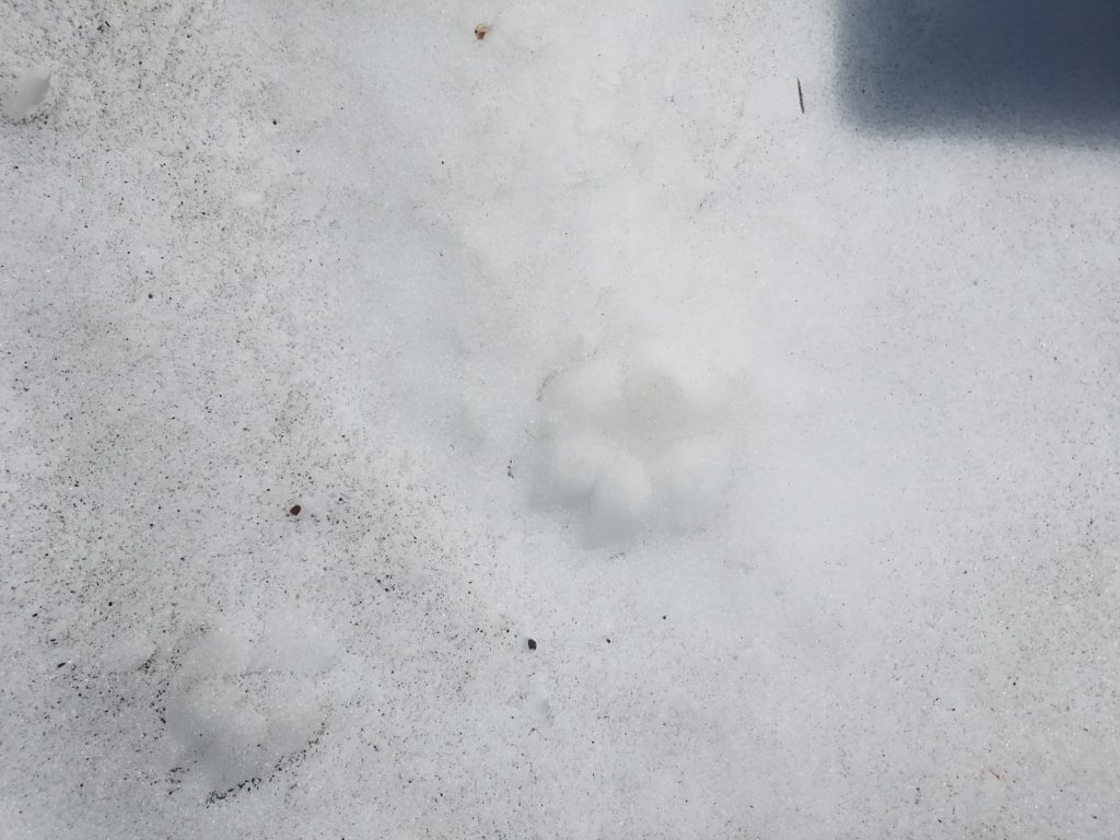
With a start, I came on the footprints below which gave me a quick start. At first I thought they belonged to a mountain lion and I anxiously looked around me for the sulking predator. But the paw prints were obviously too small to belong to a cougar and they had faint nail etchings, something not found with cats. (On the way down, I spotted the fox who left those prints. He quickly darted away from me and traipsed over the snow to some hidden abode.)
The going got tougher and slower on the upper slopes. Snowfields covered many of the approaches to the ridge. Without equipment, they were steep enough – and with a bad enough run-out – that I didn’t want to venture on them and risk a slip on a fast surface.
Instead I worked my way over the boulders and only crossed relatively flat portions of snow, or where I couldn’t avoid it. The final couple hundred feet – but a scree scramble the year before – had a lot of snow and an almost dicey final ascent to a notch that opened onto the ridge.
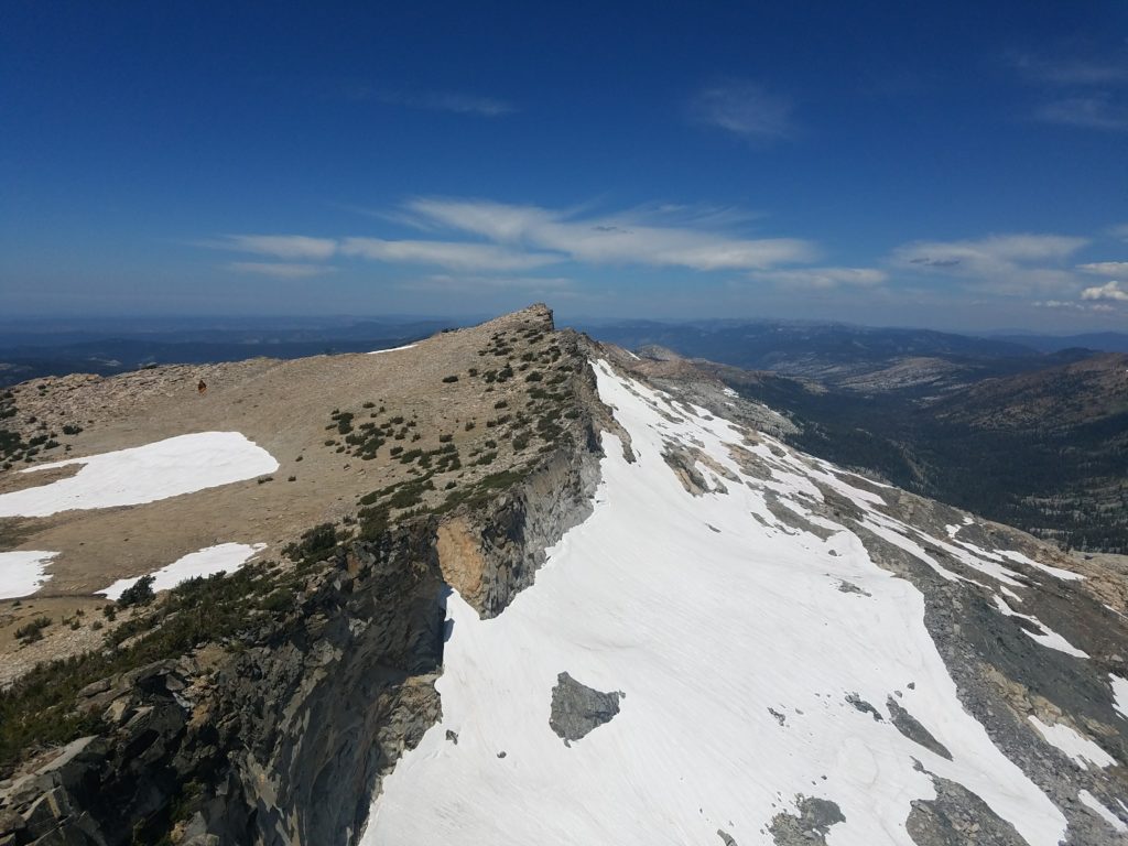
At that point, I had to decide if I would climb along the ridge, a solid Class 3, or down climb to what looked like flatter ground. Other trip reports recommend climbing over the ridge to the gentler west side and then downclimbing a bit en route to the summit blocks. I tried to emulate this.
But I hadn’t crossed the typical notch due to my southerly route up the Slabs of Insanity. I also didn’t climb low enough, instead traversing on ledges and across small chutes.
This climbing, I think, would constitute class 4. 20+ feet of exposure beneath ledges, hugging boulders as I worked horizontally with the occasional vertical move. Lack of consistent vertical movement makes me a little hesitant to call it Class 4; however, given that settled Class 3 moves up to the Mt. Agassiz summit (and moves to start climbing Jack’s Peak after the ridge traverse from Dick’s Peak) had much less exposure and presented almost no technical challenge, I feel comfortable in claiming it.
Quite obviously, edging along the narrow ridges and climbing on some Class 4 terrain slowed me and I quickly fell behind desired schedule. It took 15 minutes to go a few hundred feet as I looked for the easiest routes and executed on them.
Mt. Price Summit
After that slow maneuvering, I finally reached the hunk of rubble that leads to Mt. Price from the west. Where had that been all along! It made the last couple dozen of feet very easy and I soon topped out at the summit.
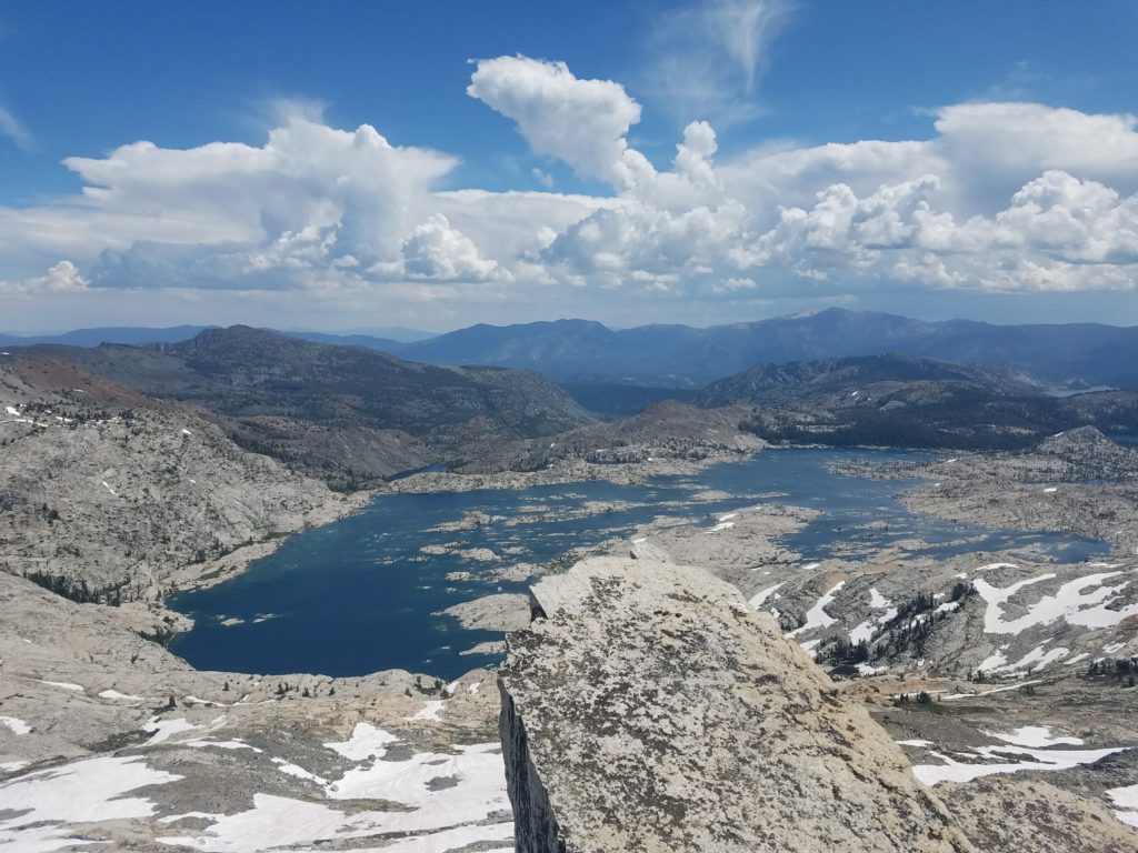
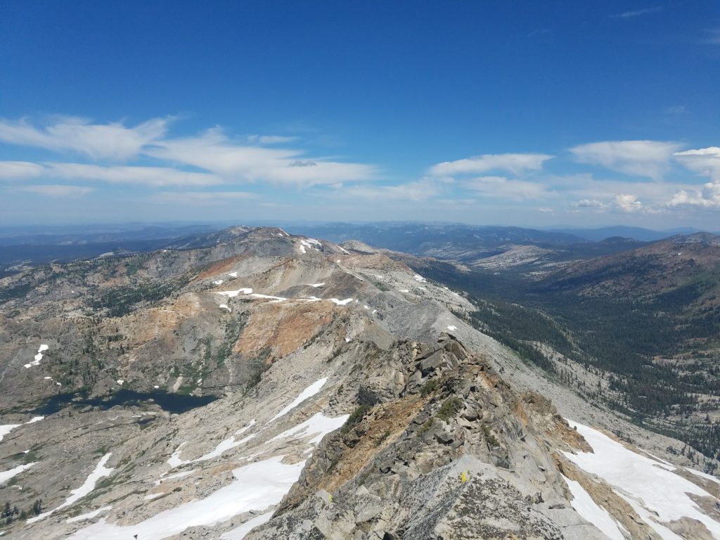
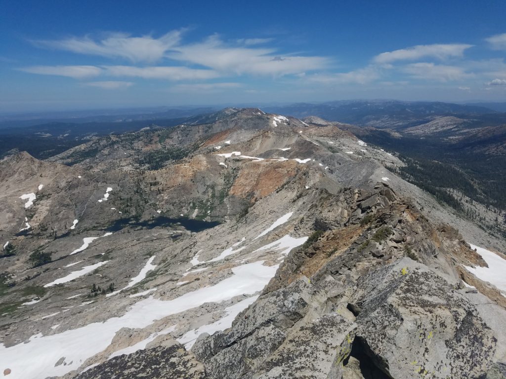
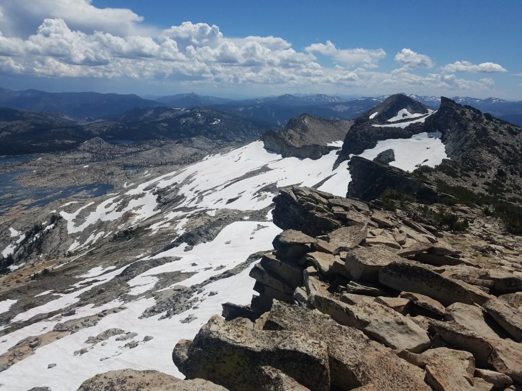
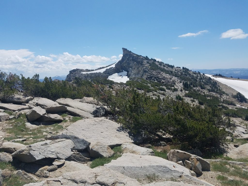
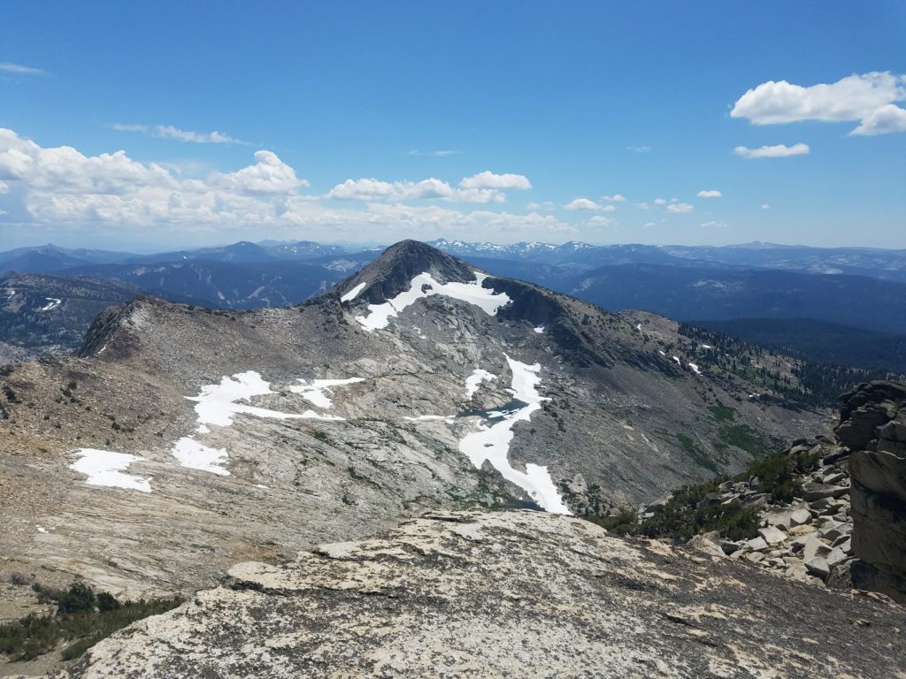
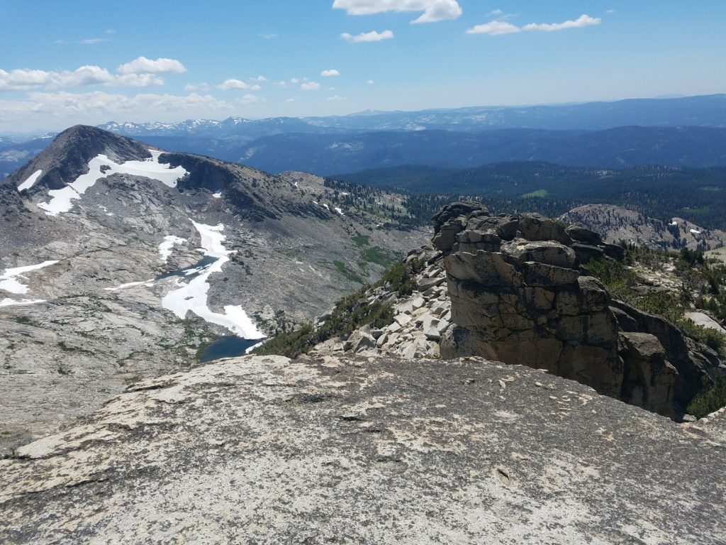
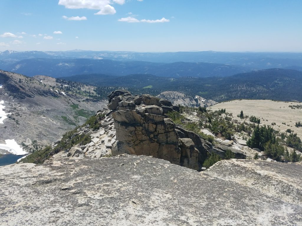
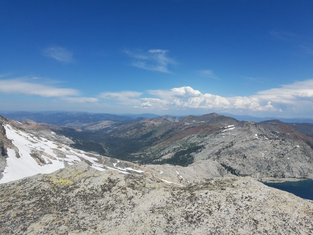
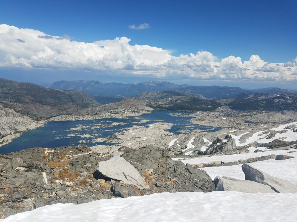
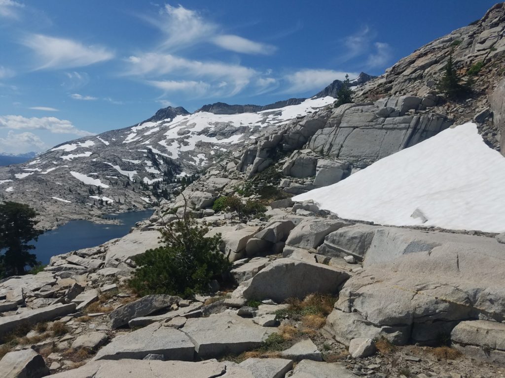
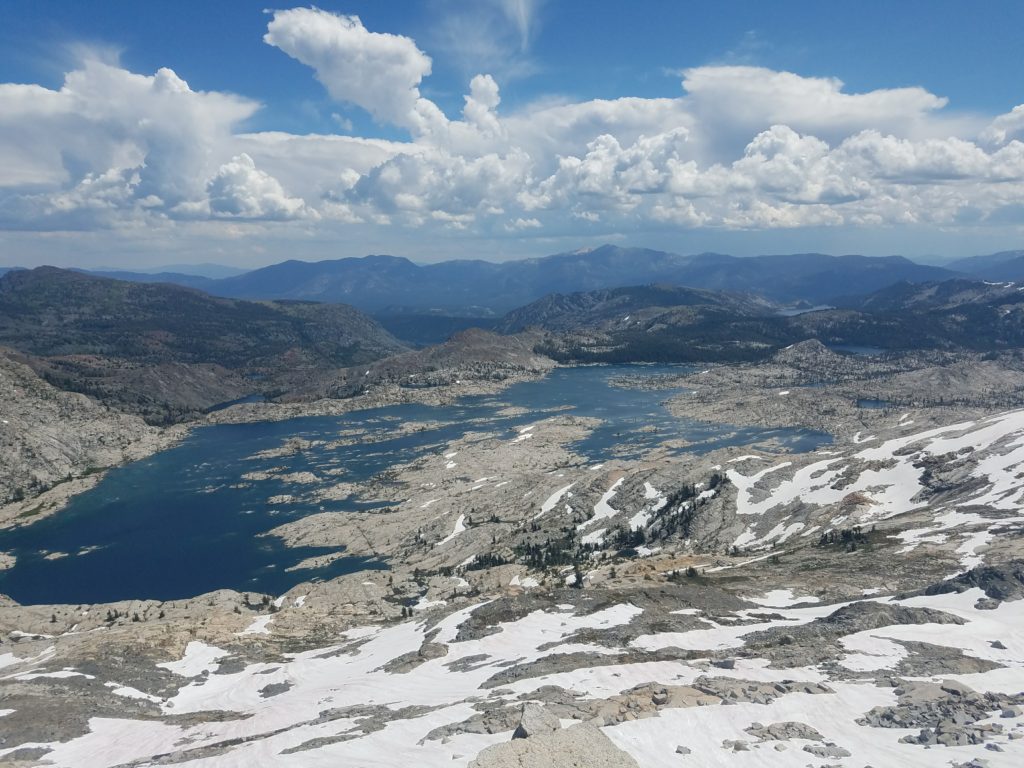
Mt. Price’s summit offers incredible views of Desolation Valley, across to Rockbound Valley, other Crystal Range peaks, and, to the west, rolling peaks down to Central Valley. The Cracked Crag, Mt. Agassiz, Pyramid Peak, Jack and Dick’s Peak, and Mt. Tallac all loom large. Lake Aloha’s various shades of azure water entice 1,600 feet below.
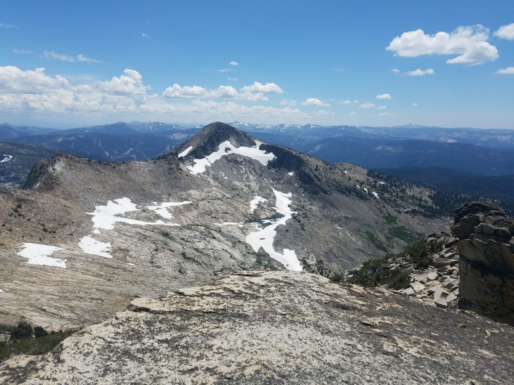
Mt. Agassiz Summit
From Mt. Price, the traverse to Mt. Agassiz takes less than 15 minutes on an easy path. Climbing a bit below the ridge line to the chaparral exposes a use trail with no technical difficulty.
Mt. Agassiz technically doesn’t have enough clean prominence to be considered a peak. It’s Mt. Price’s southern summit, but few hikers in Desolation Wilderness bother with the distinction. There’s even a summit register.
The summit block requires what others consider a Class 3 move to gain the final boulders. I didn’t find it Class 3 – or hard – for want of exposure. Regardless, it takes little effort and in short order you’re on a durable boulder that looms over Crystal Range with a few hundred feet exposure on each side.
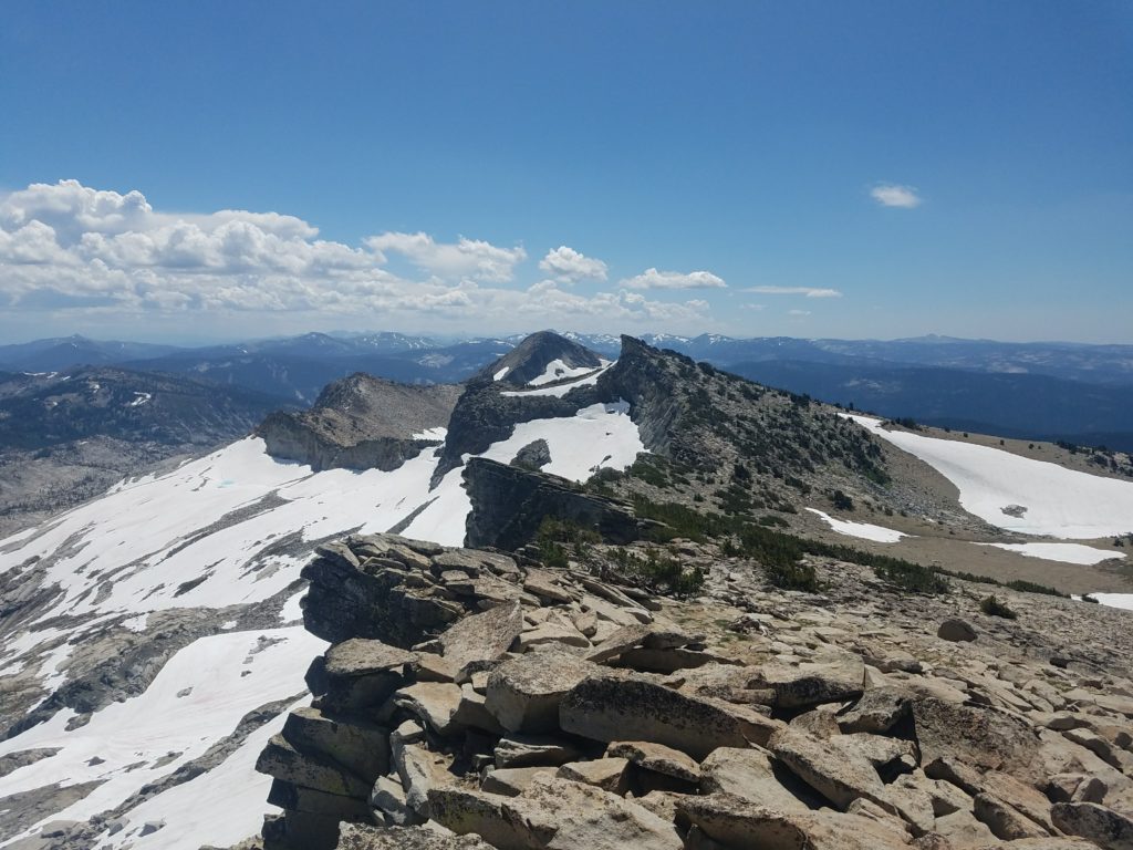
As luck would have it, a marmot had freshly deposited its excrements right on the edge of the summit rock, so I didn’t take the usual overhang picture. Still, a lovely view unfolded. Mt. Price stood regal to the left and Pyramid Peak ever so enticing to the right. The summit register is just off the blocks to the peak’s north.
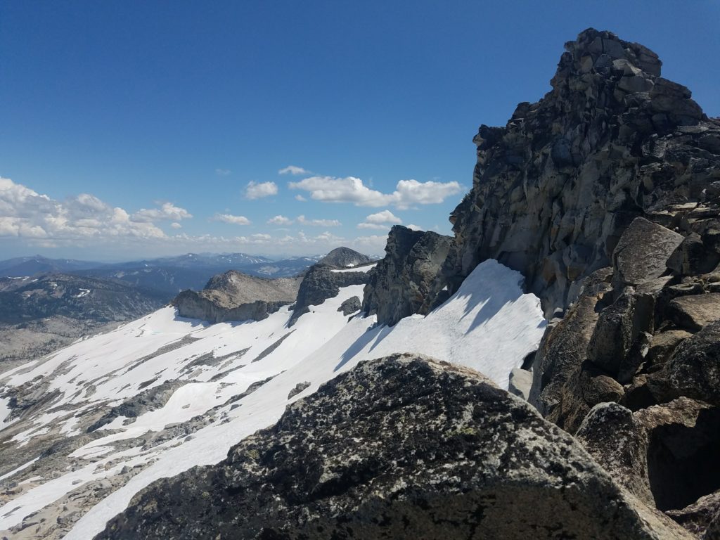
The traverse to Pyramid Peak presents some technical challenges. The ridge ovulates and, unlike earlier, dropping to the west doesn’t solve all problems. There are a few areas where you have to climb across to the eastern part of the ridge, typically the steepest. On final ascent to Pyramid Peak, climbers overcome a few Class 3-4 moves that may require spotting, but no ropes. It’s taken others 45-60 minutes on way.
I poked around a little bit on the far side of Mt. Agassiz to see whether I had a chance of a faster traverse but couldn’t find an obvious downclimb to the ridge. At that point I backed to the southwestern flank of Mt. Agassiz and enjoyed my lunch out of the wind.
Downclimbing from Mt. Price
It took no time to make it back to Mt. Price. From there, I planned to remedy my mistake from early and climb lower. I started doing so but ran into similar Class 3+ moves. After a bit, I tired of the slow moving and ascended up to the ridge line, figuring it wouldn’t be worse and would better help me scout a relatively snow-free route down from the ridge.
I found one area and started climbing down. However, after a couple dozen feet, I came to an impasse. Continuing north would require edging on a very thin ledge with no obvious holds. South would have been rock climbing over. Down a seven or so foot drop onto a couple square foot area that then dropped to other slopes and snow.
At that point I felt committed to this route down, partly because I couldn’t see a better route further north. Steep snow met the sharp ridge drop. My route had little snow on the first part of the downclimb.
So I dropped my pack and watched it roll off the area, crept forward and started lowering myself before feeling my hands slipping and then jumped, hoping I wouldn’t fall.
Snow shaped my path. I couldn’t avoid it 100%, but didn’t come across anything too steep. At one point, I dropped myself to a none-too-steep snowbank but in a small berg – the snow field was about 3 feet above the boulders but 4 or 5 feet from the next ledge. Again I let my backpack slide and then jumped onto the bank and glissaded into standing.
Winding around the snow meant descending through the Slabs of Insanity took longer than the previous year. I worked with a lot of caution on snowbanks because, though not overly steep, they were slick and had terrible run-outs. I probably played it too safe here but would have felt much more comfortable with microspikes or an ice axe.
By 8,500 feet or so the snow had largely disappeared, and I worked over the boulders. I reached Mosquito Pass at 3:30 and figured I would reach the trailhead by 6. My knee had started hurting, the same pain from an injury on Mt. Shasta in May, and I figured that would slow me down some.
Returning to Fallen Leaf Lake
The hike continued with relative ease – and a decent amount of boredom. Too much hiking on Glen Alpine for it to excite me.
As I reached the last couple miles, I started hearing voices behind. Not used to hikers passing me, I picked up my pace. 1.5 miles from the trailhead one person caught up as I sat eating carrots, so I quickly packed and pushed ahead to keep my lead.
In the last half-mile the group caught me despite my best efforts. Thankfully, they were running – I felt no shame in getting passed by those running at least part of the trail. (It was a long hike and avoiding those coming gave me some task and way to divert myself from the miles and soreness.)
I reached Lily Lake at 6 and returned to camp by 6:10, finishing 18 or 19 miles and 3,600 feet of climbing in 10 hours, 9 of which I spent moving.
What I Learned on the Crystal Range
- Better route scoping
- Carrying an axe doesn’t hurt
- Hydration matters a lot when climbing as the lethargy that can come from dehydration makes everything slower
Aside from those lessons, this was a good opportunity to gain confidence and time on Class 3+ terrain. I will definitely be faster on it going forward and approach with less weariness.
Time Splits
Trailhead: 8:30a
Susie Lake: 9:30
Heather Lake: 10:00
Lake Aloha: 10:30
Slabs of Insanity: 11:05
Mt. Price notch: 11:50
Mt. Price summit: 12:15
Mt. Agassiz summit: 12:45 (I spent 15 minutes or so on Mt. Price)
Turned around: 1:30
Mt. Price ridge: 2:00
Slabs of Insanity: 2:45
Mosquito Pass: 3:15
Fallen Leaf Lake: 6:05